1970s Maps of Cass County, Minnesota
Explore 55 historic maps of Cass County from the 1970s. These maps offer a rare glimpse into what life looked like during the 1970s — showing old roads, neighborhoods, homes, and landmarks that have changed or disappeared over time.
Whether you're researching your family's past, planning a metal detecting trip, or studying how Cass County's landscape evolved across the 1970s, these high-resolution maps are a powerful tool for exploring the history of this region.
- Focus on a specific era: All maps on this page are from the 1970s, giving you a focused view of this time period.
- See what’s changed: Compare century-old streets, trails, and buildings to today's modern landscape using overlays and satellite layers.
- Research with precision: Use these maps for genealogy, historical research, land use analysis, or educational projects.
- View, download, or print: Maps are fully viewable online in high resolution, and can be downloaded or printed for your own records.
Start exploring Cass County's history through authentic maps from the 1970s. This is your window into the past.
Cass County, MN maps
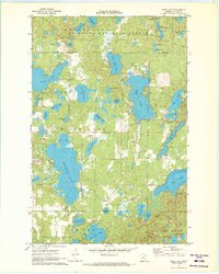
(55)- 1970 Map of Laura Lake, 1972 Print
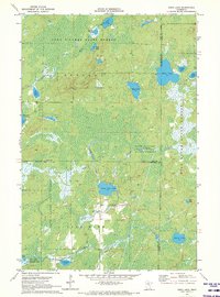
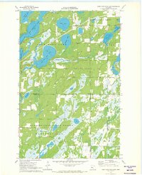
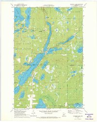
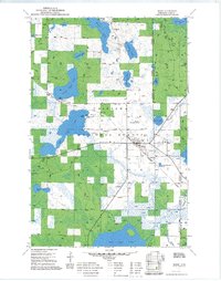
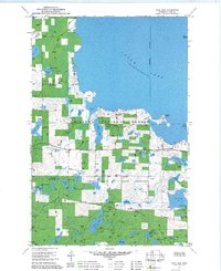
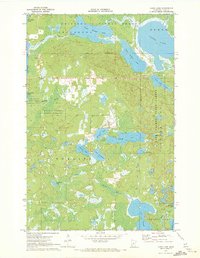 1970 Laura Lake1972 Print · USGSCass County’s lake country is captured here during the 1970s, showing a landscape defined by state and national forest management. Researchers can trace the water levels and shorelines of Laura Lake, Inguadona Lake, and the complex wetlands surrounding Daggett Brook.2 unique versions available
 - 1970 Map of Spider Lake, 1972 Print
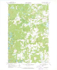
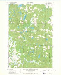
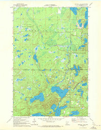
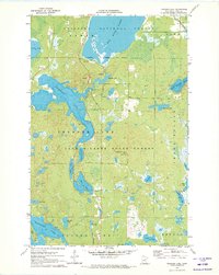
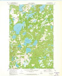
 1970 Spider Lake1972 Print · USGSCass County’s lake-country landscape is documented here in the early seventies, showing a transitional area of state forests and glacial topography. Researchers can locate family landmarks like Bethlehem Ch, the Spider Lake Lookout Tower, and the local Townhall.
 - 1970 Map of Backus, 1972 Print
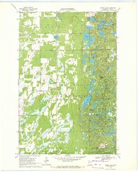
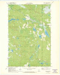
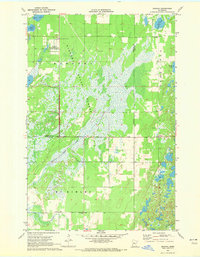
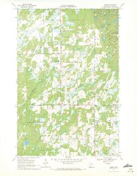
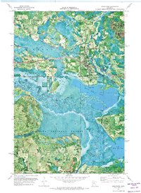
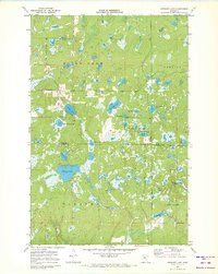
 1970 Backus1972 Print · USGSBackus and the lake country of Cass County are captured here in the early seventies, just as the regional rail and forest infrastructure reached its modern peak. Local historians can trace the Burlington Northern line through town, locate the Evergreen Cem, and explore the wooded expanse of the Deerfield State Forest.2 unique versions available
 - 1970 Map of Hackensack, 1972 Print
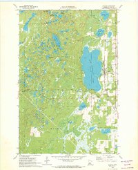
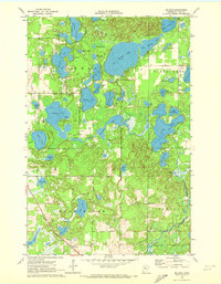
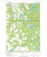
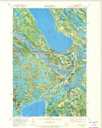
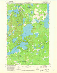
 1970 Hackensack1972 Print · USGSHackensack was a thriving Cass County hub in the early 1970s, where the railroad and forest service roads met the shoreline. Genealogists and historians can trace family-named sites like Paquet Lake and Hiram Lake or locate Hillcrest Cem.2 unique versions available
 - 1970 Map of Edna Lake, 1972 Print
 1970 Edna Lake1972 Print · USGSThe wilderness at the junction of Cass, Aitkin, and Crow Wing counties is captured here in the early seventies. Genealogists and outdoorsmen can trace the water systems of Little Pine Lake and Edna Lake or locate the remote outpost of Mae.2 unique versions available
 - 1970 Map of Bungo Creek, 1972 Print
 1970 Bungo Creek1972 Print · USGSCass County’s timberlands and glacial lakes are preserved here in the early 1970s before modern development altered these Northwoods townships. Genealogists and outdoorsmen can trace the Bull Moose Trail past Townhall 1364 and through the Foot Hills State Forest.
 - 1970 Map of Shovel Lake, 1972 Print
 1970 Shovel Lake1972 Print · USGSNorthwestern Minnesota’s lake-and-forest country is mapped here in the early seventies, spanning the borders of Cass and Aitkin Counties. Local historians and outdoorsmen can trace the Soo Line rail corridor, the Lakeview Cem, and an extensive early Snowmobile Trail.2 unique versions available
 - 1970 Map of Mildred, 1972 Print
 1970 Mildred1972 Print · USGSIn the lakes country of Cass County during the early 1970s, this survey captures the transition between the rail-dependent settlement of Mildred and the surrounding wilderness. Genealogists and local historians can trace the Northern Pacific line past Pine River Cem and the boundaries of Chickamaw Beach.2 unique versions available
 - 1970 Map of Webb Lake, 1972 Print
 1970 Webb Lake1972 Print · USGSCass County, Minnesota, is shown at the start of the 1970s as a densely forested wilderness of the Chippewa National Forest. Genealogists and researchers can trace old access roads and landmarks like the Radio Tower (KNMT-TV) or the many lakefronts from Webb Lake to Pleasant Lake.2 unique versions available
 - 1970 Map of Graff, 1972 Print
 1970 Graff1972 Print · USGSCass County's lake-dotted interior is captured in the early seventies, showing a land defined by its water and woods. Genealogists and local historians can locate Graff, trace the old Railroad grade, and find the secluded Moose Lake Cem.
 - 1970 Map of Oshawa, 1972 Print
 1970 Oshawa1972 Print · USGSThe Hubbard and Cass county line in the early seventies shows a landscape dedicated to forestry and rural survival. Researchers can trace the footprints of the timber industry through the State Nursery, the Badoura Lookout Tower, and the settlement at Oshawa.2 unique versions available
 - 1970 Map of Crystal Lake, 1972 Print
 1970 Crystal Lake1972 Print · USGSThe lake-strewn woods of Hubbard and Cass Counties are captured here in the early 1970s, showcasing a landscape defined by state and national forests. Genealogists and local historians can trace the sites of Akeley, Chamberlain, and the White Oak Cem.2 unique versions available
 - 1970 Map of First Crow Wing Lake, 1972 Print
 1970 First Crow Wing Lake1972 Print · USGSThe Crow Wing River chain winds through Hubbard County during the early seventies, linking the First Crow Wing Lake to its neighbors. Trace the boundaries of the Badoura State Forest or find the remote Campground near Tripp Lake.
 - 1970 Map of Leader, 1972 Print
 1970 Leader1972 Print · USGSCass County's rural townships are captured in detail during the early 1970s, showcasing the intersection of wilderness and remote settlement. Genealogists and local historians can trace the foundations of Poplar and Leader, locating the Poplar Cem and Leader Community Hall.2 unique versions available
 - 1970 Map of Mitchell Lake, 1972 Print
 1970 Mitchell Lake1972 Print · USGSCass and Crow Wing counties are captured here in the early 1970s, showcasing a landscape defined by Northwoods water and state forest land. Genealogists and local historians can trace the corporate limits of Fifty Lakes and Emily or locate family sites near Mitchell Lake and Kego Lake.2 unique versions available
 - 1970 Map of Woman Lake, 1972 Print
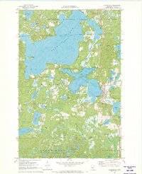
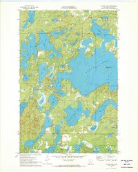 1970 Woman Lake1972 Print · USGSCass County’s lake country is captured in the early seventies, showcasing a landscape defined by complex glacial waterways and the Chippewa National Forest. Local historians can locate the Seaplane Base on Woman Lake or trace the early shorelines of Baby Lake and Black Water Lake.3 unique versions available
 - 1970 Map of Roosevelt Lake, 1972 Print
 1970 Roosevelt Lake1972 Print · USGSThe lake country of Cass and Crow Wing counties is shown in the early seventies as a hub of woodland recreation and conservation. Genealogists and local researchers can trace early settlements at Outing and Emily or locate landmarks like the Ranger Station and Plummers Point.2 unique versions available
 - 1970 Map of Thunder Lake, 1972 Print
 1970 Thunder Lake1972 Print · USGSCass County’s lake-studded timberlands are captured here in the early 1970s, showing the intersection of two major forests. Researchers can locate the Townhall, the high point of Draper Lookout Tower, and smaller family-named waters like Michaud Lake.2 unique versions available
 - 1970 Map of Deer River, 1973 Print
 1970 Deer River1973 Print · USGSItasca County at the start of the 1970s shows the bustling rail-and-river hub of Deer River alongside the winding Mississippi River. Researchers can locate Olivet Cem, the local High Sch, and rural landmarks like White Oak Point.
 - 1970 Map of Ball Club, 1973 Print
 1970 Ball Club1973 Print · USGSThe meeting of Itasca and Cass Counties in the 1970s is defined by the winding Mississippi and the timberlands of the Chippewa National Forest. Local history researchers can trace the town of Ball Club, Tibbets Cem, and the path of the Burlington Northern rail line.
 - 1971 Map of Remer, 1973 Print
 1971 Remer1973 Print · USGSRemer and the surrounding north-central Minnesota woodlands are captured here in the early 1970s as a hub for forestry and rail transport. Genealogists and historians can trace the Soo Line tracks through town, locate the Remer Municipal Airport, and explore the shorelines of Big Sand Lake and Little Sand Lake.2 unique versions available
 - 1971 Map of Lake Ada, 1973 Print
 1971 Lake Ada1973 Print · USGSThe northern lakes of Cass County are shown here in the early seventies, featuring the settlements of Pontoria and Chickamaw Beach. Researchers can trace local landmarks like the Ponto Lake Cem, the Townhall, and a Winter Trail winding through the woods.2 unique versions available
 - 1971 Map of Stewart Lake, 1973 Print
 1971 Stewart Lake1973 Print · USGSThe Cass and Crow Wing county line runs through this dense Minnesota lake country as it appeared in the early seventies. Trace the network of seasonal routes and forest landmarks, including Thompson Trail, Blind Lake Ch, and the intriguing Dirty House Lake.2 unique versions available
 - 1971 Map of Longville, 1973 Print
 1971 Longville1973 Print · USGSThe lakeside community of Longville and the surrounding national forest are captured here in the early seventies. Genealogists and local historians can trace family locations at the Wabedo Cemetery or locate landmarks like Camp Olson and the Longville Lookout Tower.2 unique versions available
 - 1971 Map of Jack Lake, 1973 Print
 1971 Jack Lake1973 Print · USGSLeech Lake and the surrounding woodlands are captured here in the early 1970s within the Leech Lake Indian Reservation. Researchers can locate Medicine Rite Cem, trace the shoreline of Uram Bay, and find old Gravel Pit sites and sawmills.2 unique versions available
Showing maps 1-25 of 55
Top cities of Cass County
- Sylvan historical maps
- Lake Shore historical maps
- East Gull Lake historical maps
- Walker historical maps
- Pine River historical maps
- Cass Lake historical maps
See more
Frequently asked questions
- What are the different types of historical maps available for Cass County?
- What is the oldest map of Cass County?
- Where can I purchase historical maps of Cass County for my home or office?
- Where can I download high-res historical maps of Cass County?
- Are there historical topographic maps available for Cass County?
- Is there historical aerial imagery available for Cass County?
- Where are historical maps of Cass County sourced from?