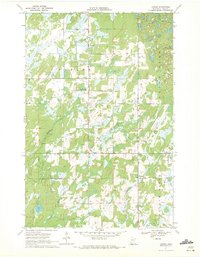
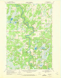
1970 Map of Leader
USGS Topo · Published 1972About this map
Poplar and Leader emerge as the primary social hubs of this central Minnesota landscape, where the town of Ellis and the Poplar Community also anchor the local settlement pattern. The terrain is defined by a dense network of wetlands and watercourses, including Farnham Creek, Tower Creek, and the winding Swan Creek, which drains toward the southern reaches of the quadrangle. These waterways, alongside Hardwood Lake and Mud Lake, reflect a glaciated geography where agriculture and timber interests have shaped the rural layout. Significant local landmarks such as the Leader Community Hall and the Poplar Cem provide critical touchpoints for genealogical research, documenting the community centers of the townships of Poplar, Byron, and Meadowbrook during the early 1970s.
Find a feature on this map
17 named features on this map. Tap any name to fly to it.
Don’t see what you’re looking for? This feature index may not catch every label — zoom into the map to look around manually.
Map Details
Editions of this 1970 Leader Map
2 editions found
Other maps of this area

1919 · Leader
USGS Topo · 1:62,500

1953 · Brainerd
USGS Topo · 1:250,000

1957 · Brainerd
USGS Topo · 1:250,000

1958 · Brainerd
USGS Topo · 1:250,000

1965 · Brainerd
USGS Topo · 1:250,000

1966 · Staples NE
USGS Topo · 1:24,000
1966 · Casino
USGS Topo · 1:24,000
1966 · Motley NW
USGS Topo · 1:24,000

1969 · Burgen Lake
USGS Topo · 1:24,000
1969 · Oylen
USGS Topo · 1:24,000