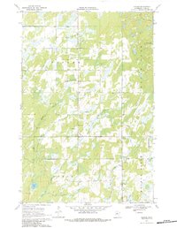
1970 Map of Leader
USGS Topo · Published 1984About this map
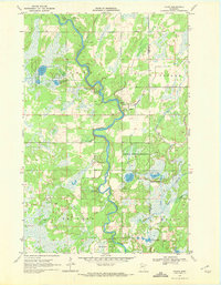
The unincorporated settlements of Poplar and Leader anchor this 1970 landscape in southern Cass County, where the township boundaries of Poplar and Byron meet. The geography is defined by a dense network of wetlands and small water bodies, including the prominent Moose Lake and Hardwood Lake, which feed into the meandering courses of Swan Creek and Meadow Brook. Local community life is centered around landmarks such as the Poplar Community Church, the Poplar Cemetery, and the Leader Community Hall. Small-scale industry is represented by scattered Sandpit sites, while the presence of the tiny hamlet of Ellis near the southern border illustrates the sparse, rural nature of the region. The map captures a moment when the area remained primarily agricultural and wild, before modern development further altered the complex drainage patterns of the Farnham and Martin systems.
Find a feature on this map
19 named features on this map. Tap any name to fly to it.
Don’t see what you’re looking for? This feature index may not catch every label — zoom into the map to look around manually.
Map Details
Editions of this 1970 Leader Map
2 editions found
Other maps of this area

1919 · Leader
USGS Topo · 1:62,500

1953 · Brainerd
USGS Topo · 1:250,000

1957 · Brainerd
USGS Topo · 1:250,000

1958 · Brainerd
USGS Topo · 1:250,000

1965 · Brainerd
USGS Topo · 1:250,000

1966 · Staples NE
USGS Topo · 1:24,000
1966 · Casino
USGS Topo · 1:24,000
1966 · Motley NW
USGS Topo · 1:24,000

1969 · Burgen Lake
USGS Topo · 1:24,000
1969 · Oylen
USGS Topo · 1:24,000