1970s Maps of Koochiching County, Minnesota
Explore 66 historic maps of Koochiching County from the 1970s. These maps offer a rare glimpse into what life looked like during the 1970s — showing old roads, neighborhoods, homes, and landmarks that have changed or disappeared over time.
Whether you're researching your family's past, planning a metal detecting trip, or studying how Koochiching County's landscape evolved across the 1970s, these high-resolution maps are a powerful tool for exploring the history of this region.
- Focus on a specific era: All maps on this page are from the 1970s, giving you a focused view of this time period.
- See what’s changed: Compare century-old streets, trails, and buildings to today's modern landscape using overlays and satellite layers.
- Research with precision: Use these maps for genealogy, historical research, land use analysis, or educational projects.
- View, download, or print: Maps are fully viewable online in high resolution, and can be downloaded or printed for your own records.
Start exploring Koochiching County's history through authentic maps from the 1970s. This is your window into the past.
Koochiching County, MN maps
(66)- 1970 Map of Devlin, 1973 Print
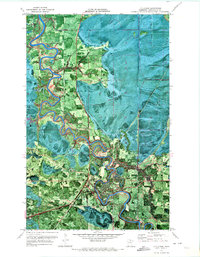
 1970 Devlin1973 Print · USGSThe international border along the Rainy River comes to life in the early 1970s, showcasing the timberlands and rail lines of the northern frontier. Researchers can trace the Canadian National tracks through Devlin or explore the Old Railroad Grade in the Smokey Bear State Forest.
 - 1970 Map of Rauch, 1973 Print
 1970 Rauch1973 Print · USGSThe Koochiching and Itasca county line comes alive in the early 1970s, showing a landscape defined by timber and the winding Little Fork River. Genealogists and local historians can locate Rauch and the SS Peter & Paul Ch amidst the deep woods.
 - 1970 Map of Johnson Landing SE, 1973 Print
 1970 Johnson Landing SE1973 Print · USGSNorthwestern Minnesota’s dense timberlands are shown in the early seventies through this orthophotomap of the Koochiching State Forest. Local historians can trace the paths of the seasonal Winter Trail and locate work sites such as a Gravel Pit.
 - 1970 Map of Littlefork SE, 1973 Print
 1970 Littlefork SE1973 Print · USGSKoochiching County at the dawn of the 1970s is seen here through a detailed orthophotomap of its dense northern forests and river systems. Genealogists and researchers can locate Cross River Hall, the Happy Land Lookout Tower, and historical routes like the Winter Trail.
 - 1970 Map of Littlefork, 1973 Print
 1970 Littlefork1973 Print · USGSLittlefork and its surrounding Koochiching County forests are captured in the early 1970s as a hub for timber and river transit. Trace the winding Little Fork River past the Burlington Northern line and Northwood Chapel.
 - 1970 Map of Nett Lake River SE, 1973 Print
 1970 Nett Lake River SE1973 Print · USGSNorthern Minnesota's wilderness is captured in the early 1970s as seasonal paths and waterways define the landscape. Researchers can trace the winding Little Fork River and the extensive Nett Lake Indian Reservation Boundary through dense forest.
 - 1970 Map of Nett Lake River East, 1973 Print
 1970 Nett Lake River East1973 Print · USGSKoochiching County is captured in the early 1970s as a densely forested expanse of the North Woods. Genealogists and historians can trace the Reservation Boundary and locate isolated landmarks like Fort Lookout Tower and the Winter Trail.
 - 1970 Map of Littlefork SW, 1973 Print
 1970 Littlefork SW1973 Print · USGSKoochiching County was a land of timber and iron-railed connectivity in the early 1970s. Researchers can trace the path of the Burlington Northern railroad and seasonal routes like the Wisner Grove Trail or the many Winter Trails.
 - 1970 Map of Big Falls SE, 1973 Print
 1970 Big Falls SE1973 Print · USGSKoochiching County at the start of the seventies is captured in this detailed orthophotomap of the northern Minnesota timberlands. Researchers can trace the winding Winter Trail through the Pine Island State Forest and locate a small Cem in the woods.
 - 1970 Map of Lindford SW, 1973 Print
 1970 Lindford SW1973 Print · USGSPine Island State Forest in the early 1970s is shown here as a landscape of timber and seasonal trails. Researchers can trace the path of the Big Fork River and locate remote sites like Hendrickson Camp or the Winter Trail network.
 - 1970 Map of Silverdale, 1973 Print
 1970 Silverdale1973 Print · USGSNorthern Minnesota timberlands and river valleys are captured here at the start of the 1970s. Local researchers can locate the small settlements of Silverdale and Greaney, including the site of St Bridgets Ch along the winding Little Fork River.
 - 1970 Map of Lindford, 1973 Print
 1970 Lindford1973 Print · USGSKoochiching County was still a rugged wilderness of timber and bogs in the early seventies, accessible primarily by the Big Fork River. Researchers can trace the layout of Lindford and find remote landmarks like the Northern Light Gospel Mission and various seasonal Winter Trails.
 - 1970 Map of Manitou, 1973 Print
 1970 Manitou1973 Print · USGSThe northern borderlands of Koochiching County are captured here in the early 1970s, where the international line follows the river. Researchers can trace seasonal routes like the Winter Trail and locate early settlements at Manitou and Burton.
 - 1970 Map of Lindford NW, 1973 Print
 1970 Lindford NW1973 Print · USGSKoochiching County at the dawn of the seventies was a landscape of deep timber and seasonal routes. Researchers can trace the winding Black River through the Pine Island State Forest and locate the remote Winter Trail network.
 - 1970 Map of Nett Lake SW, 1973 Print
 1970 Nett Lake SW1973 Print · USGSKoochiching County remains a wild landscape of water and forest in the early 1970s. Researchers can trace the Nett Lake Indian Reservation Boundary and follow seasonal travel routes like the Winter Trail through the Koochiching State Forest.
 - 1970 Map of Deer Lake NE, 1973 Print
 1970 Deer Lake NE1973 Print · USGSKoochiching and Itasca Counties are shown in the early 1970s at a time when much of the landscape remained undeveloped timberland. Researchers can trace seasonal routes like the Winter Road and Holstrum Spur Trail through the Koochiching State Forest.
 - 1970 Map of Lindford SE, 1973 Print
 1970 Lindford SE1973 Print · USGSThe northern wilderness of Koochiching Co comes into focus in the early seventies, centered on the winding Littlefork River. Trace the river to Hendrickson Landing or follow the network of Winter Trails through the Pine Island State Forest.
 - 1970 Map of Nett Lake River West, 1973 Print
 1970 Nett Lake River West1973 Print · USGSKoochiching County at the start of the 1970s is captured in this orthophotomap of the wooded river valleys south of the Canadian border. Trace the sinuous Little Fork River past Deadmans Rapids and through the Koochiching State Forest.
 - 1970 Map of Pelland, 1973 Print
 1970 Pelland1973 Print · USGSThe Rainy River borderlands of Koochiching County come into focus during the early 1970s. Researchers can trace the riverfront settlements of Pelland and Isherwood, alongside the Canadian National tracks and the historic Winter Road Trail.
 - 1970 Map of Deer Lake NW, 1973 Print
 1970 Deer Lake NW1973 Print · USGSThe northern Minnesota wilderness in the early seventies is revealed through this detailed orthophotomap of the lake-studded timberlands. Researchers can trace the seasonal Winter Trail network and locate landmarks like the Lookout Tower and Myrtle Lake.
 - 1970 Map of Johnson Landing NE, 1973 Print
 1970 Johnson Landing NE1973 Print · USGSKoochiching County was a vast expanse of timber and water in the early seventies, shown here in a rare orthophoto style. Trace the paths of the Cross River and Winter Trail, or locate the site of the Denton Lookout Tower deep within the state forest.
 - 1970 Map of Nett Lake NW, 1973 Print
 1970 Nett Lake NW1973 Print · USGSNett Lake and its surrounding reservation lands are captured here during the late 1960s, showing a landscape defined by water and forest. Researchers can trace seasonal routes like the Winter Trail or locate early industrial sites such as the Gravel Pits within the Nett Lake Indian Reservation Boundary.
 - 1970 Map of Littlefork NW, 1973 Print
 1970 Littlefork NW1973 Print · USGSThe northern Minnesota wilderness in the early seventies is revealed here through aerial photography and survey data. Genealogists can find the Riverside Cem while researchers trace the oxbows of the Big Fork River and various Winter Trails.
 - 1970 Map of Loman, 1973 Print
 1970 Loman1973 Print · USGSThe Rainy River borderlands come into focus in the early 1970s as logging trails and small settlements define the Koochiching County landscape. Genealogists and local historians can trace the foundations of Loman and Indus, locating sites like Riverside Cem and the Old Railroad Grade.
 - 1970 Map of Margie, 1973 Print
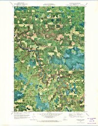
 1970 Margie1973 Print · USGSIn the early 1970s, the northern woods of Koochiching County were defined by the timber industry and the Burlington Northern rail line. Researchers can locate the settlement of Margie, its associated Margie Cem, and the seasonal Winter Trail through the Pine Island State Forest.
Showing maps 1-25 of 66
Top cities of Koochiching County
- International Falls historical maps
- Littlefork historical maps
- Big Falls historical maps
- Northome historical maps
- Ranier historical maps
- Mizpah historical maps
Frequently asked questions
- What are the different types of historical maps available for Koochiching County?
- What is the oldest map of Koochiching County?
- Where can I purchase historical maps of Koochiching County for my home or office?
- Where can I download high-res historical maps of Koochiching County?
- Are there historical topographic maps available for Koochiching County?
- Is there historical aerial imagery available for Koochiching County?
- Where are historical maps of Koochiching County sourced from?