1990s Maps of Koochiching County, Minnesota
Explore 14 historic maps of Koochiching County from the 1990s. These maps offer a rare glimpse into what life looked like during the 1990s — showing old roads, neighborhoods, homes, and landmarks that have changed or disappeared over time.
Whether you're researching your family's past, planning a metal detecting trip, or studying how Koochiching County's landscape evolved across the 1990s, these high-resolution maps are a powerful tool for exploring the history of this region.
- Focus on a specific era: All maps on this page are from the 1990s, giving you a focused view of this time period.
- See what’s changed: Compare century-old streets, trails, and buildings to today's modern landscape using overlays and satellite layers.
- Research with precision: Use these maps for genealogy, historical research, land use analysis, or educational projects.
- View, download, or print: Maps are fully viewable online in high resolution, and can be downloaded or printed for your own records.
Start exploring Koochiching County's history through authentic maps from the 1990s. This is your window into the past.
Koochiching County, MN maps
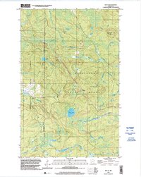
(14)- 1996 Map of Coddington Lake, 1998 Print
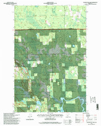 1996 Coddington Lake1998 Print · USGSItasca and Koochiching counties meet in this 1990s wilderness survey dominated by the Big Fork River and its surrounding wetlands. Local historians can locate the Grafton Cemetery and trace the complex boundaries of the Chippewa National Forest.
 - 1996 Map of Elmwood Island, 1998 Print
 1996 Elmwood Island1998 Print · USGSItasca and Koochiching counties meet in this dense forest and wetland landscape during the mid-1990s. Genealogists and outdoorsmen can trace the remote waterways of Moose Lake or locate family landmarks like Elmwood Island and Tuefer Lake.
 - 1996 Map of Pomroy, 1998 Print
 1996 Pomroy1998 Print · USGSThe North Woods of Itasca County are captured here in the mid-nineties, showing a landscape of dense state and national forests. Genealogists and outdoorsmen can trace the Big Fork River past Robbs Rapids or locate the remote settlement of Pomroy.
 - 1996 Map of Northome South, 1998 Print
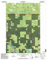
 1996 Northome South1998 Print · USGSNorthern Minnesota timber and lakeland are shown in detail during the late nineties, centered on the border of Itasca and Koochiching counties. Genealogists can locate Forest Hill Cemetery and the settlement of Bergville, while the terrain captures Island Lake and Northome.
 - 1996 Map of Wildwood SE, 1998 Print
 1996 Wildwood SE1998 Print · USGSThe northern Minnesota wilderness of the mid-1990s is captured here, showing the convergence of several major public timberlands. Researchers can trace the winding Big Fork River past Hauck Rapids and navigate the remote Winter Trail.
 - 1999 Map of International Falls, 2003 Print
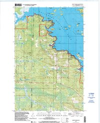
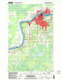 1999 International Falls2003 Print · USGSInternational Falls and the Canadian border at the turn of the millennium show a landscape defined by the Rainy River and northern industry. Genealogists and local historians can trace civic life through Forest Hill Cem, Holler Sch, and the Old Winter Trail.
 - 1999 Map of Cranberry Bay, 2003 Print
 1999 Cranberry Bay2003 Print · USGSThe Minnesota-Ontario borderlands at the end of the century are captured here, showcasing the watery expanse of the northern frontier. Researchers can trace historic transit routes like the Winter Trail and locate family landmarks such as Cemetery Island.
 - 1999 Map of Ranier, 2003 Print
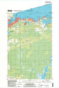 1999 Ranier2003 Print · USGSRanier and the international border are captured here at the end of the millennium, showing a landscape shaped by water and rail. Researchers can trace local landmarks like Falls Junction, the sprawling Koochiching State Forest, and the winding Rat Root River.
 - 1999 Map of Ray SW, 2003 Print
 1999 Ray SW2003 Print · USGSKoochiching County at the end of the twentieth century remains a landscape of deep woods and winding waterways. Follow the path of the Rat Root River or trace the seasonal route of the Winter Trail through the State Forest.
 - 1999 Map of Ray, 2003 Print
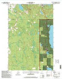
 1999 Ray2003 Print · USGSNear the Canadian border in the late 1990s, this region shows a landscape shaped by the timber industry and forest conservation. Researchers can locate the Lyman Cem, the settlement of Ray, and the winding course of the Rat Root River.
 - 1999 Map of Ray SE, 2003 Print
 1999 Ray SE2003 Print · USGSThe Northwoods of St. Louis County are captured here at the close of the twentieth century, showing a landscape defined by timber and water. Researchers can trace the path of the Rat Root River, find the Kabetogama Lookout Tower, and locate remote points like Arbutus.
 - 1999 Map of Ericsburg, 2003 Print
 1999 Ericsburg2003 Print · USGSThe northern Minnesota border country comes into focus in the late 1990s as it appeared before modern development. Researchers can trace the seasonal Winter Trail network and river landings near Ericsburg or explore the banks of Rat Root Lake.
 - 1999 Map of Kabetogama, 2003 Print
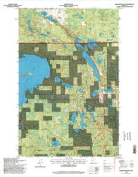
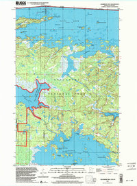
 1999 Kabetogama2003 Print · USGSThe northern lake country comes alive in the late nineties, documenting the shoreline where the village meets the national park. Genealogists and historians can locate community landmarks like Kabetogama Ch, the St Jude Chapel, and the Wooden Frog Campground along the water.
 - 1999 Map of Island View, 2003 Print
 1999 Island View2003 Print · USGSThe Minnesota-Ontario borderlands at the end of the millennium show a landscape defined by water and protected forests. Local historians can trace the intricate shorelines of Island View and locate specific landmarks like the Black Bay Lookout Tower and Sha Sha Point.
End of results
Showing maps 1-14 of 14
Top cities of Koochiching County
- International Falls historical maps
- Littlefork historical maps
- Big Falls historical maps
- Northome historical maps
- Ranier historical maps
- Mizpah historical maps
Frequently asked questions
- What are the different types of historical maps available for Koochiching County?
- What is the oldest map of Koochiching County?
- Where can I purchase historical maps of Koochiching County for my home or office?
- Where can I download high-res historical maps of Koochiching County?
- Are there historical topographic maps available for Koochiching County?
- Is there historical aerial imagery available for Koochiching County?
- Where are historical maps of Koochiching County sourced from?