Old Maps of Lac qui Parle County, Minnesota for Metal Detecting
Plan your next treasure hunt with 167 historic maps of Lac qui Parle County. Find old homesites, ghost towns, trails, and gathering spots that may be lost to time — perfect for identifying promising metal detecting locations.
- Locate forgotten sites: Uncover places like long-lost settlements, abandoned rail lines, or gathering spots.
- Plan better hunts: Use map overlays combined with LiDAR or satellite views to narrow in on historically rich areas.
- Made for detectorists: Thousands of hobbyists use these maps to discover relics, coins, and hidden history.
Use these historic maps to boost your research and find new opportunities beneath the surface of Lac qui Parle County.
Lac qui Parle County, MN maps
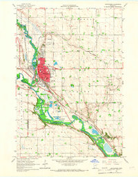
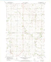
(167)- 1953 Map of Ortonville, 1955 Print
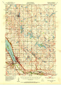 1953 Ortonville1955 Print · USGSThe Minnesota-South Dakota borderlands come alive in this mid-century survey of the lake-rich prairie. Genealogists and historians can locate numerous rural landmarks like Greenwood Cem, Pleasant Valley Ch, and the many numbered schools scattered between Clinton and Odessa.
 - 1953 Map of Bellingham, 1955 Print
 1953 Bellingham1955 Print · USGSThe borderlands of western Minnesota and South Dakota are shown here in the mid-fifties as a landscape of rail-connected prairie towns and a dense network of country school districts. Genealogists can trace family footprints near Bellingham and Marietta, or locate rural sites like Immanuel Ch and the Swedish Mission Cem.
 - 1953 Map of Milbank, 1958 Print
 1953 Milbank1958 Print · USGSThe tri-state border region of South Dakota, North Dakota, and Minnesota is shown here during the early fifties, a landscape defined by glacial lakes and the Sisseton Indian Reservation. Researchers can trace the legacy of the western railroads, locating old stops along the Great Northern and settlements like Milbank, Webster, and Sisseton.3 unique versions available
 - 1953 Map of Watertown, 1968 Print
 1953 Watertown1968 Print · USGSEastern South Dakota and the Minnesota borderlands are captured here during the mid-twentieth century as the region's agricultural and rail-service centers thrived. Genealogists and local historians can trace family-named sites across the Coteau des Prairies and find landmarks in Watertown, De Smet, and Brookings.3 unique versions available
 - 1953 Map of New Ulm, 1968 Print
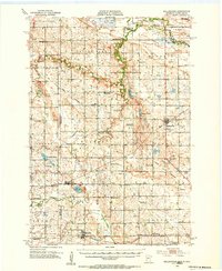
 1953 New Ulm1968 Print · USGSSouthern Minnesota in the mid-1950s is defined by its deep river valleys and the expanding reach of the Great Northern and Chicago and North Western railroads. Researchers can trace rural lineages through landmarks like the Milford State Monument, St. John's Ch, and the Upper Sioux Indian Res.3 unique versions available
 - 1953 Map of Saint Cloud, 1968 Print
 1953 Saint Cloud1968 Print · USGSCentral Minnesota's lake country and the Mississippi River valley are caught in a period of steady mid-century growth. Researchers can trace historic rail lines, old granite works, and local landmarks like St. Johns University, Camp Ripley, and the shores of Lake Minnewaska.3 unique versions available
 - 1957 Map of Saint Cloud
 1957 Saint Cloud1957 Print · USGSCentral Minnesota's lake country and rail corridors are meticulously detailed in the mid-1950s. Genealogists and researchers can trace the growth of towns like Alexandria, Willmar, and Saint Cloud along the Great Northern railroad line.
 - 1957 Map of New Ulm
 1957 New Ulm1957 Print · USGSCentral Minnesota in the mid-fifties remains a landscape of river-valley commerce and prairie agriculture defined by its historic mission sites and rail towns. Genealogists and local historians can trace the development of New Ulm and Montevideo, or locate specific landmarks like the Milford State Monument and Minnesota Falls.
 - 1958 Map of New Ulm
 1958 New Ulm1958 Print · USGSSouth-central Minnesota’s river valleys and prairie towns are captured here in the mid-fifties, during the height of the region's rail-and-river economy. Genealogists and historians can trace the legacy of the Upper Sioux Indian Mission or locate early rail stops along the Chicago and North Western Ry in towns like Redwood Falls and Glencoe.
 - 1958 Map of Milbank
 1958 Milbank1958 Print · USGSThe northern Great Plains in the late fifties show a landscape of glacial lakes and reservation lands shaped by the Great Northern railroad. Genealogists and local historians can trace the grid of settlements from Britton to Milbank and locate landmarks like Enemy Swim Lake and the Sisseton Indian Reservation.
 - 1958 Map of Watertown
 1958 Watertown1958 Print · USGSThe eastern South Dakota prairie and the Minnesota borderlands are captured here in the late fifties, showcasing a landscape of terminal moraine lakes and burgeoning rail hubs. Genealogists and historians can trace the early paths of the Chicago and North Western railroad or locate family roots in Watertown, Clark, or the Sisseton Indian Reservation.2 unique versions available
 - 1958 Map of Saint Cloud
 1958 Saint Cloud1958 Print · USGSCentral Minnesota in the mid-1950s shows a landscape of growing regional hubs and hundreds of glacial lakes connected by an extensive rail network. Genealogists and historians can trace the early footprints of Saint Cloud, Alexandria, and Willmar along the Great Northern Railway.
 - 1958 Map of Cerro Gordo, 1959 Print
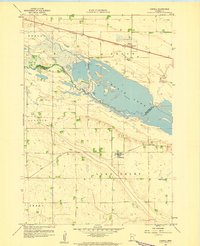
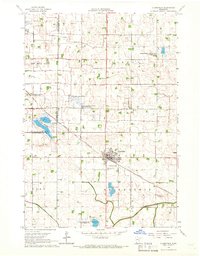
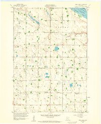 1958 Cerro Gordo1959 Print · USGSLac Qui Parle County remains a landscape of traditional township grids and rural school districts in the late fifties. Genealogists and local historians can locate several specific district schools and parish landmarks, including Borgund Ch, School No 871, and the settlement at Cerro Gordo.
 - 1958 Map of Madison, 1959 Print
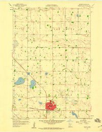 1958 Madison1959 Print · USGSMadison and its surrounding townships are captured here in the late fifties as a settled agricultural hub. Genealogists and local researchers can trace the old Minneapolis and St Louis rail line and locate landmarks like the Hegre Cem and County Home.
 - 1958 Map of Correll, 1959 Print
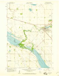
 1958 Correll1959 Print · USGSBig Stone and Lac qui Parle counties meet along the Minnesota River in the late fifties, where rail and water shaped the local economy. Genealogists and historians can trace the footprint of Correll and Louisburg, or locate School No 867 and the local Quarry.
 - 1958 Map of Milan, 1959 Print
 1958 Milan1959 Print · USGSChippewa and Lac qui Parle counties meet along the Minnesota River valley in the late fifties, where rail and river networks converge. Researchers can trace the Milwaukee Road through Milan, locate School No 836, and find the historic Kviteseid Cem.2 unique versions available
 - 1958 Map of Watson, 1959 Print
 1958 Watson1959 Print · USGSThe river bottomlands and prairies of Chippewa County are captured here in the late fifties as rural life revolved around the rail line and river forks. Genealogists and local historians can trace schoolhouse districts like School No 277 and School No 288 or locate family sites near Churchill and Zion Ch.3 unique versions available
 - 1958 Map of Appleton, 1960 Print
 1958 Appleton1960 Print · USGSAppleton and the surrounding prairies of Swift County are documented here in the late fifties, where the river systems dominate the terrain. Genealogists and local historians can trace family-named sites like Appleton Cem, the Minnesota Valley Ch, and the old rail lines of the Great Northern.2 unique versions available
 - 1965 Map of Montevideo, 1966 Print
 1965 Montevideo1966 Print · USGSThe river confluence at Montevideo flourished in the mid-sixties as a center for rail and river-valley transport. Researchers can trace family history through many local landmarks, including Sunset Memorial Cemetery, St Johns Ch, and the tiny settlement of Wegdahl.2 unique versions available
 - 1965 Map of Clarkfield, 1966 Print
 1965 Clarkfield1966 Print · USGSMid-century Yellow Medicine County is defined here by the diagonal tracks of the Chicago and North Western and a vast network of prairie wetlands. Trace the development of Clarkfield through its cemetery, Storage Bins, and the many wildlife areas like Lake Louie.
 - 1965 Map of Clarkfield NE, 1966 Print
 1965 Clarkfield NE1966 Print · USGSThe confluence of the Minnesota and Chippewa Rivers defines this rural landscape in the mid-1960s. Genealogists can trace family footprints at German American Cem and St Petri Cem, or locate landmarks like School No 839.
 - 1965 Map of Tenmile Lake, 1966 Print
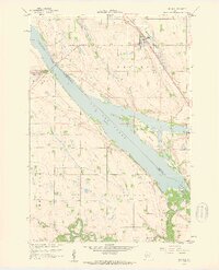
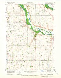
 1965 Tenmile Lake1966 Print · USGSLac Qui Parle County is captured in the mid-1960s as a productive agricultural landscape defined by its river bends and drainage networks. Genealogists and researchers can locate landmarks like Our Saviors Ch, the Townhall, and the Chicago and North Western rail line.
 - 1965 Map of Boyd, 1966 Print
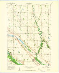
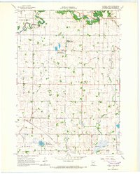
 1965 Boyd1966 Print · USGSThe rural prairie of Lac qui Parle and Yellow Medicine counties is captured in the mid-1960s as a landscape of structured drainage and rail-side commerce. Researchers can locate specific family history sites like Trinity Cem, the Zion Ch, and the township Townhall.
 - 1967 Map of New Ulm
 1967 New Ulm1967 Print · USGSSouthern Minnesota in the mid-fifties is captured here as a landscape of river-valley missions and busy prairie rail towns. Researchers can trace the Yellow Medicine Trail and locate historic sites like the Morton Indian Mission and Milford State Monument.
 - 1967 Map of Dawson SW, 1968 Print
 1967 Dawson SW1968 Print · USGSLac qui Parle and Yellow Medicine counties meet here in the late sixties, showing a landscape defined by prairie agriculture and rural townships. Researchers can find deep local roots at the Providence Valley Ch or trace the winding Lazarus Creek.
Showing maps 1-25 of 167
Top cities of Lac qui Parle County
- Madison historical maps
- Dawson historical maps
- Cerro Gordo historical maps
- Boyd historical maps
- Bellingham historical maps
- Providence historical maps
See more
Frequently asked questions
- What are the different types of historical maps available for Lac qui Parle County?
- What is the oldest map of Lac qui Parle County?
- Where can I purchase historical maps of Lac qui Parle County for my home or office?
- Where can I download high-res historical maps of Lac qui Parle County?
- Are there historical topographic maps available for Lac qui Parle County?
- Is there historical aerial imagery available for Lac qui Parle County?
- Where are historical maps of Lac qui Parle County sourced from?