
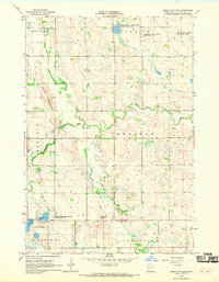
1967 Map of Dawson SW
USGS Topo · Published 1968About this map
Providence and Freeland townships define the northern landscape of this prairie region, where an extensive network of drainage projects like Co Ditch No 85 and County Ditch No 79 reshaped the land for agriculture during the mid-20th century. The rural character of the era is anchored by small community centers and burial grounds, including the St Johns Cem and Nicolai Cem. In the southern reaches, the Lac qui Parle River and Lazarus Creek wind through Hammer and Oshkosh townships, providing the primary natural drainage amidst a grid of section lines and gravel roads. Local landmarks like the Providence Valley Ch and its neighboring Providence Valley Cem serve as vital touchstones for genealogists tracing family histories in these rural Minnesota precincts.
Find a feature on this map
21 named features on this map. Tap any name to fly to it.
Don’t see what you’re looking for? This feature index may not catch every label — zoom into the map to look around manually.
Map Details
Editions of this 1967 Dawson SW Map
This is the sole edition of this map. No revisions or reprints were ever made.
Other maps of this area

1953 · Watertown
USGS Topo · 1:250,000

1958 · Watertown
USGS Topo · 1:250,000

1967 · Canby
USGS Topo · 1:24,000

1967 · Porter
USGS Topo · 1:24,000
1967 · Providence
USGS Topo · 1:24,000
1967 · St Leo
USGS Topo · 1:24,000

1967 · Gary SE
USGS Topo · 1:24,000
1967 · Dawson
USGS Topo · 1:24,000
1967 · Dawson NW
USGS Topo · 1:24,000
1967 · Mount Wickham
USGS Topo · 1:24,000