
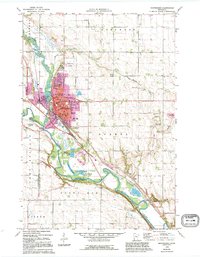
1965 Map of Montevideo
USGS Topo · Published 1966About this map
Montevideo sits at the confluence of the Chippewa River and the Minnesota River, serving as a central hub for western Minnesota's river-valley agriculture in the mid-1960s. The map illustrates a developed local infrastructure, from the Montevideo Airport north of town to the numerous educational facilities like Ramsey Sch, Sibley Sch, and the High School. The landscape is a mix of urban density and agrarian townships such as Sparta and Tunsberg, with the Chicago Milwaukee St Paul and Pacific railroad threading through the river bottoms.
Find a feature on this map
50 named features on this map. Tap any name to fly to it.
Don’t see what you’re looking for? This feature index may not catch every label — zoom into the map to look around manually.
Map Details
Editions of this 1965 Montevideo Map
2 editions found
Other maps of this area

1953 · New Ulm
USGS Topo · 1:250,000

1953 · Saint Cloud
USGS Topo · 1:250,000

1957 · Saint Cloud
USGS Topo · 1:250,000

1957 · New Ulm
USGS Topo · 1:250,000

1958 · New Ulm
USGS Topo · 1:250,000

1958 · Saint Cloud
USGS Topo · 1:250,000

1958 · Watson
USGS Topo · 1:24,000

1958 · Gracelock
USGS Topo · 1:24,000

1958 · Gracelock SW
USGS Topo · 1:24,000

1965 · Clarkfield
USGS Topo · 1:24,000