Old Maps of Baudette, Minnesota for Academic Research
Study the evolution of Baudette with 17 high-resolution historic maps. Whether you're teaching, researching, or modeling changes in land use, these maps provide essential visual documentation of urban, environmental, and geographic change.
- Analyze long-term change: Track patterns in development, transportation, and natural features.
- Ideal for environmental or urban studies: Support academic projects with primary historical map data.
- Use in the classroom or lab: Educators and researchers rely on these maps to bring historical context to life.
These maps are a powerful tool for teaching, research, and visualizing how Baudette has changed over the decades.
Baudette, MN maps
(17)- 1921 Map of Baudette
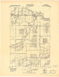 1921 Baudette1921 Print · USGSBaudette and Spooner anchor this borderland survey during the early 1920s, showing a landscape defined by timber and drainage. Researchers can trace early railroad history along the Canadian Northern or locate rural landmarks like Pitt and Wabanica Creek.2 unique versions available
 - 1954 Map of Roseau, 1969 Print
 1954 Roseau1969 Print · USGSNorthern Minnesota's borderlands come alive in the 1950s, showing a landscape defined by timber, water, and rail. Trace family roots through old schools and cemeteries near Roseau, Warroad, and the expansive Red Lake Indian Reservation.2 unique versions available
 - 1957 Map of Roseau
 1957 Roseau1957 Print · USGSThe international border and tribal lands define Northern Minnesota in the mid-fifties, from the shores of Lake of the Woods to the Red Lake Indian Reservation. Researchers can trace the path of the Great Northern railroad and locate isolated outposts like the U S Custom House and Ponemah.
 - 1958 Map of Roseau
 1958 Roseau1958 Print · USGSNorthern Minnesota's borderlands and vast lake country are captured here in the late fifties. Researchers can trace the Canadian National rail line through Warroad or find family history in frontier settlements like Baudette, Waskish, and Shotley.
 - 1968 Map of Pitt, 1971 Print
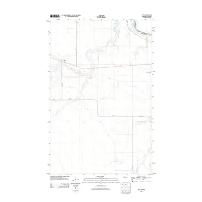
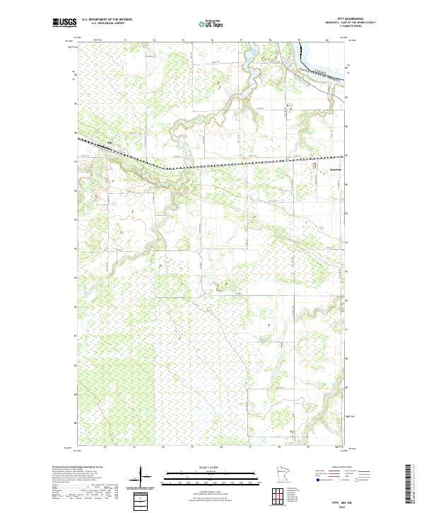
 1968 Pitt1971 Print · USGSNear the Canadian border in the late sixties, this northern Minnesota landscape is defined by the Rainy River and the Red Lake Indian Reservation. Genealogists and local historians can locate the Pitt settlement and Hagen Sch along the Canadian National rail line.
 - 1968 Map of Baudette, 1971 Print
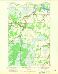
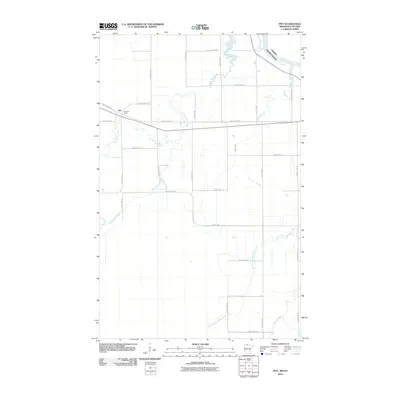
 1968 Baudette1971 Print · USGSBaudette and the international border stood as a bustling rail and river hub in the late sixties. Researchers can trace local landmarks like Elm Park Cem, the Fairgrounds, and the sprawl of the Red Lake Indian Reservation.
 - 1976 Map of Baudette, 1993 Print
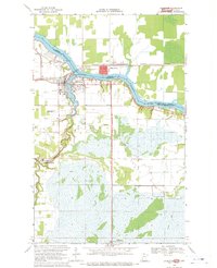
 1976 Baudette1993 Print · USGSNorthern Minnesota’s borderlands are shown here in the mid-1970s, as the Rainy River winds toward the vast Lake of the Woods. Genealogists and local historians can trace the foundations of Baudette and Williams, or locate rural landmarks within the Pine Island State Forest.
 - 2010 Map of Pitt, 2010 Print
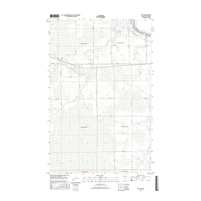
 2010 Pitt2010 Print · USGSCovers Baudette, including Dawson Township, Rainy River District, and other nearby areas
 - 2010 Map of Baudette, 2010 Print
 2010 Baudette2010 Print · USGSCovers Baudette, including Rainy River, Dawson Township, and other nearby areas
 - 2013 Map of Baudette, 2013 Print
 2013 Baudette2013 Print · USGSCovers Baudette, including Rainy River, Dawson Township, and other nearby areas
 - 2013 Map of Pitt, 2013 Print
 2013 Pitt2013 Print · USGSCovers Baudette, including Dawson Township, Rainy River District, and other nearby areas
 - 2016 Map of Baudette, 2016 Print
 2016 Baudette2016 Print · USGSCovers Baudette, including Rainy River, Dawson Township, and other nearby areas
 - 2016 Map of Pitt, 2016 Print
 2016 Pitt2016 Print · USGSCovers Baudette, including Dawson Township, Rainy River District, and other nearby areas
 - 2019 Map of Pitt, 2019 Print
 2019 Pitt2019 Print · USGSCovers Baudette, including Dawson Township, Rainy River District, and other nearby areas
 - 2019 Map of Baudette, 2019 Print
 2019 Baudette2019 Print · USGSCovers Baudette, including Rainy River, Dawson Township, and other nearby areas
 - 2022 Map of Pitt, 2022 Print
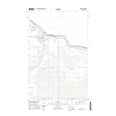
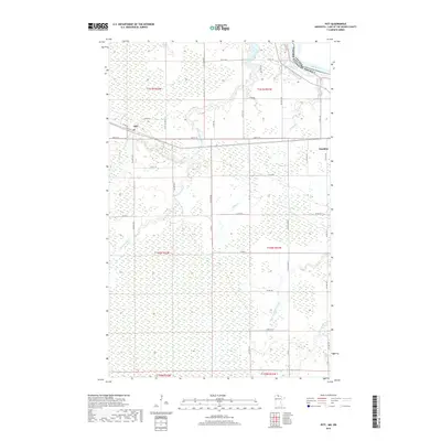
 2022 Pitt2022 Print · USGSIn the northern reaches of Lake of the Woods County, this modern survey details the rural crossroads and river systems near the Canadian border. Genealogists and local historians can trace family locations near Pitt or follow the paths of Miller Cr and Peppermint Cr.
 - 2022 Map of Baudette, 2022 Print
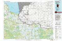
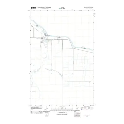
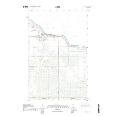
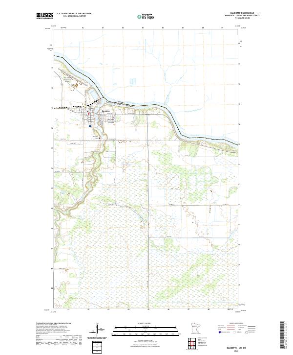 2022 Baudette2022 Print · USGSThe northern border of Minnesota at the Rainy River is captured in this contemporary survey of Baudette. Researchers can trace the civic footprint of the county seat, from the Lake of the Woods County Courthouse to Elm Park Cem.
End of results
Showing maps 1-17 of 17
Frequently asked questions
- What are the different types of historical maps available for Baudette?
- What is the oldest map of Baudette?
- Where can I purchase historical maps of Baudette for my home or office?
- Where can I download high-res historical maps of Baudette?
- Are there historical topographic maps available for Baudette?
- Is there historical aerial imagery available for Baudette?
- Where are historical maps of Baudette sourced from?