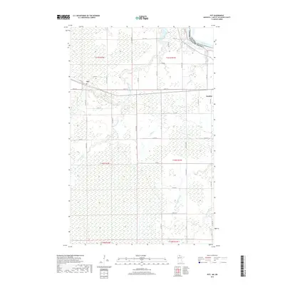
2019 Map of Pitt
USGS Topo · Published 2019About this map
The international border with Canada follows the course of the Rainy River at the northern edge of this landscape, marking a remote stretch of Lake of the Woods County. The small settlement of Pitt serves as a local landmark along the east-west corridor of Main St W, while the larger community of Baudette is situated on the eastern edge of the quadrangle. This area is defined by its complex hydrology, where numerous waterways like the Winter Road River and Miller Creek wind through the terrain. The drainage patterns are further articulated by the W Fork Baudette River and Baudette River, which intersect the section lines of the Public Land Survey System. A dense network of county roads, such as Co Hwy 1 and Co Rd 162, provides access to the surrounding timberlands and agricultural fields that characterize this northern Minnesota borderland.
Find a feature on this map
41 named features on this map. Tap any name to fly to it.
Don’t see what you’re looking for? This feature index may not catch every label — zoom into the map to look around manually.
Map Details
Editions of this 2019 Pitt Map
This is the sole edition of this map. No revisions or reprints were ever made.
Other maps of this area

1918 · Williams
USGS Topo · 1:62,500

1919 · Peppermint Creek
USGS Topo · 1:62,500

1919 · Canada
USGS Topo · 1:62,500

1921 · Baudette
USGS Topo · 1:62,500

1943 · Peppermint Creek
USGS Topo · 1:62,500

1954 · Roseau
USGS Topo · 1:250,000

1957 · Roseau
USGS Topo · 1:250,000

1958 · Roseau
USGS Topo · 1:250,000
1967 · Williams SE
USGS Topo · 1:24,000
1967 · Wheelers Point
USGS Topo · 1:24,000