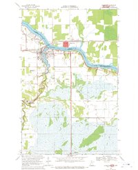
1968 Map of Baudette
USGS Topo · Published 1971About this map
The international border crossing between Baudette and the town of Rainy River defines this late-1960s survey. Situated at the confluence of the Rainy River and the Baudette River, this border community serves as a vital point of transit, marked by the Canadian National railroad corridor and the presence of both US Customs and Canadian Customs. The landscape reveals a mix of civic infrastructure and remote access points, including the Baudette International Airport, a Seaplane Base, and the local Courthouse.
Find a feature on this map
23 named features on this map. Tap any name to fly to it.
Don’t see what you’re looking for? This feature index may not catch every label — zoom into the map to look around manually.
Map Details
Editions of this 1968 Baudette Map
This is the sole edition of this map. No revisions or reprints were ever made.
Other maps of this area

1919 · Canada
USGS Topo · 1:62,500

1921 · Baudette
USGS Topo · 1:62,500

1954 · Roseau
USGS Topo · 1:250,000

1957 · Roseau
USGS Topo · 1:250,000

1958 · Roseau
USGS Topo · 1:250,000
1967 · Wheelers Point
USGS Topo · 1:24,000

1968 · Baudette SE
USGS Topo · 1:24,000

1968 · Clementson
USGS Topo · 1:24,000

1968 · Clementson SW
USGS Topo · 1:24,000
1968 · Baudette SW
USGS Topo · 1:24,000