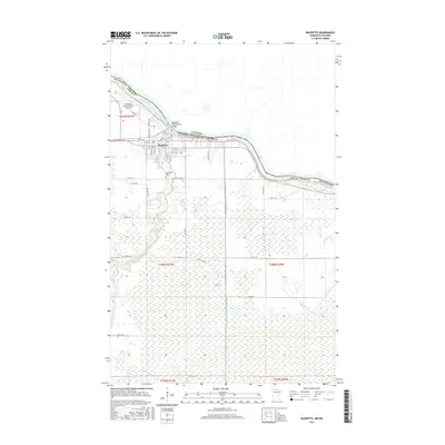
2016 Map of Baudette
USGS Topo · Published 2016About this map
Baudette serves as a critical international gateway along the northern border, situated where the Baudette River flows into the expansive Rainy River. This 2016 survey highlights the town's position as a transit hub, connected to Canada by the Baudette International Bridge and served by the Baudette International Airport to the northwest. The settlement pattern is concentrated near the river junction, with a grid of residential and commercial streets such as Main Ave and 2nd St NW giving way to the vast wetlands that dominate the southern and eastern landscape. Local landmarks like Elm Park Cem and the surrounding township lines provide essential geographic context for genealogists and researchers. Away from the town center, the terrain is defined by drainage features like W Br Silver Cr and a network of rural routes including Gun Club Rd SE, illustrating the transition from a border community to the dense, marshy wilds of Lake of the Woods County.
Find a feature on this map
42 named features on this map. Tap any name to fly to it.
Don’t see what you’re looking for? This feature index may not catch every label — zoom into the map to look around manually.
Map Details
Editions of this 2016 Baudette Map
This is the sole edition of this map. No revisions or reprints were ever made.
Other maps of this area

1919 · Canada
USGS Topo · 1:62,500

1921 · Baudette
USGS Topo · 1:62,500

1954 · Roseau
USGS Topo · 1:250,000

1957 · Roseau
USGS Topo · 1:250,000

1958 · Roseau
USGS Topo · 1:250,000
1967 · Wheelers Point
USGS Topo · 1:24,000

1968 · Baudette SE
USGS Topo · 1:24,000

1968 · Clementson
USGS Topo · 1:24,000

1968 · Clementson SW
USGS Topo · 1:24,000
1968 · Baudette SW
USGS Topo · 1:24,000