1900s (20th Century) Maps of Morrison County, Minnesota
Explore 70 historic maps of Morrison County from the 1900s (20th Century). These maps offer a rare glimpse into what life looked like during the 1900s — showing old roads, neighborhoods, homes, and landmarks that have changed or disappeared over time.
Whether you're researching your family's past, planning a metal detecting trip, or studying how Morrison County's landscape evolved across the 1900s, these high-resolution maps are a powerful tool for exploring the history of this region.
- Focus on a specific era: All maps on this page are from the 1900s, giving you a focused view of this time period.
- See what’s changed: Compare century-old streets, trails, and buildings to today's modern landscape using overlays and satellite layers.
- Research with precision: Use these maps for genealogy, historical research, land use analysis, or educational projects.
- View, download, or print: Maps are fully viewable online in high resolution, and can be downloaded or printed for your own records.
Start exploring Morrison County's history through authentic maps from the 1900s. This is your window into the past.
Morrison County, MN maps
(70)- 1916 Map of Pillager, 1957 Print
 1916 Pillager1957 Print · USGSThe Brainerd Lakes region at the start of the twentieth century shows a landscape of growing settlements and interconnected waterways. Genealogists and historians can trace the foundations of local communities through several rural schoolhouses and the early paths of the Northern Pacific railroad through Pillager and Barrows.2 unique versions available
 - 1919 Map of Pillager
 1919 Pillager1919 Print · USGSThe Gull Lake region in the years before the Great War shows a landscape transitioning between early frontier settlement and a burgeoning vacation destination. Genealogists can locate numerous rural schoolhouses like Home Brook School and Franzon School alongside the historic Grand View Lodge.3 unique versions available
 - 1947 Map of Flensburg, 1951 Print
 1947 Flensburg1951 Print · USGSMorrison County farming and timber lands are captured here in the late 1940s as rural life centered on local townships. Trace family roots at Mission Covenant Church and Cemetery, Culdrum Town Hall, or Flensburg.
 - 1948 Map of Belle Prairie, 1961 Print
 1948 Belle Prairie1961 Print · USGSMorrison and Crow Wing counties are captured here in the late 1940s, a landscape defined by military grounds and a dense network of country schools. Researchers can trace the legacy of early settlements through Old Darling Mission Cemetery, the Northern Pacific line at Darling Switch, and St Mathias Church.
 - 1948 Map of Pierz, 1967 Print
 1948 Pierz1967 Print · USGSMorrison and Benton Counties in the late 1940s are characterized by a dense network of rail lines and rural school districts. Genealogists can trace family roots through numerous numbered schools, St Johns Church, and local landmarks like Rosemarks Store.
 - 1948 Map of Lastrup, 1971 Print
 1948 Lastrup1971 Print · USGSCentral Minnesota farming communities thrive along the riverbanks in this post-war landscape. Genealogists can trace family roots through numerous rural landmarks like Holy Cross Church, the Freedhem Cemetery, and the Granite Town Hall.
 - 1948 Map of Cushing, 1972 Print
 1948 Cushing1972 Print · USGSThe post-war lake country of Morrison and Todd counties comes to life in this mid-century survey, revealing a landscape of small lakeside settlements and one-room schoolhouses. Researchers can trace the roots of rural communities through dozens of local landmarks like Cushing, Betesta Church, and Willis School.2 unique versions available
 - 1948 Map of Little Falls, 1973 Print
 1948 Little Falls1973 Print · USGSMid-century Central Minnesota comes alive in this survey of the river valleys and rail towns north of St. Cloud. Genealogists can locate family landmarks like St Mary Church, Pike Creek Town Hall, and numerous rural schools from Bowlus to Royalton.
 - 1950 Map of Lastrup
 1950 Lastrup1950 Print · USGSIn the late 1940s, the rural townships of eastern Morrison County were organized around a dense network of local school districts and small parish towns. Researchers can trace family roots at Riverside Cemetery or locate the sites of numerous vanished rural schools like District No 19 School and District No 84 School.2 unique versions available
 - 1950 Map of Swanville
 1950 Swanville1950 Print · USGSCentral Minnesota at mid-century reveals a landscape of lakeside settlements and rural school districts across the Todd and Morrison county borders. Genealogists and historians can trace family roots through sites like Spring Brook Cemetery, the Bruce Town Hall, and Lake Beauty School.2 unique versions available
 - 1950 Map of Belle Prairie
 1950 Belle Prairie1950 Print · USGSMorrison and Crow Wing counties are captured here in the late 1940s, showing a landscape defined by the winding Mississippi and sprawling military grounds. Researchers can trace rural lineages through local landmarks like St Mathias Church, Darling Switch, and Rail Prairie Town Hall.2 unique versions available
 - 1950 Map of Little Falls
 1950 Little Falls1950 Print · USGSMid-century Morrison County reveals a landscape of river-driven industry and rural township life along the Mississippi River. Genealogists can trace family roots through numerous sites like St Stan Kostka Cemetery, School No 54, and Pike Creek Town Hall.2 unique versions available
 - 1950 Map of Pierz
 1950 Pierz1950 Print · USGSIn the mid-twentieth century, this central Minnesota region was a bustling network of small farming townships and rail-connected villages. Genealogists can trace family roots through dozens of local landmarks like St Johns Church, Rosemarks Store, and numerous rural schoolhouses.
 - 1950 Map of Cushing
 1950 Cushing1950 Print · USGSMorrison and Todd counties come alive in the postwar years, showing a landscape of small farming communities and a vast network of glacial lakes. Genealogists can trace family roots through numerous rural landmarks like Randall Cemetery, Zion Church, and over twenty numbered country schools.
 - 1951 Map of Flensburg
 1951 Flensburg1951 Print · USGSMorrison County settlement in the post-war years centered on the village of Flensburg and its connection to the Northern Pacific railroad. Genealogists can trace family roots through several country schools and local landmarks like Immanuel Church and the Sacred Heart Cemetery.
 - 1953 Map of Duluth, 1964 Print
 1953 Duluth1964 Print · USGSNortheastern Minnesota and northwestern Wisconsin are shown here during a period of industrial maturity and expanding conservation. Genealogists and historians can trace rail-connected towns like McGrath and Wahkon, or locate heritage sites within the Fond du Lac Indian Reservation.2 unique versions available
 - 1953 Map of Brainerd, 1966 Print
 1953 Brainerd1966 Print · USGSCentral Minnesota's lake country and iron ranges are detailed in the mid-fifties, showing the intersection of industry and wilderness. Researchers can locate specific local landmarks like the Crow Wing County Courthouse or trace the early paths of the Soo Line Railroad and the Cuyuna Range Iron Mines.3 unique versions available
 - 1953 Map of Saint Cloud, 1968 Print
 1953 Saint Cloud1968 Print · USGSCentral Minnesota's lake country and the Mississippi River valley are caught in a period of steady mid-century growth. Researchers can trace historic rail lines, old granite works, and local landmarks like St. Johns University, Camp Ripley, and the shores of Lake Minnewaska.3 unique versions available
 - 1953 Map of Stillwater, 1980 Print
 1953 Stillwater1980 Print · USGSThe Twin Cities and the St. Croix Valley are captured in this mid-century survey as the interstate era began to transform the Upper Midwest. Genealogists and historians can trace the rail-and-river geography of Stillwater, locate landmarks in Anoka, or explore the sprawling St Croix State Park.
 - 1954 Map of Baxter, 1955 Print
 1954 Baxter1955 Print · USGSBaxter and the lake-country of central Minnesota are captured here in the mid-1950s as a burgeoning transportation and recreation hub. Genealogists and local historians can trace family-named sites like Oak Land Cem, the Plumly Sch (Abandoned), and the rail-side community of Barrows.5 unique versions available
 - 1954 Map of Pillager, 1955 Print
 1954 Pillager1955 Print · USGSCentral Minnesota's river-and-rail corridor is captured here in the mid-1950s, highlighting the transition from rural school districts to larger state and military lands. Trace the legacy of Pillager and its Pillager Dam alongside Wildwood Cem and the Pillsbury State Forest.4 unique versions available
 - 1955 Map of Stillwater, 1965 Print
 1955 Stillwater1965 Print · USGSThe Upper St. Croix Valley and the growing Twin Cities area are shown here during the mid-fifties, before the interstate era transformed the regional commute. You can trace the lines of the Northern Pacific RR through towns like Rush City or locate the Saint Croix Indian Reservation.
 - 1956 Map of Belle Prairie NW, 1958 Print
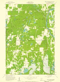 1956 Belle Prairie NW1958 Print · USGSThe mid-Minnesota lake country and military grounds come into focus in the mid-fifties, just south of the Brainerd area. Researchers can trace rural landmarks and military infrastructure across the Camp Ripley Military Reservation, locating School No 47, the historic Fort Ripley, and the winding Mississippi River.4 unique versions available
 - 1956 Map of Fort Ripley, 1958 Print
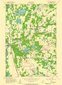 1956 Fort Ripley1958 Print · USGSCentral Minnesota's riverfront and military landscapes are captured here in the mid-1950s. Researchers can trace family history through several rural landmarks, including St Mathias Church, School No 16, and the Ft Ripley Cemetery.2 unique versions available
 - 1956 Map of Randall, 1958 Print
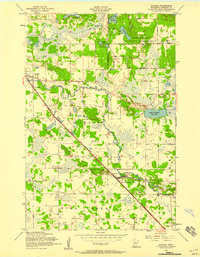 1956 Randall1958 Print · USGSSettled along the Northern Pacific rail line during the mid-1950s, this area of Morrison County reflects a classic rural Minnesota layout. Researchers can trace the heritage of local school districts and parishes at St James Cemetery, School No 35, and the Old Darling Mission Cemetery.4 unique versions available
Showing maps 1-25 of 70
Top cities of Morrison County
- Little Falls historical maps
- Pierz historical maps
- Royalton historical maps
- Cushing historical maps
- Morrill historical maps
- Motley historical maps
See more
Frequently asked questions
- What are the different types of historical maps available for Morrison County?
- What is the oldest map of Morrison County?
- Where can I purchase historical maps of Morrison County for my home or office?
- Where can I download high-res historical maps of Morrison County?
- Are there historical topographic maps available for Morrison County?
- Is there historical aerial imagery available for Morrison County?
- Where are historical maps of Morrison County sourced from?