1980s Maps of Morrison County, Minnesota
Explore 12 historic maps of Morrison County from the 1980s. These maps offer a rare glimpse into what life looked like during the 1980s — showing old roads, neighborhoods, homes, and landmarks that have changed or disappeared over time.
Whether you're researching your family's past, planning a metal detecting trip, or studying how Morrison County's landscape evolved across the 1980s, these high-resolution maps are a powerful tool for exploring the history of this region.
- Focus on a specific era: All maps on this page are from the 1980s, giving you a focused view of this time period.
- See what’s changed: Compare century-old streets, trails, and buildings to today's modern landscape using overlays and satellite layers.
- Research with precision: Use these maps for genealogy, historical research, land use analysis, or educational projects.
- View, download, or print: Maps are fully viewable online in high resolution, and can be downloaded or printed for your own records.
Start exploring Morrison County's history through authentic maps from the 1980s. This is your window into the past.
Morrison County, MN maps
(12)- 1981 Map of Freedhem, 1982 Print
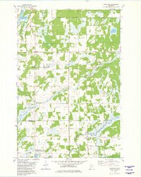
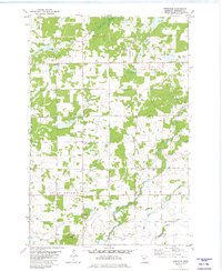 1981 Freedhem1982 Print · USGSMorrison County in the early eighties was a landscape of small townships and riparian corridors. Genealogists and local historians can locate the Freedhem Cem, trace the winding Platte River, and identify old Quarries near the community of Freedhem.
 - 1981 Map of Lincoln, 1982 Print
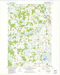
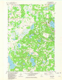 1981 Lincoln1982 Print · USGSThe lake country of Todd and Morrison Counties is shown in detail during the early 1980s, revealing a landscape of dense wetlands and fishing retreats. Local historians can trace the rail corridor of the Burlington Northern or locate the Lincoln Ch near the shores of Fish Trap Lake.
 - 1981 Map of Cushing, 1982 Print
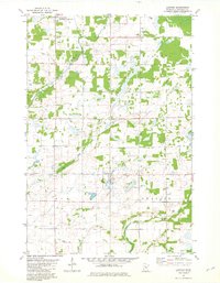
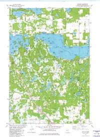 1981 Cushing1982 Print · USGSThis central Minnesota lake country in the early eighties shows a landscape shaped by water and rail. Researchers can locate family roots at Scandia Valley Cem or trace the Burlington Northern line through Cushing and past Fish Trap Lake.
 - 1981 Map of Lastrup NW, 1982 Print
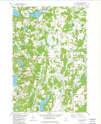
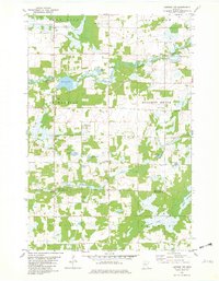 1981 Lastrup NW1982 Print · USGSCrow Wing and Morrison County during the late seventies reveal a landscape of dense wetlands and forest management. Researchers can locate remote landmarks like the Daggett Lookout Tower, the Riverside Union Ch, and the Kohl Landing Strip among the bends of the Nokasippi River.
 - 1981 Map of Shephard, 1982 Print
 1981 Shephard1982 Print · USGSCrow Wing County's river-fed lowlands and small townships are captured here in the early eighties. Genealogists and local historians can locate the Pine Tree Cem, the community Townhall, and the rural crossroads of Shephard.
 - 1981 Map of Randall West, 1982 Print
 1981 Randall West1982 Print · USGSMorrison County's rural landscape is captured here in the early eighties as the railroad still active through Randall shaped local commerce. Researchers can trace family history through several burial sites like Parker-Bethany Cem or locate the local Townhall.
 - 1981 Map of Lastrup, 1982 Print
 1981 Lastrup1982 Print · USGSThe rural landscape of central Minnesota is captured here in the early eighties, showing a network of small townships and family farms. Genealogists and local historians can trace the foundations of Lastrup and Harding, or locate the Holy Cross Ch and Free Polish National Ch.
 - 1981 Map of Lake Beauty, 1982 Print
 1981 Lake Beauty1982 Print · USGSIn the early eighties, this pocket of Central Minnesota shows a landscape of small townships and glacial waters. Genealogists and historians can trace the rural layout of Culdrum, locate the Zion Cem, and explore the grounds of Lake Beauty Camp.
 - 1985 Map of Mora
 1985 Mora1985 Print · USGSCentral Minnesota's river valleys and farming hubs are captured here in the mid-eighties, showing the region before significant modern expansion. Researchers can trace historic rail lines like the Burlington Northern and locate community landmarks in Mora, Milaca, and Princeton.
 - 1985 Map of Mille Lacs Lake
 1985 Mille Lacs Lake1985 Print · USGSMille Lacs Lake and its surrounding settlements are shown in the mid-1980s as a hub of lake-shore recreation and rail commerce. Researchers can trace historic transport lines like the Soo Line and locate communities such as Wahkon and Garrison.2 unique versions available
 - 1986 Map of St. Cloud
 1986 St. Cloud1986 Print · USGSCentral Minnesota in the mid-1980s reveals a landscape where river industry and growing highway corridors meet traditional farming communities. Researchers can trace the layout of small-town landmarks like St Wendel Ch and St Anna Cem or follow the path of the Sauk River as it winds toward the Mississippi.2 unique versions available
 - 1986 Map of Brainerd
 1986 Brainerd1986 Print · USGSCentral Minnesota's lake country and river junctions are captured here in the mid-1980s. Genealogists and historians can trace the Burlington Northern line through Staples or locate family sites near Brainerd State Hospital and Gull Lake.2 unique versions available
End of results
Showing maps 1-12 of 12
Top cities of Morrison County
- Little Falls historical maps
- Pierz historical maps
- Royalton historical maps
- Cushing historical maps
- Morrill historical maps
- Motley historical maps
See more
Frequently asked questions
- What are the different types of historical maps available for Morrison County?
- What is the oldest map of Morrison County?
- Where can I purchase historical maps of Morrison County for my home or office?
- Where can I download high-res historical maps of Morrison County?
- Are there historical topographic maps available for Morrison County?
- Is there historical aerial imagery available for Morrison County?
- Where are historical maps of Morrison County sourced from?