1940s Maps of Amite County, Mississippi
Explore 6 historic maps of Amite County from the 1940s. These maps offer a rare glimpse into what life looked like during the 1940s — showing old roads, neighborhoods, homes, and landmarks that have changed or disappeared over time.
Whether you're researching your family's past, planning a metal detecting trip, or studying how Amite County's landscape evolved across the 1940s, these high-resolution maps are a powerful tool for exploring the history of this region.
- Focus on a specific era: All maps on this page are from the 1940s, giving you a focused view of this time period.
- See what’s changed: Compare century-old streets, trails, and buildings to today's modern landscape using overlays and satellite layers.
- Research with precision: Use these maps for genealogy, historical research, land use analysis, or educational projects.
- View, download, or print: Maps are fully viewable online in high resolution, and can be downloaded or printed for your own records.
Start exploring Amite County's history through authentic maps from the 1940s. This is your window into the past.
Amite County, MS maps
(6)- 1941 Map of Woodland
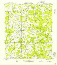 1941 Woodland1941 Print · USGSEast Feliciana Parish and the Mississippi borderlands are captured here in the early 1940s. Researchers can trace rural life through landmarks like Felixville P. O., family sites like Kent Cem, and schools such as Phares Sch and Macedonia Sch.
 - 1941 Map of Norwood
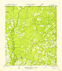
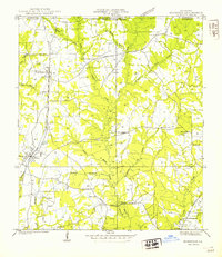 1941 Norwood1941 Print · USGSEast Feliciana Parish near the Mississippi border reveals its 1940s landscape of rural settlements and transport corridors. Genealogists can trace family roots through landmarks like Antioch Ch, Morning Glory Ch, and burial sites such as Beech Grove Cem.
 - 1941 Map of Chipola
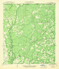 1941 Chipola1941 Print · USGSSt. Helena and East Feliciana parishes are shown here in the early 1940s just as the modern highway system began to solidify. Family historians can trace local roots at Hurst Cem, Joiners, and rural school sites like St Helena Sch.
 - 1942 Map of Liverpool
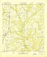
 1942 Liverpool1942 Print · USGSSt. Helena Parish at the start of the 1940s is a landscape of rural homesteads and river branches along the Mississippi border. Researchers can trace family sites like Anglin Cem and Bates Cem or locate the old Oakland Sch and the Liverpool Fire Tower.
 - 1945 Map of Norwood
 1945 Norwood1945 Print · USGSEast Feliciana Parish near the Mississippi border is shown here during the mid-1940s, centered on the Illinois Central rail line. Researchers can trace rural genealogy through landmarks like Pemble Cem, Morning Glory Ch, and the Industrial Training Sch.
 - 1945 Map of Chipola
 1945 Chipola1945 Print · USGSSt. Helena Parish was a landscape of small crossroads and creek-side settlements in the years following the Great Depression. Genealogists and local historians can trace family locations near Chipola, Darlington, and rural landmarks like the Riverside Sch.
End of results
Showing maps 1-6 of 6
Top cities of Amite County
Frequently asked questions
- What are the different types of historical maps available for Amite County?
- What is the oldest map of Amite County?
- Where can I purchase historical maps of Amite County for my home or office?
- Where can I download high-res historical maps of Amite County?
- Are there historical topographic maps available for Amite County?
- Is there historical aerial imagery available for Amite County?
- Where are historical maps of Amite County sourced from?