Old Maps of Amite County, Mississippi for Genealogy
Trace your family roots with 150 historic maps of Amite County. These high-res maps reveal old neighborhoods, homesites, landmarks, and streets — helping you uncover where your ancestors lived and how the area evolved over time.
- Explore historic neighborhoods: Identify where your relatives may have lived in the 1800s or 1900s.
- Compare maps over time: Trace the changes in streets, buildings, and landmarks for multi-generational research.
- Perfect for genealogy & ancestry research: Used by family historians and researchers to map out lineage and migration.
These maps are an incredible resource for exploring your personal connection to Amite County's past.
Amite County, MS maps
(150)- 1906 Map of Bayou Sara
 1906 Bayou Sara1906 Print · USGSThe Feliciana parishes and the Mississippi River bottomlands come to life in this early twentieth-century survey. Genealogists can trace family footprints through river-town settlements like St Francisville or find early rail stops such as Gayden Sta (Gurley P.O.) and Slaughter.3 unique versions available
 - 1941 Map of Woodland
 1941 Woodland1941 Print · USGSEast Feliciana Parish and the Mississippi borderlands are captured here in the early 1940s. Researchers can trace rural life through landmarks like Felixville P. O., family sites like Kent Cem, and schools such as Phares Sch and Macedonia Sch.
 - 1941 Map of Norwood
 1941 Norwood1941 Print · USGSEast Feliciana Parish near the Mississippi border reveals its 1940s landscape of rural settlements and transport corridors. Genealogists can trace family roots through landmarks like Antioch Ch, Morning Glory Ch, and burial sites such as Beech Grove Cem.
 - 1941 Map of Chipola
 1941 Chipola1941 Print · USGSSt. Helena and East Feliciana parishes are shown here in the early 1940s just as the modern highway system began to solidify. Family historians can trace local roots at Hurst Cem, Joiners, and rural school sites like St Helena Sch.
 - 1942 Map of Liverpool
 1942 Liverpool1942 Print · USGSSt. Helena Parish at the start of the 1940s is a landscape of rural homesteads and river branches along the Mississippi border. Researchers can trace family sites like Anglin Cem and Bates Cem or locate the old Oakland Sch and the Liverpool Fire Tower.
 - 1945 Map of Norwood
 1945 Norwood1945 Print · USGSEast Feliciana Parish near the Mississippi border is shown here during the mid-1940s, centered on the Illinois Central rail line. Researchers can trace rural genealogy through landmarks like Pemble Cem, Morning Glory Ch, and the Industrial Training Sch.
 - 1945 Map of Chipola
 1945 Chipola1945 Print · USGSSt. Helena Parish was a landscape of small crossroads and creek-side settlements in the years following the Great Depression. Genealogists and local historians can trace family locations near Chipola, Darlington, and rural landmarks like the Riverside Sch.
 - 1950 Map of Kentwood
 1950 Kentwood1950 Print · USGSKentwood and Tangipahoa thrive along the Illinois Central rail corridor during the mid-century, marking a period of established rural settlement along the Mississippi state line. Researchers can locate numerous family burial sites and churches, including the Camp Moore Confederate Cem, Barnes Cem, and Bethel Ch.
 - 1953 Map of Natchez, 1966 Print
 1953 Natchez1966 Print · USGSSouthwest Mississippi and the Louisiana border country come alive in this mid-century survey of the river valley and forest lands. Researchers can trace the rail lines of the Illinois Central RR and locate rural hubs like Gloster and Ferriday.3 unique versions available
 - 1954 Map of Baton Rouge, 1974 Print
 1954 Baton Rouge1974 Print · USGSSoutheast Louisiana in the mid-fifties is captured here during a period of transition for its river and rail economies. Researchers can trace the path of the Mississippi River and find landmarks like the Bonnet Carre Spillway and Bayou Plaquemine.2 unique versions available
 - 1956 Map of Natchez
 1956 Natchez1956 Print · USGSThe Mississippi River borderlands and the Pine Hills come alive in this mid-fifties study of the Natchez region. Genealogists and historians can trace rail-era towns along the Illinois Central RR and explore the oxbows of Lake Bruin and Lake Concordia.
 - 1956 Map of Baton Rouge
 1956 Baton Rouge1956 Print · USGSSouth Louisiana at the height of the mid-century oil boom shows a landscape of river oxbows and rising industry. Researchers can trace family roots through river towns like Scotlandville or locate early industrial sites and Oil wells near Lake Maurepas.
 - 1958 Map of Felixville, 1959 Print
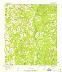 1958 Felixville1959 Print · USGSEast Feliciana Parish and the Mississippi border country come alive in this late 1950s survey of rural life. Researchers can trace family sites at the Eighth Ward Sch, find legacy churches like Wesley Chapel, or locate old settlements including Hatchersville and Felixville (PO).4 unique versions available
 - 1958 Map of Kentwood, 1959 Print
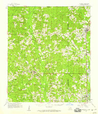 1958 Kentwood1959 Print · USGSThe Florida Parishes in the late fifties centered on the busy Illinois Central rail line and the growing timber towns of Kentwood and Roseland. Researchers can trace old family homesteads and landmarks like Camp Moore Cem, New Zion Sch, and Venable Ch.2 unique versions available
 - 1958 Map of Clinton, 1959 Print
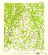 1958 Clinton1959 Print · USGSEast Feliciana Parish in the late fifties remains a landscape defined by its small towns, rail lines, and scattered family homesteads. Genealogists can trace roots at Richland Cem & Ch, find the Parish Industrial Training Sch, or follow the path of the old Plank Road.3 unique versions available
 - 1959 Map of Natchez
 1959 Natchez1959 Print · USGSSouthwestern Mississippi and eastern Louisiana are captured in the late fifties, showing a landscape defined by the winding Mississippi River and the timbered Homochitto National Forest. Researchers can trace the sprawling Illinois Central RR and find rural landmarks like Union Church and Camp Van Dorn (Abandoned).
 - 1961 Map of Liberty, 1962 Print
 1961 Liberty1962 Print · USGSAmite County in the early sixties reveals a landscape of small river settlements and forest land. Researchers can trace family history through dozens of rural sites like Bewelcome, McGeehee Cem, and Amite River Galilee Ch.3 unique versions available
 - 1961 Map of Crosby, 1962 Print
 1961 Crosby1962 Print · USGSThe Homochitto River valley and its neighboring oil fields are captured here in the early sixties as they span four Mississippi counties. Researchers can trace rural lineages through numerous family sites like Dorsey Cem, Perrytown Ch, and the Illinois Central Railroad corridor.3 unique versions available
 - 1961 Map of Gloster, 1963 Print
 1961 Gloster1963 Print · USGSSouthwest Mississippi is mapped here in the early sixties, showing the rural communities along the Illinois Central line. Genealogists can trace family roots at Wilkinson Cem, Mt Carmel Ch, and the small settlement of Caledonia.2 unique versions available
 - 1961 Map of Baton Rouge, 1966 Print
 1961 Baton Rouge1966 Print · USGSSoutheastern Louisiana in the early sixties remains a landscape of deep river bends and sprawling coastal lakes. Genealogists and historians can trace the rail-and-river economy through landmarks like Free-Nigger Point, Donaldsonville, and the Illinois Central Railroad.
 - 1962 Map of Baton Rouge
 1962 Baton Rouge1962 Print · USGSSouth Louisiana in the early sixties reveals a landscape of river-bend parishes and emerging interstate corridors. Genealogists and historians can trace family roots through historic river towns like Donaldsonville and Plaquemine, or follow the path of the Illinois Central Railroad through the swamp basins.
 - 1962 Map of Bude, 1964 Print
 1962 Bude1964 Print · USGSSouthwest Mississippi's timber and oil country comes to life in the early sixties, centered on the lumber and rail hubs of Meadville and Bude. Genealogists can trace family lines through dozen of rural landmarks like Byrds Chapel, Smyrna Cemetery, and the West Bude Oil Field.2 unique versions available
 - 1972 Map of Smithdale, 1974 Print
 1972 Smithdale1974 Print · USGSAmite County and Franklin County are captured here in the early seventies, a landscape of family farms and rural industry along the Amite River. Researchers can locate several family burial sites like Lumpkin Cem and old country parishes such as Oak Grove Ch.
 - 1972 Map of Auburn, 1974 Print
 1972 Auburn1974 Print · USGSAmite and Lincoln Counties come into focus in the early seventies as the local oil industry expands across the landscape. Genealogists can trace family roots through numerous country sites like Johnston Chapel, Terrell Cem, and the Smithdale Oil Field.
 - 1972 Map of Peoria, 1974 Print
 1972 Peoria1974 Print · USGSAmite County's rural river country is captured here in the early 1970s, showcasing a landscape shaped by water and historical lines. You can trace the Old Indian Treaty Boundary and locate family landmarks like Bates-Felder Cem and Browns Chapel.
Showing maps 1-25 of 150
Top cities of Amite County
Frequently asked questions
- What are the different types of historical maps available for Amite County?
- What is the oldest map of Amite County?
- Where can I purchase historical maps of Amite County for my home or office?
- Where can I download high-res historical maps of Amite County?
- Are there historical topographic maps available for Amite County?
- Is there historical aerial imagery available for Amite County?
- Where are historical maps of Amite County sourced from?