1980s Maps of Amite County, Mississippi
Explore 18 historic maps of Amite County from the 1980s. These maps offer a rare glimpse into what life looked like during the 1980s — showing old roads, neighborhoods, homes, and landmarks that have changed or disappeared over time.
Whether you're researching your family's past, planning a metal detecting trip, or studying how Amite County's landscape evolved across the 1980s, these high-resolution maps are a powerful tool for exploring the history of this region.
- Focus on a specific era: All maps on this page are from the 1980s, giving you a focused view of this time period.
- See what’s changed: Compare century-old streets, trails, and buildings to today's modern landscape using overlays and satellite layers.
- Research with precision: Use these maps for genealogy, historical research, land use analysis, or educational projects.
- View, download, or print: Maps are fully viewable online in high resolution, and can be downloaded or printed for your own records.
Start exploring Amite County's history through authentic maps from the 1980s. This is your window into the past.
Amite County, MS maps
(18)- 1980 Map of Kentwood, 1981 Print
 1980 Kentwood1981 Print · USGSKentwood and Tangipahoa appear during the early 1980s as the railroad and timber landscape of the Louisiana-Mississippi line remains firmly established. Researchers can find dozens of family burial sites like Westmoreland Cem and the Camp Moore Confederate Cem.2 unique versions available
 - 1981 Map of Liverpool
 1981 Liverpool1981 Print · USGSThe rural borderlands of St. Helena Parish come to life in the early 1980s, where small settlements sit amidst a network of naming-rich creeks and timber tracks. Genealogists can trace family legacies at Old Venable Cem, Bates Cem, and New Zion Sch.
 - 1983 Map of New Roads
 1983 New Roads1983 Print · USGSThe river parishes of central Louisiana are documented in the early 1980s, showcasing the winding courses of the Atchafalaya and Mississippi. Genealogists and historians can trace rail-served river towns like Melville and Simmesport, or locate the Port Hudson National Cem and the State Penitentiary.2 unique versions available
 - 1983 Map of Amite
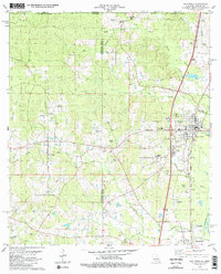
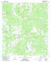
 1983 Amite1983 Print · USGSThe Florida Parishes and southern Mississippi are captured here in the early 1980s, centered on the Illinois Central Gulf rail corridor. Genealogists and historians can trace family-named sites like the Camp Moore Confederate Cem, Magnolia Ch, and the Idlewild Plantation (State University).
 - 1984 Map of McComb
 1984 McComb1984 Print · USGSSouth Mississippi in the mid-eighties was defined by the rail corridor connecting McComb and Magnolia to the surrounding timberlands. You can trace the rural network of Pike County through landmarks like Holmesville, Percy Quin State Park, and the winding Bogue Chitto.
 - 1984 Map of Woodville
 1984 Woodville1984 Print · USGSThe Mississippi-Louisiana borderlands in the mid-eighties show a landscape defined by the shifting MISSISSIPPI RIVER and sprawling timberlands. Researchers can trace the ILLINOIS CENTRAL GULF railroad through Gloster or locate historic river points like Fort Adams and Point Breeze.
 - 1984 Map of Chipola, 1985 Print
 1984 Chipola1985 Print · USGSThe Louisiana-Mississippi border near St. Helena Parish in the early 1980s is defined by the winding Amite River and rural crossroads settlements. Genealogists can trace family footprints through sites like Coleman Town, St Helena Ch, and Kemp Cem.
 - 1984 Map of Felps, 1985 Print
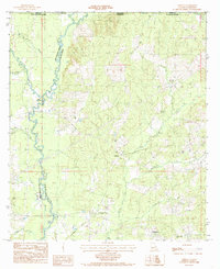
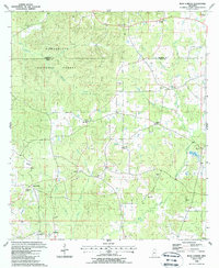
 1984 Felps1985 Print · USGSEast Feliciana Parish and Amite County meet in the early 1980s along a landscape defined by winding creeks and rural outposts. Genealogists and researchers can locate old communities like Woodland, Felixville, and Teddy, or trace the Freeman Landing Strip.2 unique versions available
 - 1985 Map of Wilson
 1985 Wilson1985 Print · USGSEast Feliciana Parish in the mid-1980s shows a landscape of rural settlements and winding bayous along the Mississippi border. Genealogists and historians can trace the Illinois Central Gulf rail line as it passes through Norwood and Wilson.
 - 1988 Map of Homochitto
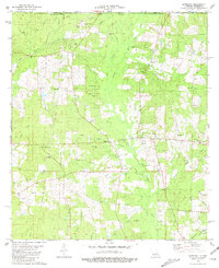
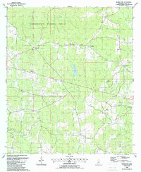
 1988 Homochitto1988 Print · USGSThe Franklin and Amite county line in the late eighties shows a landscape of timber and extraction within the Homochitto National Forest. Genealogists can locate rural landmarks like Oak Grove Ch, Bunkley Cem, and the West Bude Oil Field.
 - 1988 Map of Crosby
 1988 Crosby1988 Print · USGSSouthwestern Mississippi in the 1980s reveals a landscape where the timber industry and oil exploration meet the winding Homochitto River. Researchers can trace old family sites and rural landmarks like Berryhill Cem, Wesley Chapel, and the community of Crosby.2 unique versions available
 - 1988 Map of Berwick
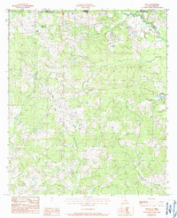
 1988 Berwick1988 Print · USGSAmite County in the late eighties shows a landscape of small settlements and family-named landmarks connected by winding creek-side roads. Researchers can trace rural lineages through sites like Ariel, Olio, and the grounds of Ebenezer Ch and Garner Cem.
 - 1988 Map of Busy Corner
 1988 Busy Corner1988 Print · USGSAmite and Franklin counties appear in the late eighties as a network of rural settlements and forest lands. Genealogists can trace family landmarks like McGehee Cem, Zion Hill, and the community of Busy Corner.
 - 1988 Map of Gloster
 1988 Gloster1988 Print · USGSAmite and Wilkinson counties are shown here in the late 1980s, centered on the rail-aligned town of Gloster. Local historians can trace family roots at Mt Carmel Church, the Galilee Cemetery, and rural sites along the Buffalo River.
 - 1988 Map of Centreville
 1988 Centreville1988 Print · USGSCentreville and its surrounding farmstead landscape are captured in the late eighties at the intersection of Wilkinson and Amite counties. Genealogists can locate numerous family-named landmarks including Stafford Cem, Nathaniel Ch, and Whitaker.
 - 1988 Map of Street
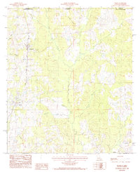
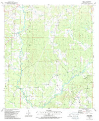 1988 Street1988 Print · USGSAmite County in the late eighties remains a landscape of family-named landmarks and timbered river bottoms. Genealogists can trace decades of history through dozens of local burial sites like Anderson Cem and rural centers such as Mt Olive Ch and Street.
 - 1988 Map of Bewelcome
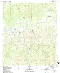
 1988 Bewelcome1988 Print · USGSAmite County in the late eighties remains a landscape of small timberlands and quiet crossroads settlements. Genealogists and historians can locate numerous family burial grounds and congregations like Day Cemetery, St Davis Ch, and Roberts Cemetery.
 - 1988 Map of Liberty
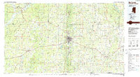
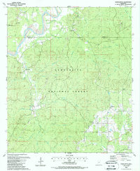
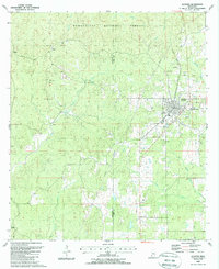
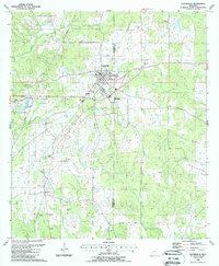
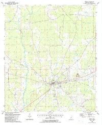 1988 Liberty1988 Print · USGSLiberty and the surrounding Amite County countryside appear in the late eighties as a network of rural churches and family cemeteries. Trace local lineage at McGehee Cem or Plainview Ch, and follow the path of the Old Railroad Grade.
End of results
Showing maps 1-18 of 18
Top cities of Amite County
Frequently asked questions
- What are the different types of historical maps available for Amite County?
- What is the oldest map of Amite County?
- Where can I purchase historical maps of Amite County for my home or office?
- Where can I download high-res historical maps of Amite County?
- Are there historical topographic maps available for Amite County?
- Is there historical aerial imagery available for Amite County?
- Where are historical maps of Amite County sourced from?