1980s Maps of Franklin County, Mississippi
Explore 16 historic maps of Franklin County from the 1980s. These maps offer a rare glimpse into what life looked like during the 1980s — showing old roads, neighborhoods, homes, and landmarks that have changed or disappeared over time.
Whether you're researching your family's past, planning a metal detecting trip, or studying how Franklin County's landscape evolved across the 1980s, these high-resolution maps are a powerful tool for exploring the history of this region.
- Focus on a specific era: All maps on this page are from the 1980s, giving you a focused view of this time period.
- See what’s changed: Compare century-old streets, trails, and buildings to today's modern landscape using overlays and satellite layers.
- Research with precision: Use these maps for genealogy, historical research, land use analysis, or educational projects.
- View, download, or print: Maps are fully viewable online in high resolution, and can be downloaded or printed for your own records.
Start exploring Franklin County's history through authentic maps from the 1980s. This is your window into the past.
Franklin County, MS maps
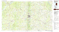
(16)- 1984 Map of Natchez
 1984 Natchez1984 Print · USGSThe Mississippi-Louisiana borderlands in the mid-eighties show a landscape defined by the winding Mississippi River and its rail networks. Trace family history at the Natchez National Cemetery or explore the river towns of Vidalia and Ferriday.
 - 1984 Map of Brookhaven
 1984 Brookhaven1984 Print · USGSSouth-central Mississippi's rural character and rail-centered commerce are shown here in the mid-eighties, from the Homochitto woods to the Pearl River. Trace local roots through Union Church, Meadows Store, and the campus of Copiah-Lincoln Jr College.2 unique versions available
 - 1984 Map of McComb
 1984 McComb1984 Print · USGSSouth Mississippi in the mid-eighties was defined by the rail corridor connecting McComb and Magnolia to the surrounding timberlands. You can trace the rural network of Pike County through landmarks like Holmesville, Percy Quin State Park, and the winding Bogue Chitto.
 - 1984 Map of Woodville
 1984 Woodville1984 Print · USGSThe Mississippi-Louisiana borderlands in the mid-eighties show a landscape defined by the shifting MISSISSIPPI RIVER and sprawling timberlands. Researchers can trace the ILLINOIS CENTRAL GULF railroad through Gloster or locate historic river points like Fort Adams and Point Breeze.
 - 1988 Map of Kirby
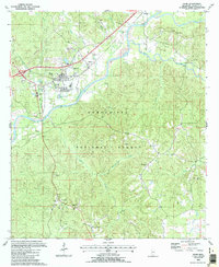
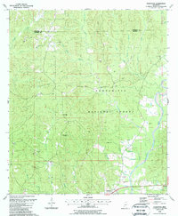
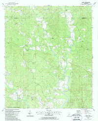 1988 Kirby1988 Print · USGSFranklin and Jefferson counties in the late 1980s show a landscape where timber and energy extraction define the rural economy. Local researchers can pinpoint family cemeteries like Sixteen Cem, or trace the development of the Middle Fork Oil Field near the village of Oldenburg.
 - 1988 Map of Homochitto
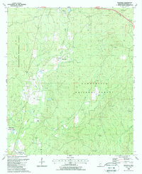
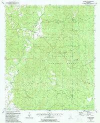
 1988 Homochitto1988 Print · USGSThe Franklin and Amite county line in the late eighties shows a landscape of timber and extraction within the Homochitto National Forest. Genealogists can locate rural landmarks like Oak Grove Ch, Bunkley Cem, and the West Bude Oil Field.
 - 1988 Map of Crosby
 1988 Crosby1988 Print · USGSSouthwestern Mississippi in the 1980s reveals a landscape where the timber industry and oil exploration meet the winding Homochitto River. Researchers can trace old family sites and rural landmarks like Berryhill Cem, Wesley Chapel, and the community of Crosby.2 unique versions available
 - 1988 Map of Bude
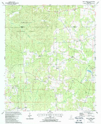
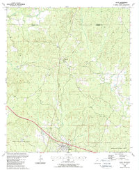
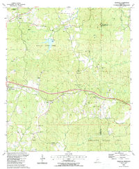
 1988 Bude1988 Print · USGSFranklin County in the late eighties shows a landscape shaped by timber and the Homochitto River valley. Researchers can trace rural lineages through family landmarks like Montgomery Cem and Byrds Chapel or locate the old Franklin Sch.
 - 1988 Map of Busy Corner
 1988 Busy Corner1988 Print · USGSAmite and Franklin counties appear in the late eighties as a network of rural settlements and forest lands. Genealogists can trace family landmarks like McGehee Cem, Zion Hill, and the community of Busy Corner.
 - 1988 Map of Knoxville
 1988 Knoxville1988 Print · USGSSouthwestern Mississippi's timberlands and evolving energy fields are documented here in the late eighties. Researchers can trace family names and local landmarks at White Apple, McMillan Cem, and the Dry Creek Oil Field.
 - 1988 Map of Garden City
 1988 Garden City1988 Print · USGSWilkinson County was still defined by its dense timber and winding waterways in the late eighties. Researchers can trace rural lineages through markers like Perrytown Ch, Homer Hill Cem, and the settlement of Garden City.2 unique versions available
 - 1988 Map of Eddiceton
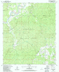
 1988 Eddiceton1988 Print · USGSFranklin and Jefferson Counties in the late eighties are defined by the timberlands of the Homochitto. Genealogists and local historians can locate many rural burial sites and churches, including McDanial Cem, New Hope Ch, and Sarepta.
 - 1988 Map of Roxie
 1988 Roxie1988 Print · USGSFranklin and Jefferson counties are shown here in the late eighties as timber and natural resources shaped the landscape. Researchers can trace family history through numerous rural burial sites like Old Rose Hill Cem and Armstrong Cem or follow the Old Railroad Grade near Hamburg.
 - 1988 Map of Meadville
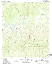
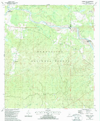
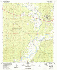 1988 Meadville1988 Print · USGSMeadville and the surrounding Franklin County timberlands appear in the late eighties as a mixture of government forest and active oil exploration. Researchers can locate family burial sites at Hegan Cem and Mayfield Cem or trace the early paths around New Fork Ch.
 - 1988 Map of Jeannette
 1988 Jeannette1988 Print · USGSThe border of Adams and Franklin counties appears here in the late eighties, showing a landscape defined by timber management and petroleum extraction. Researchers can locate remote family landmarks like Holmes Cem and Carter Cem alongside the many Oil Wells of the Locust Hill Oil Field.
 - 1988 Map of Cranfield
 1988 Cranfield1988 Print · USGSAdams County’s rural landscape is captured here in the late eighties as timberlands and energy production defined the local economy. Researchers can trace family history through dozens of landmarks like Roaring Dale Cem, Robinson Chapel, and the Illinois Central Gulf Railroad.
End of results
Showing maps 1-16 of 16
Top cities of Franklin County
Frequently asked questions
- What are the different types of historical maps available for Franklin County?
- What is the oldest map of Franklin County?
- Where can I purchase historical maps of Franklin County for my home or office?
- Where can I download high-res historical maps of Franklin County?
- Are there historical topographic maps available for Franklin County?
- Is there historical aerial imagery available for Franklin County?
- Where are historical maps of Franklin County sourced from?