Old Maps of Grenada County, Mississippi for Metal Detecting
Plan your next treasure hunt with 109 historic maps of Grenada County. Find old homesites, ghost towns, trails, and gathering spots that may be lost to time — perfect for identifying promising metal detecting locations.
- Locate forgotten sites: Uncover places like long-lost settlements, abandoned rail lines, or gathering spots.
- Plan better hunts: Use map overlays combined with LiDAR or satellite views to narrow in on historically rich areas.
- Made for detectorists: Thousands of hobbyists use these maps to discover relics, coins, and hidden history.
Use these historic maps to boost your research and find new opportunities beneath the surface of Grenada County.
Grenada County, MS maps
(109)- 1932 Map of Philipp
 1932 Philipp1932 Print · USGSTallahatchie and Grenada counties in the early 1930s show a landscape shaped by river bends and the expansion of the rail network. Genealogists can trace family roots through numerous country schools and churches like Cowart Sch, Rosenwald Sch, and Jorden Hill Cem.4 unique versions available
 - 1935 Map of Philipp
 1935 Philipp1935 Print · USGSThe Mississippi Delta meets the bluff hills in the 1930s, revealing a landscape of winding bayous and railroad-line settlements. Genealogists can locate family landmarks like the Rosenwald Sch, Paynes Cem, and the river town of Locopolis.2 unique versions available
 - 1936 Map of Greenwood
 1936 Greenwood1936 Print · USGSThe Mississippi Delta's river-driven economy is on full display in the mid-1930s as the forks of the Yazoo converge at Greenwood. Genealogists and historians can locate rural landmarks like Geren PO, Little Zion Ch, and the Rosenwald Sch among the oxbows of Tippo Bayou.2 unique versions available
 - 1939 Map of Philipp, 1943 Print
 1939 Philipp1943 Print · USGSThe Tallahatchie River Delta is captured here in the decade before major postwar transformation, showing a landscape defined by bayous and small rural hubs. Local researchers can trace family roots through numerous churches and schools like St Mark Ch, Jones Chapel Sch, and the Tallahat Boy Scout Camp.
 - 1940 Map of Greenwood, 1945 Print
 1940 Greenwood1945 Print · USGSThe Mississippi Delta's river-and-rail economy is in full view at the start of the 1940s, where the Yazoo River begins. Genealogists and historians can trace rural communities through the Rosenwald Sch, Ruby Sta, and the historic Malmaison estate.
 - 1953 Map of Greenwood, 1966 Print
 1953 Greenwood1966 Print · USGSThe Mississippi Delta in the mid-fifties is captured here as a thriving network of river towns, railroads, and oxbow lakes. Researchers can trace the legacy of the Illinois Central Railroad and locate landmarks like the State Penal Farm and Greenville Air Force Base.5 unique versions available
 - 1953 Map of West Point, 1973 Print
 1953 West Point1973 Print · USGSNorth-Central Mississippi and the Alabama borderlands are captured here during the mid-twentieth century as new reservoirs and national forests transformed the landscape. Researchers can trace the path of the Mississippi & Skuna Valley railroad or locate old landings along the Tombigbee River and Schooner Creek.3 unique versions available
 - 1954 Map of Grenada
 1954 Grenada1954 Print · USGSGrenada and the surrounding hills are captured here just as the river valley was transformed by the reservoir. Genealogists can locate family sites like Preston Sch & Ch, Barksdale Cem, and the railroad community of Dubard.2 unique versions available
 - 1954 Map of Duck Hill
 1954 Duck Hill1954 Print · USGSThe hills of north-central Mississippi come alive in the 1950s, showing a landscape defined by the Illinois Central and small rural parishes. Researchers can trace the layout of Camp McCain (Abandoned) or find family roots at Hays Creek Ch Sch & Cem and Sweatman.2 unique versions available
 - 1954 Map of McCarley
 1954 McCarley1954 Print · USGSCarroll County and the surrounding hill country are captured here in the mid-fifties, showing a dense network of rural churches and family cemeteries. Researchers can trace the Illinois Central rail line through Glenwild or locate sites like Camp McCain and Pink Flower Ch & Cem.
 - 1955 Map of Coffeeville
 1955 Coffeeville1955 Print · USGSYalobusha and Grenada Counties are captured here in the mid-fifties, just as the local landscape was being reshaped by the rising Grenada Reservoir. Genealogists and historians can trace dozens of rural landmarks, from the Hopewell Ch & Cem to the Indian Mound and the Illinois Central rail line.2 unique versions available
 - 1956 Map of Greenwood
 1956 Greenwood1956 Print · USGSThe Mississippi Delta in the mid-fifties is captured here during a period of significant military and agricultural activity. Researchers can trace the rail lines of the Illinois Central RR, find the Greenville Air Force Base, or locate the State Penal Farm.
 - 1957 Map of Philipp
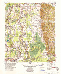 1957 Philipp1957 Print · USGSThe Tallahatchie River basin in the mid-fifties is a landscape of river cut-offs and rural crossroads settlements. Genealogists can trace family roots at St. Paul Sch Ch & Cem, Philipp, and the Needmore Cem along the Illinois Central line.3 unique versions available
 - 1957 Map of Greenwood
 1957 Greenwood1957 Print · USGSThe Mississippi Delta in the late fifties shows a landscape of river-bend settlements and extensive rail networks. Genealogists can trace family roots at Little Zion Ch & Cem, Money, and the many rural churches like Lanes Chapel or Evergreen Ch.3 unique versions available
 - 1958 Map of West Point
 1958 West Point1958 Print · USGSNortheastern Mississippi and western Alabama are shown in the late 1950s, highlighting a region defined by its river-and-rail economy. Researchers can trace family roots through numerous settlements like Artesia and Vardaman or explore the corridor of the Tombigbee River.
 - 1963 Map of West Point
 1963 West Point1963 Print · USGSEastern Mississippi and western Alabama are captured in the early sixties as industrial centers and rail lines connected the Black Prairie to the hills. Genealogists and historians can trace family-named watercourses and the early footprints of Starkville, Columbus, and the Noxubee National Wildlife Refuge.2 unique versions available
 - 1974 Map of Philipp SE, 1975 Print
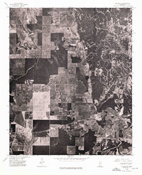 1974 Philipp SE1975 Print · USGSTallahatchie County is captured in the mid-1970s as agricultural fields give way to the wooded bluffs near Cascilla. Genealogists and local historians can trace exact farm clearings, rural road networks, and the sharp boundary between timber and tillage.
 - 1974 Map of Greenwood NW, 1975 Print
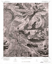 1974 Greenwood NW1975 Print · USGSThe Mississippi Delta's intricate river systems dominate this mid-seventies aerial perspective of Leflore County. Genealogists and researchers can trace the settlement patterns around MONEY and the winding course of the Tallahatchie and Yalobusha River.
 - 1974 Map of Greenwood NE, 1975 Print
 1974 Greenwood NE1975 Print · USGSThe Mississippi Delta meets the hills in the mid-1970s, showcasing a landscape of river bends and rural clearings. Genealogists and land researchers can trace the settlement at Avalon and the winding course of the Yalobusha River.
 - 1974 Map of Philipp SW, 1975 Print
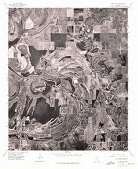 1974 Philipp SW1975 Print · USGSThe Mississippi Delta's alluvial landscape comes into focus in the mid-1970s, showing the deep agricultural roots of the region. Researchers can trace the winding course of the Tallahatchie River and its impact on the settlement patterns near Philipp.
 - 1981 Map of Cascilla, 1982 Print
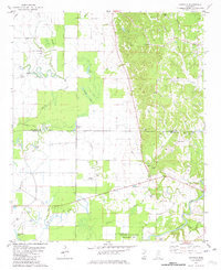 1981 Cascilla1982 Print · USGSThe transition from the Mississippi Delta to the eastern hills is captured here in the early eighties. Researchers can locate family landmarks such as Oxberry Cem, McClennen Grove Ch, and the rural landing at La Belle Landing Field.
 - 1981 Map of Philipp, 1982 Print
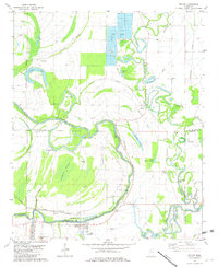 1981 Philipp1982 Print · USGSThe Mississippi Delta's winding waterways and rural settlements come into focus in the early 1980s. Genealogists can trace family sites at Eagle Plantation, Philipp, and several country churches like Jonas Chapel or Mt Calvary Ch.
 - 1982 Map of Avalon
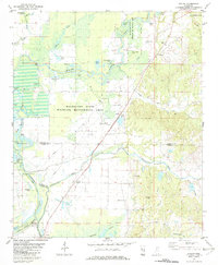 1982 Avalon1982 Print · USGSGrenada and Carroll County landscapes in the early eighties show a world of riverbottom settlements and country churches near the Yalobusha River. Genealogists can trace family landmarks like Union Grove Ch, St James Cem, and the community at Avalon.
 - 1982 Map of Money
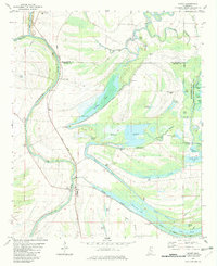 1982 Money1982 Print · USGSLeflore County in the early eighties is defined here by the winding Tallahatchie River and the small communities along the Illinois Central Gulf railroad. Researchers can locate family landmarks like Eagle Plantation Cem, Hayward Chapel, and the riverfront at Peebles Landing.
 - 1983 Map of Tie Plant
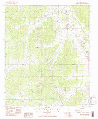 1983 Tie Plant1983 Print · USGSRailroad history and rural community life intersect in 1980s Mississippi where three counties meet. Genealogists can trace family names at Old Salem Cem and Wesley Chapel or follow the Illinois Central Gulf corridor through Tie Plant.
Showing maps 1-25 of 109
Top cities of Grenada County
Frequently asked questions
- What are the different types of historical maps available for Grenada County?
- What is the oldest map of Grenada County?
- Where can I purchase historical maps of Grenada County for my home or office?
- Where can I download high-res historical maps of Grenada County?
- Are there historical topographic maps available for Grenada County?
- Is there historical aerial imagery available for Grenada County?
- Where are historical maps of Grenada County sourced from?