Old Maps of Harrison County, Mississippi for Genealogy
Trace your family roots with 166 historic maps of Harrison County. These high-res maps reveal old neighborhoods, homesites, landmarks, and streets — helping you uncover where your ancestors lived and how the area evolved over time.
- Explore historic neighborhoods: Identify where your relatives may have lived in the 1800s or 1900s.
- Compare maps over time: Trace the changes in streets, buildings, and landmarks for multi-generational research.
- Perfect for genealogy & ancestry research: Used by family historians and researchers to map out lineage and migration.
These maps are an incredible resource for exploring your personal connection to Harrison County's past.
Harrison County, MS maps
(166)- 1893 Map of Cat Island
 1893 Cat Island1893 Print · USGSThe Louisiana-Mississippi coastal border appears here in the late nineteenth century, charting the vital islands and channels of the Gulf. Researchers can trace the early maritime landscape of Cat Island, the position of Cat Island Light, and the reaches of Isle A Pitre.4 unique versions available
 - 1893 Map of Toulme
 1893 Toulme1893 Print · USGSThe coastal marshlands of Hancock County are captured in the late 1890s, where the rail line meets the sound. Genealogists and maritime historians can trace the lonely locations of the St. Joseph Island Light, the settlement at Toulme, and the intricate reaches of Heron Bay.4 unique versions available
 - 1946 Map of Isle Au Pitre
 1946 Isle Au Pitre1946 Print · USGSThe maritime border between Mississippi and Louisiana is captured here just after the war, showing the intricate marshlands and navigation routes. Researchers can trace the shifting sands of Cat Island and the isolated lights of Merrill Shell Bank LH and Cat Island LH.
 - 1950 Map of Dog Keys Pass, 1958 Print
 1950 Dog Keys Pass1958 Print · USGSThe Mississippi barrier islands and their deep-water channels are captured here at mid-century, documenting the coastal boundary between Harrison and Jackson counties. Marine researchers and historians can trace the 1950s shorelines of Ship Island and Horn Island near the vital Dog Keys Pass.3 unique versions available
 - 1950 Map of Ship Island, 1958 Print
 1950 Ship Island1958 Print · USGSCoastal Mississippi in the 1950s is defined here by the thin, strategic arc of Ship Island before modern storms reshaped its shores. Trace the maritime history of the sound through landmarks like Old Fort Massachusetts and the Ship Island Lighthouse.3 unique versions available
 - 1951 Map of Cat Island, 1958 Print
 1951 Cat Island1958 Print · USGSCat Island sits at the edge of the Mississippi Sound in the early fifties, preserving the legacy of the Juan De Cuevas Claim. Maritime history enthusiasts can trace coastal landmarks like the Great Sand Hill, Negro Point, and the Flowing Well along the eastern shore.3 unique versions available
 - 1953 Map of Mobile, 1968 Print
 1953 Mobile1968 Print · USGSThe Gulf Coast comes alive in this mid-century survey, from the streets of Mobile to the marshes of New Orleans. Trace family roots in coastal towns like Pass Christian and Bayou La Batre or locate military landmarks including Keesler AFB.3 unique versions available
 - 1954 Map of Isle Au Pitre
 1954 Isle Au Pitre1954 Print · USGSThe coastal boundary of Louisiana and Mississippi is captured mid-century, documenting the shifting marshlands of the Mississippi Sound. Researchers can trace historical navigation markers like Cat Island LH and the wetlands around Isle Au Pitre and Bayou Pierre.
 - 1954 Map of Vestry, 1955 Print
 1954 Vestry1955 Print · USGSCoastal Mississippi's pine forests and small rural communities are captured here in the mid-1950s. Genealogists can trace family roots through sites like Ramsey Cemetery, Bonnie Chapel, and the settlement of White Plains along the Tchoutacabouffa River.4 unique versions available
 - 1954 Map of McHenry, 1955 Print
 1954 McHenry1955 Print · USGSHarrison County's timberlands and railroad towns are shown here in the mid-1950s as the De Soto National Forest was being actively managed. Genealogists and local historians can locate early landmarks like Yellow Fever Cemetery, Advance School, and the Illinois Central rail line.3 unique versions available
 - 1954 Map of Gulfport North, 1958 Print
 1954 Gulfport North1958 Print · USGSCoastal Mississippi in the mid-fifties reveals a landscape shaped by growing urban centers and sprawling federal installations. Researchers can trace the development of Gulfport and Mississippi City alongside the Illinois Central tracks and the Veterans Hospital.6 unique versions available
 - 1954 Map of Gulfport South, 1958 Print
 1954 Gulfport South1958 Print · USGSGulfport and its deep-water harbor are captured here in the mid-fifties, showing a coastal economy built on rail and sea. Trace the shipping lanes of the Gulfport Channel or locate landmarks like Gaston Point and the U S Naval Reservation.4 unique versions available
 - 1954 Map of Ocean Springs, 1958 Print
 1954 Ocean Springs1958 Print · USGSThe Mississippi Gulf Coast at mid-century reveals the intricate relationship between growing coastal towns and the surrounding bayous. Genealogists and historians can trace the foundations of Ocean Springs, the early layout of Gulf Hills, and rural landmarks like Antioch Ch.5 unique versions available
 - 1954 Map of Biloxi, 1958 Print
 1954 Biloxi1958 Print · USGSThe Mississippi Gulf Coast is captured here in the mid-fifties, showing the expansion of Biloxi and Keesler Air Force Base. Genealogists and historians can trace coastal landmarks like Beauvoir, the Louisville and Nashville rail line, and the northern woods of the De Soto National Forest.5 unique versions available
 - 1954 Map of Deer Island, 1958 Print
 1954 Deer Island1958 Print · USGSCoastal Mississippi in the mid-1950s is captured here through its shifting shorelines and maritime channels. Researchers can trace the exact position of the Intracoastal Waterway and the inlets of Grand Bayou and Simmons Bayou before later coastal changes.3 unique versions available
 - 1954 Map of Biloxi, 1962 Print
 1954 Biloxi1962 Print · USGSThe Mississippi Gulf Coast is captured here in the mid-fifties, during a decade of rapid expansion for the Biloxi and Ocean Springs area. Researchers can trace the layout of Keesler Air Force Base or locate local landmarks like the Wool Market Sch and Bayou Talla Ch.2 unique versions available
 - 1955 Map of Savannah, 1956 Print
 1955 Savannah1956 Print · USGSCoastal Mississippi's piney woods and river bottoms come alive in the mid-fifties, showing the intersection of four counties. Genealogists can locate family landmarks like Necaise Cem, Riceville, and Steep Hollow Ch among the timber of the De Soto National Forest.3 unique versions available
 - 1955 Map of Pass Christian, 1958 Print
 1955 Pass Christian1958 Print · USGSThe Mississippi coast in the mid-fifties reveals a landscape of historic land grants and growing shorefront communities. Genealogists can locate family names on the Alexander Dimitry Claim or trace local landmarks like Gulf Park College and Courtenay Cem.6 unique versions available
 - 1955 Map of Isle Au Pitre, 1959 Print
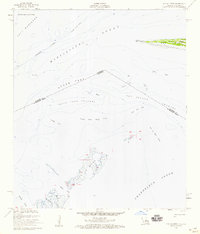 1955 Isle Au Pitre1959 Print · USGSThe maritime boundary between Louisiana and Mississippi is captured in the mid-fifties, showing a landscape of shifting shoals and vital coastal waterways. You can trace the Juan De Cuevas Claim on Cat Island or locate the Lighthouse and historic lights along Pass Marianne.3 unique versions available
 - 1956 Map of Bay St. Louis, 1958 Print
 1956 Bay St. Louis1958 Print · USGSThe Mississippi Gulf Coast is captured here in the mid-fifties, showing the vital rail and road links across St Louis Bay. Researchers can locate family landmarks like the Widow Morin Claim or historic institutions such as St Stanislaus College.5 unique versions available
 - 1956 Map of Vidalia, 1960 Print
 1956 Vidalia1960 Print · USGSCoastal Harrison County and the bayou country come into focus during the mid-fifties as rural settlements like Vidalia and De Lisle remained centered on timber and tide. Genealogists can trace family landmarks like Sand Hill Cem, St Joseph Ch, and St Stephens Sch.5 unique versions available
 - 1956 Map of Gulfport NW, 1960 Print
 1956 Gulfport NW1960 Print · USGSHarrison County's coastal hinterlands are captured here in the mid-fifties, showing a landscape of river bends and early naval infrastructure. Genealogists and local historians can locate the Alexander Dimitry Claim, Allen Cem, and the old settlement at Jones Mill.5 unique versions available
 - 1956 Map of Isle Au Pitre, 1971 Print
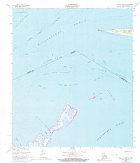 1956 Isle Au Pitre1971 Print · USGSThe Louisiana-Mississippi borderlands come alive in this mid-century survey of the island chains and sounds. Trace historic maritime landmarks and land claims such as the Lighthouse at West Point and the significant Juan De Cuevas Claim Cat Island.
 - 1957 Map of Mobile
 1957 Mobile1957 Print · USGSThe Gulf Coast in the mid-1950s reveals a bustling corridor of rail-and-river commerce connecting Alabama to Louisiana. Genealogists and historians can trace old settlements and military hubs from Keesler Afb to the coastal reaches of Ship Island and Bogalusa.3 unique versions available
 - 1960 Map of Mobile
 1960 Mobile1960 Print · USGSThe Gulf Coast at the dawn of the sixties shows a landscape of busy ports, military airbases, and barrier islands. Trace the rail lines of the Louisville & Nashville through BILOXI and Pascagoula or find family history in towns like Bayou La Batre and Poplarville.
Showing maps 1-25 of 166
Top cities of Harrison County
- Gulfport historical maps
- Biloxi historical maps
- Long Beach historical maps
- D'Iberville historical maps
- Pass Christian historical maps
Frequently asked questions
- What are the different types of historical maps available for Harrison County?
- What is the oldest map of Harrison County?
- Where can I purchase historical maps of Harrison County for my home or office?
- Where can I download high-res historical maps of Harrison County?
- Are there historical topographic maps available for Harrison County?
- Is there historical aerial imagery available for Harrison County?
- Where are historical maps of Harrison County sourced from?