1970s Maps of Lawrence County, Mississippi
Explore 14 historic maps of Lawrence County from the 1970s. These maps offer a rare glimpse into what life looked like during the 1970s — showing old roads, neighborhoods, homes, and landmarks that have changed or disappeared over time.
Whether you're researching your family's past, planning a metal detecting trip, or studying how Lawrence County's landscape evolved across the 1970s, these high-resolution maps are a powerful tool for exploring the history of this region.
- Focus on a specific era: All maps on this page are from the 1970s, giving you a focused view of this time period.
- See what’s changed: Compare century-old streets, trails, and buildings to today's modern landscape using overlays and satellite layers.
- Research with precision: Use these maps for genealogy, historical research, land use analysis, or educational projects.
- View, download, or print: Maps are fully viewable online in high resolution, and can be downloaded or printed for your own records.
Start exploring Lawrence County's history through authentic maps from the 1970s. This is your window into the past.
Lawrence County, MS maps
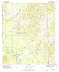
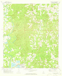
(14)- 1970 Map of Prentiss West, 1972 Print
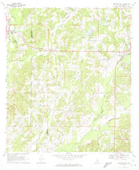 1970 Prentiss West1972 Print · USGSJefferson Davis County at the start of the 1970s shows a landscape of small settlements and rural industries. Trace the rail-and-river economy through the Illinois Central corridor, locating Williams Sch, Silver Creek, and Bethany Ch.
 - 1970 Map of Topeka, 1972 Print
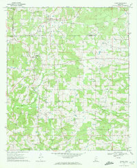
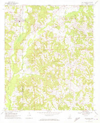
 1970 Topeka1972 Print · USGSLawrence County and the Lawrence-Lincoln border appear here in the early seventies, capturing a rural landscape of ridges and creek bottoms. Genealogists can trace family connections through landmarks like Ballards Chapel, Topeka-Tilton Sch, and the many gravel pits near Topeka.
 - 1970 Map of Monticello, 1972 Print
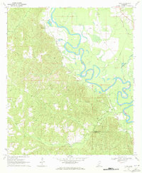
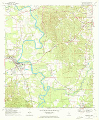 1970 Monticello1972 Print · USGSMonticello and the surrounding Lawrence County countryside thrive along the Pearl River in the late sixties. Researchers can trace the rail lines of the Gulf Mobile and Ohio or locate family landmarks like Armstrong Cem and Canaan Ch.
 - 1970 Map of Darbun, 1972 Print
 1970 Darbun1972 Print · USGSSouth Mississippi’s rural crossroads come into focus during the early seventies, where the borders of three counties meet. Researchers can trace family history through a concentration of country churches and burial grounds like Sartinville Ch, Darbun Ch, and Sauls Valley Cem.
 - 1970 Map of Jayess, 1972 Print
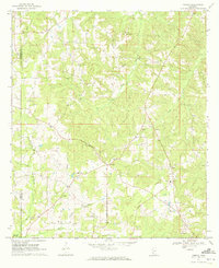
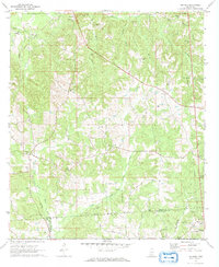
 1970 Jayess1972 Print · USGSSouth Mississippi rural life in the early seventies centers on the settlements of Jayess and Enon. Genealogists and historians can trace community roots through numerous landmarks like New Hope Ch, Greer Cem, and the New Bethel Sch.
 - 1970 Map of Oak Vale, 1972 Print
 1970 Oak Vale1972 Print · USGSJefferson Davis County and the Pearl River basin are shown here in the early seventies as a hub of rail transit and rural industry. Researchers can trace the Illinois Central railroad through Oak Vale or locate historic sites like Hepzibah Ch and Bourne Cem.2 unique versions available
 - 1970 Map of New Hebron, 1972 Print
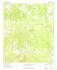
 1970 New Hebron1972 Print · USGSLawrence and Jefferson Davis counties are captured here in the early seventies, centered on the oil and gas industry and the rail corridor. Genealogists can trace family landmarks like Oakley Jr High School, Gholar Cem, and Sardis Baptist Mission.2 unique versions available
 - 1970 Map of Nola, 1972 Print
 1970 Nola1972 Print · USGSLawrence County and the outskirts of Monticello are captured here in the early seventies, showing a landscape of timbered hills and winding creek bottoms. Genealogists can trace rural communities around Mt Pleasant Ch, New Zion Ch, and Rosella along the Gulf Mobile and Ohio tracks.
 - 1970 Map of Tilton, 1972 Print
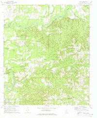
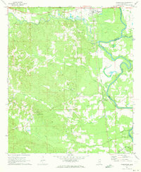
 1970 Tilton1972 Print · USGSLawrence County during the late Vietnam era was defined by the winding Pearl River and its busy rail lines. Genealogists and historians can trace family locations near Robinwood, Chinalee Ch, and the Bozeman Cem.
 - 1971 Map of Schley, 1973 Print
 1971 Schley1973 Print · USGSThe confluence of the Strong and Pearl Rivers defined rural life in Simpson County during the early seventies. Genealogists can locate family landmarks like Armstrong-Buckley Cem and rural centers such as Schley or Bridgeport.2 unique versions available
 - 1971 Map of Monticello NE, 1973 Print
 1971 Monticello NE1973 Print · USGSLawrence County's river-driven landscape is captured here in the early seventies, just as industrial footprints like the large Paper Mill began to reshape the southern terrain. Genealogists can locate several family-named burial grounds and rural pulpits, including Buckley Cem, Scarber Cem, and St James Ch.
 - 1971 Map of Oma, 1973 Print
 1971 Oma1973 Print · USGSThe rural borderlands of Lawrence and Copiah Counties are captured here in the early 1970s along the winding Pearl River. Researchers can trace family history through sites like Bahala Chapel Cem, the rail stop at Oma, and the Gulf Mobile and Ohio line.2 unique versions available
 - 1971 Map of Shivers, 1973 Print
 1971 Shivers1973 Print · USGSSouthern Mississippi's Piney Woods are captured here in the early 1970s, where rural industry meets historic county lines. Trace the OLD INDIAN TREATY BOUNDARY near Shivers or locate family roots at Pilgrim Rest Cem and Rose Hill Ch.2 unique versions available
 - 1971 Map of Georgetown, 1973 Print
 1971 Georgetown1973 Print · USGSThe Pearl River valley in the early seventies shows a landscape of river-bottom settlements and upland timber stands. Genealogists can trace family names at Lily Mae Cem and Norman Cem or locate rural centers like Rockport and Georgetown.3 unique versions available
End of results
Showing maps 1-14 of 14
Top cities of Lawrence County
Frequently asked questions
- What are the different types of historical maps available for Lawrence County?
- What is the oldest map of Lawrence County?
- Where can I purchase historical maps of Lawrence County for my home or office?
- Where can I download high-res historical maps of Lawrence County?
- Are there historical topographic maps available for Lawrence County?
- Is there historical aerial imagery available for Lawrence County?
- Where are historical maps of Lawrence County sourced from?