Old Maps of Lawrence County, Mississippi for Hiking & Exploration
Hike through history with 97 historic maps of Lawrence County. Explore old trails, ghost towns, and forgotten backroads — perfect for outdoor adventurers and local explorers.
- Rediscover forgotten places: Map out old mining camps, roads, and footpaths that no longer exist on modern maps.
- Layer with modern tools: Combine with LiDAR or satellite views to plan hikes through historical terrain.
- Made for exploration: Popular among hikers, overlanders, and local history lovers.
Use these maps to find adventure and explore the hidden past of Lawrence County.
Lawrence County, MS maps
(97)- 1953 Map of Hattiesburg, 1965 Print
 1953 Hattiesburg1965 Print · USGSSouth Mississippi and western Alabama are shown here during the mid-twentieth century as the timber and rail industries shaped the region. Genealogists and historians can trace rail lines like the Mississippi Central and locate rural centers such as Magee, Richton, and Mount Vernon.4 unique versions available
 - 1953 Map of Natchez, 1966 Print
 1953 Natchez1966 Print · USGSSouthwest Mississippi and the Louisiana border country come alive in this mid-century survey of the river valley and forest lands. Researchers can trace the rail lines of the Illinois Central RR and locate rural hubs like Gloster and Ferriday.3 unique versions available
 - 1956 Map of Natchez
 1956 Natchez1956 Print · USGSThe Mississippi River borderlands and the Pine Hills come alive in this mid-fifties study of the Natchez region. Genealogists and historians can trace rail-era towns along the Illinois Central RR and explore the oxbows of Lake Bruin and Lake Concordia.
 - 1958 Map of Hattiesburg
 1958 Hattiesburg1958 Print · USGSSoutheastern Mississippi's timber and rail networks are at their peak during the late fifties, centered on the growing hubs of Hattiesburg and Laurel. Researchers can trace old family landmarks like Sims Chapel, the Busbey Game Refuge, and the vanished stops along the Mississippi Central railroad.2 unique versions available
 - 1959 Map of Natchez
 1959 Natchez1959 Print · USGSSouthwestern Mississippi and eastern Louisiana are captured in the late fifties, showing a landscape defined by the winding Mississippi River and the timbered Homochitto National Forest. Researchers can trace the sprawling Illinois Central RR and find rural landmarks like Union Church and Camp Van Dorn (Abandoned).
 - 1970 Map of Prentiss West, 1972 Print
 1970 Prentiss West1972 Print · USGSJefferson Davis County at the start of the 1970s shows a landscape of small settlements and rural industries. Trace the rail-and-river economy through the Illinois Central corridor, locating Williams Sch, Silver Creek, and Bethany Ch.
 - 1970 Map of Topeka, 1972 Print
 1970 Topeka1972 Print · USGSLawrence County and the Lawrence-Lincoln border appear here in the early seventies, capturing a rural landscape of ridges and creek bottoms. Genealogists can trace family connections through landmarks like Ballards Chapel, Topeka-Tilton Sch, and the many gravel pits near Topeka.
 - 1970 Map of Monticello, 1972 Print
 1970 Monticello1972 Print · USGSMonticello and the surrounding Lawrence County countryside thrive along the Pearl River in the late sixties. Researchers can trace the rail lines of the Gulf Mobile and Ohio or locate family landmarks like Armstrong Cem and Canaan Ch.
 - 1970 Map of Darbun, 1972 Print
 1970 Darbun1972 Print · USGSSouth Mississippi’s rural crossroads come into focus during the early seventies, where the borders of three counties meet. Researchers can trace family history through a concentration of country churches and burial grounds like Sartinville Ch, Darbun Ch, and Sauls Valley Cem.
 - 1970 Map of Jayess, 1972 Print
 1970 Jayess1972 Print · USGSSouth Mississippi rural life in the early seventies centers on the settlements of Jayess and Enon. Genealogists and historians can trace community roots through numerous landmarks like New Hope Ch, Greer Cem, and the New Bethel Sch.
 - 1970 Map of Oak Vale, 1972 Print
 1970 Oak Vale1972 Print · USGSJefferson Davis County and the Pearl River basin are shown here in the early seventies as a hub of rail transit and rural industry. Researchers can trace the Illinois Central railroad through Oak Vale or locate historic sites like Hepzibah Ch and Bourne Cem.2 unique versions available
 - 1970 Map of New Hebron, 1972 Print
 1970 New Hebron1972 Print · USGSLawrence and Jefferson Davis counties are captured here in the early seventies, centered on the oil and gas industry and the rail corridor. Genealogists can trace family landmarks like Oakley Jr High School, Gholar Cem, and Sardis Baptist Mission.2 unique versions available
 - 1970 Map of Nola, 1972 Print
 1970 Nola1972 Print · USGSLawrence County and the outskirts of Monticello are captured here in the early seventies, showing a landscape of timbered hills and winding creek bottoms. Genealogists can trace rural communities around Mt Pleasant Ch, New Zion Ch, and Rosella along the Gulf Mobile and Ohio tracks.
 - 1970 Map of Tilton, 1972 Print
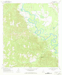 1970 Tilton1972 Print · USGSLawrence County during the late Vietnam era was defined by the winding Pearl River and its busy rail lines. Genealogists and historians can trace family locations near Robinwood, Chinalee Ch, and the Bozeman Cem.
 - 1971 Map of Schley, 1973 Print
 1971 Schley1973 Print · USGSThe confluence of the Strong and Pearl Rivers defined rural life in Simpson County during the early seventies. Genealogists can locate family landmarks like Armstrong-Buckley Cem and rural centers such as Schley or Bridgeport.2 unique versions available
 - 1971 Map of Monticello NE, 1973 Print
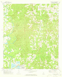 1971 Monticello NE1973 Print · USGSLawrence County's river-driven landscape is captured here in the early seventies, just as industrial footprints like the large Paper Mill began to reshape the southern terrain. Genealogists can locate several family-named burial grounds and rural pulpits, including Buckley Cem, Scarber Cem, and St James Ch.
 - 1971 Map of Oma, 1973 Print
 1971 Oma1973 Print · USGSThe rural borderlands of Lawrence and Copiah Counties are captured here in the early 1970s along the winding Pearl River. Researchers can trace family history through sites like Bahala Chapel Cem, the rail stop at Oma, and the Gulf Mobile and Ohio line.2 unique versions available
 - 1971 Map of Shivers, 1973 Print
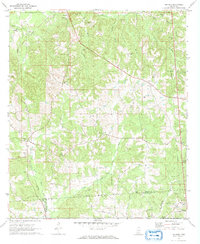 1971 Shivers1973 Print · USGSSouthern Mississippi's Piney Woods are captured here in the early 1970s, where rural industry meets historic county lines. Trace the OLD INDIAN TREATY BOUNDARY near Shivers or locate family roots at Pilgrim Rest Cem and Rose Hill Ch.2 unique versions available
 - 1971 Map of Georgetown, 1973 Print
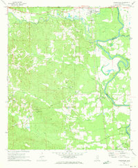 1971 Georgetown1973 Print · USGSThe Pearl River valley in the early seventies shows a landscape of river-bottom settlements and upland timber stands. Genealogists can trace family names at Lily Mae Cem and Norman Cem or locate rural centers like Rockport and Georgetown.3 unique versions available
 - 1984 Map of Hattiesburg
 1984 Hattiesburg1984 Print · USGSSouth Mississippi’s Pine Belt is seen here in the mid-eighties, showing the region as a hub of timber production and petroleum extraction. Trace the rail lines of the Illinois Central Gulf RR through old settlements like Richton or the energy developments at the Heidelberg Oil Field.2 unique versions available
 - 1984 Map of Brookhaven
 1984 Brookhaven1984 Print · USGSSouth-central Mississippi's rural character and rail-centered commerce are shown here in the mid-eighties, from the Homochitto woods to the Pearl River. Trace local roots through Union Church, Meadows Store, and the campus of Copiah-Lincoln Jr College.2 unique versions available
 - 1984 Map of Laurel
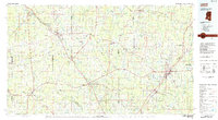 1984 Laurel1984 Print · USGSCentral Mississippi in the mid-eighties shows a landscape of timberlands and river valleys anchored by the growth of Laurel. Genealogists can trace family names near Oak Grove Ch, rural School sites, and settlements along the Illinois Central Gulf RR.
 - 1984 Map of Hattiesburg
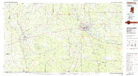 1984 Hattiesburg1984 Print · USGSSouth Mississippi’s timber and military heartland comes into focus during the mid-eighties, centering on the hub of Hattiesburg and the winding Pearl River. Researchers can trace the rail lines of the Illinois Central Gulf through old towns like Bassfield and Sumrall, or locate rural landmarks like Society Hill Ch.
 - 1984 Map of McComb
 1984 McComb1984 Print · USGSSouth Mississippi in the mid-eighties was defined by the rail corridor connecting McComb and Magnolia to the surrounding timberlands. You can trace the rural network of Pike County through landmarks like Holmesville, Percy Quin State Park, and the winding Bogue Chitto.
 - 1994 Map of Laurel
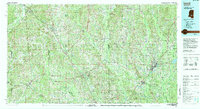 1994 Laurel1994 Print · USGSThe piney woods of south-central Mississippi come into focus in the 1990s, centered on the timber and industrial hub of Laurel. Genealogists and researchers can trace the rural landscape between Collins and Bay Springs or locate homesites near Ellisville and Magee.
Showing maps 1-25 of 97
Top cities of Lawrence County
Frequently asked questions
- What are the different types of historical maps available for Lawrence County?
- What is the oldest map of Lawrence County?
- Where can I purchase historical maps of Lawrence County for my home or office?
- Where can I download high-res historical maps of Lawrence County?
- Are there historical topographic maps available for Lawrence County?
- Is there historical aerial imagery available for Lawrence County?
- Where are historical maps of Lawrence County sourced from?