Old Maps of Crawford, Mississippi for Genealogy
Trace your family roots with 17 historic maps of Crawford. These high-res maps reveal old neighborhoods, homesites, landmarks, and streets — helping you uncover where your ancestors lived and how the area evolved over time.
- Explore historic neighborhoods: Identify where your relatives may have lived in the 1800s or 1900s.
- Compare maps over time: Trace the changes in streets, buildings, and landmarks for multi-generational research.
- Perfect for genealogy & ancestry research: Used by family historians and researchers to map out lineage and migration.
These maps are an incredible resource for exploring your personal connection to Crawford's past.
Crawford, MS maps
(17)- 1953 Map of West Point, 1973 Print
 1953 West Point1973 Print · USGSNorth-Central Mississippi and the Alabama borderlands are captured here during the mid-twentieth century as new reservoirs and national forests transformed the landscape. Researchers can trace the path of the Mississippi & Skuna Valley railroad or locate old landings along the Tombigbee River and Schooner Creek.3 unique versions available
 - 1958 Map of West Point
 1958 West Point1958 Print · USGSNortheastern Mississippi and western Alabama are shown in the late 1950s, highlighting a region defined by its river-and-rail economy. Researchers can trace family roots through numerous settlements like Artesia and Vardaman or explore the corridor of the Tombigbee River.
 - 1959 Map of Artesia, 1960 Print
 1959 Artesia1960 Print · USGSThe Gulf Mobile and Ohio railroad corridor anchors this mid-century look at the prairie country of eastern Mississippi. Genealogists can trace family names at Ledbetter Cem or locate rural centers like Truevine Sch and the community of Artesia.3 unique versions available
 - 1963 Map of West Point
 1963 West Point1963 Print · USGSEastern Mississippi and western Alabama are captured in the early sixties as industrial centers and rail lines connected the Black Prairie to the hills. Genealogists and historians can trace family-named watercourses and the early footprints of Starkville, Columbus, and the Noxubee National Wildlife Refuge.2 unique versions available
 - 1984 Map of West Point
 1984 West Point1984 Print · USGSNorth-Central Mississippi in the mid-eighties shows a landscape defined by massive water management projects and dense timberlands. Researchers can trace the legacy of rural settlements like Geeslin Corner or the rail corridors of the Illinois Central Gulf RR near Grenada Lake.3 unique versions available
 - 1987 Map of Crawford East
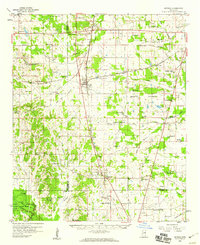
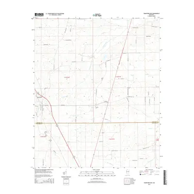
 1987 Crawford East1987 Print · USGSThe rural border of Lowndes and Noxubee Counties in the late 1980s reveals a community centered on the town of Crawford and the Gulf Mobile and Mississippi railroad. Genealogists can trace family landmarks and burial grounds like Ledbetter Cem and St James Ch.
 - 1987 Map of Crawford West
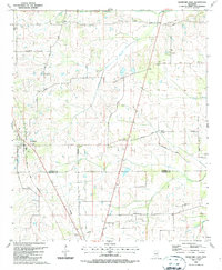
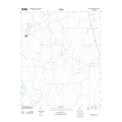
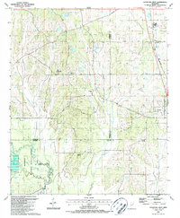 1987 Crawford West1987 Print · USGSOktibbeha County in the late 1980s reveals a landscape defined by the expansive Noxubee National Wildlife Refuge and small rural communities. Trace local family roots and early settlements through landmarks like Crawford, B L Moor High Sch, and Union Chapel.
 - 2012 Map of Crawford East, 2012 Print
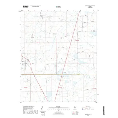
 2012 Crawford East2012 Print · USGSCovers Crawford, including Lowndes County, Noxubee County, and other nearby areas
 - 2012 Map of Crawford West, 2012 Print
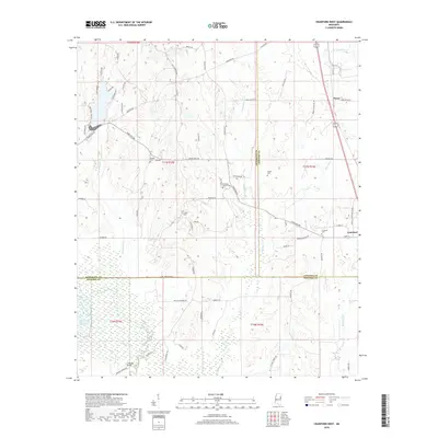
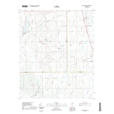
 2012 Crawford West2012 Print · USGSCovers Crawford, including Penns, Lowndes County, and other nearby areas
 - 2015 Map of Crawford East, 2015 Print
 2015 Crawford East2015 Print · USGSCovers Crawford, including Lowndes County, Noxubee County, and other nearby areas
 - 2015 Map of Crawford West, 2015 Print
 2015 Crawford West2015 Print · USGSCovers Crawford, including Penns, Lowndes County, and other nearby areas
 - 2018 Map of Crawford East, 2018 Print
 2018 Crawford East2018 Print · USGSCovers Crawford, including Lowndes County, Noxubee County, and other nearby areas
 - 2018 Map of Crawford West, 2018 Print
 2018 Crawford West2018 Print · USGSCovers Crawford, including Penns, Lowndes County, and other nearby areas
 - 2020 Map of Crawford East, 2020 Print
 2020 Crawford East2020 Print · USGSCovers Crawford, including Lowndes County, Noxubee County, and other nearby areas
 - 2020 Map of Crawford West, 2020 Print
 2020 Crawford West2020 Print · USGSCovers Crawford, including Penns, Lowndes County, and other nearby areas
 - 2024 Map of Crawford West, 2024 Print
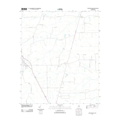
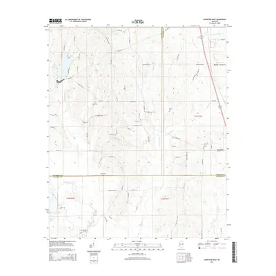
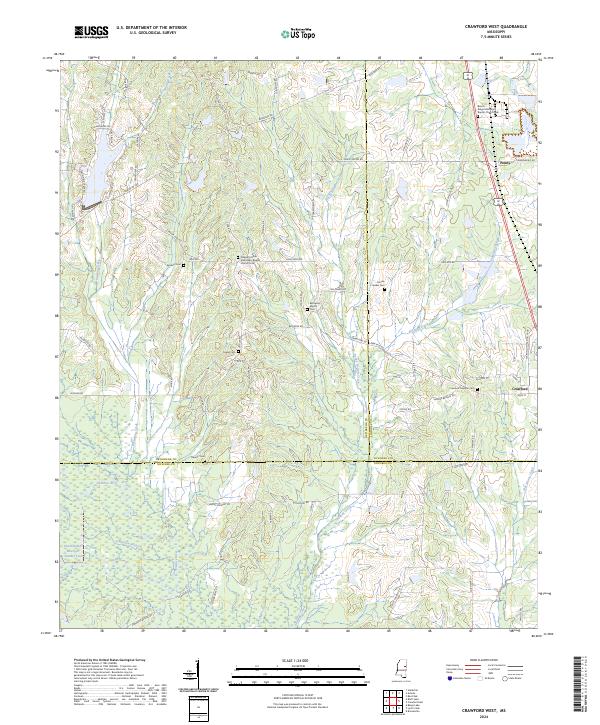 2024 Crawford West2024 Print · USGSCrawford and Penns are captured here at the convergence of three Mississippi counties during the early 2020s. Genealogists can trace deep local roots at Crawford Oaklimb Cem or Pleasant Grove Missionary Baptist Church.
 - 2024 Map of Crawford East, 2024 Print
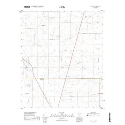
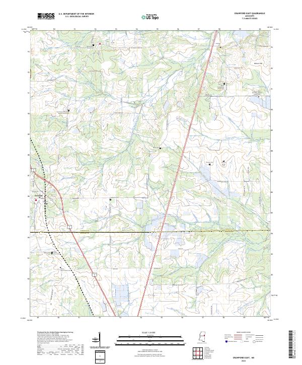 2024 Crawford East2024 Print · USGSLowndes and Noxubee counties meet in this Mississippi landscape during the 2020s, showing the rural development around Crawford. Researchers can trace local heritage through sites like Prairie Grove Church, Ledbetter Cem, and the settlement at Walnut Hills.
End of results
Showing maps 1-17 of 17
Top cities near Crawford
- Columbus historical maps
- Starkville historical maps
- Macon historical maps
- Brooksville historical maps
- Artesia historical maps
Frequently asked questions
- What are the different types of historical maps available for Crawford?
- What is the oldest map of Crawford?
- Where can I purchase historical maps of Crawford for my home or office?
- Where can I download high-res historical maps of Crawford?
- Are there historical topographic maps available for Crawford?
- Is there historical aerial imagery available for Crawford?
- Where are historical maps of Crawford sourced from?