Old Maps of Marshall County, Mississippi for Academic Research
Study the evolution of Marshall County with 144 high-resolution historic maps. Whether you're teaching, researching, or modeling changes in land use, these maps provide essential visual documentation of urban, environmental, and geographic change.
- Analyze long-term change: Track patterns in development, transportation, and natural features.
- Ideal for environmental or urban studies: Support academic projects with primary historical map data.
- Use in the classroom or lab: Educators and researchers rely on these maps to bring historical context to life.
These maps are a powerful tool for teaching, research, and visualizing how Marshall County has changed over the decades.
Marshall County, MS maps
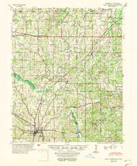
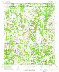
(144)- 1942 Map of Denmark, 1973 Print
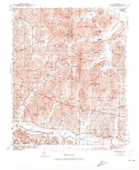 1942 Denmark1973 Print · USGSLafayette County was a landscape of small timber stands and creek-bottom farms during the early 1940s. Genealogists can trace family roots through numerous local landmarks like Lafayette Springs Sch, Bethel Ch, and Jefferson Cem.
 - 1943 Map of Denmark
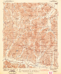 1943 Denmark1943 Print · USGSLafayette County was a landscape of small schools and forest lookouts in the years during the Second World War. Genealogists can trace family roots through numerous rural landmarks like Lafayette Springs, Denmark Sch, and Shiloh Cem.3 unique versions available
 - 1944 Map of Tyro, 1964 Print
 1944 Tyro1964 Print · USGSMississippi's hill country met a changing river landscape in the mid-1940s as the Sardis Reservoir took shape. Genealogists can trace hundreds of family landmarks, from Harmontown to local institutions like St Josephs Ch & Sch and Lammey Fam Cem.
 - 1944 Map of Potts Camp, 1973 Print
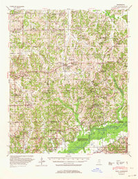
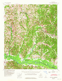
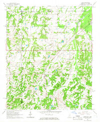
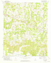
 1944 Potts Camp1973 Print · USGSMarshall County's rural landscape is captured here during the mid-1940s, highlighting the area's transition between the national forest and the Tallahatchie valley. Researchers can trace family sites at St Pauls Ch & Cem, the community at Potts Camp, and early engineering like the Tallahatchie Canal.
 - 1945 Map of Potts Camp, 1964 Print
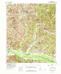
 1945 Potts Camp1964 Print · USGSNorth Mississippi's rural timber and farm country comes into focus in the mid-1940s, just as the local landscape was being reshaped by large-scale flood control projects. Genealogists can locate family landmarks such as Bethany Ch & Cem, the Winborn Lookout Tower, and small settlements like Cornersville and Malone.
 - 1948 Map of Byhalia
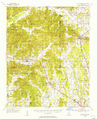
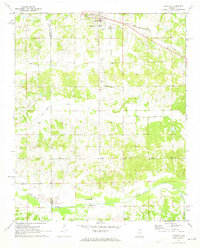
 1948 Byhalia1948 Print · USGSMarshall County in the late 1940s is captured here as a thriving network of small settlements and rail-side towns. Genealogists and historians can trace family locations through numerous rural landmarks like Shelby Ch & Cem, Red Banks, and the Marshall Inst Ch.3 unique versions available
 - 1949 Map of New Albany, 1964 Print
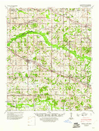
 1949 New Albany1964 Print · USGSNorth Mississippi's rural landscape comes to life in the late 1940s as rail lines and river bottoms connect scattered farming communities. Researchers can trace the heritage of local crossroads and schools like Ingomar, Possum Trot, and Beulah Grove Sch.
 - 1951 Map of New Albany
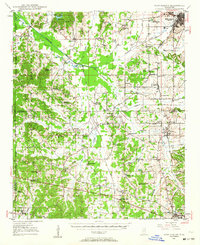
 1951 New Albany1951 Print · USGSMississippi's hill country comes into focus in the early fifties, showing a landscape defined by the GULF MOBILE AND OHIO railroad and the Tallahatchie River. Researchers can trace rural lineages through numerous local sites like Possum Trot, Turnpike Ch, and Ingomar.2 unique versions available
 - 1953 Map of Holly Springs
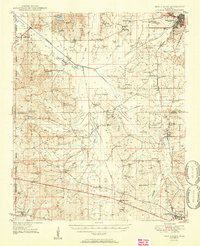
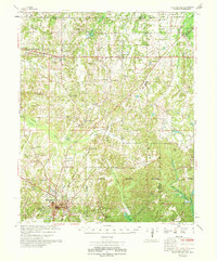
 1953 Holly Springs1953 Print · USGSNorth-central Mississippi and the Tennessee borderlands are captured here in the early 1950s, centered on the railroad crossing at Holly Springs. Genealogists can trace family locations through numerous rural sites like Hudsonville Ch & Cem and Slayden Sch.
 - 1955 Map of Blue Mountain, 1956 Print
 1955 Blue Mountain1956 Print · USGSTippah and Union counties are shown in the mid-fifties during a period of steady growth along the regional rail lines. Researchers can trace family sites among dozens of landmarks like St Matthew Ch, Pumpkin Center, and the Myrtle Lookout Tower.3 unique versions available
 - 1956 Map of Tupelo, 1967 Print
 1956 Tupelo1967 Print · USGSNortheast Mississippi and parts of Tennessee and Alabama are shown here during the mid-fifties, a time of major reservoir construction and forestry management. Researchers can trace the St Louis-San Francisco RR through Tupelo or locate historic sites like Tishomingo State Park and the University.2 unique versions available
 - 1958 Map of Tupelo
 1958 Tupelo1958 Print · USGSNortheast Mississippi and neighboring Alabama and Tennessee appear here during the late fifties as a region defined by new reservoirs and historic rail lines. Genealogists can trace family locations near Sardis Lake, Woodall Mountain, and the St Louis-San Francisco Ry.
 - 1964 Map of Waterford, 1965 Print
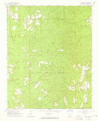 1964 Waterford1965 Print · USGSWayne County during the mid-sixties reveals a landscape of national forest land and emerging industry. Researchers can locate remote family sites like Shows Cem or trace the early Thompson Creek Oil Field and Big Creek Lookout Tower.
 - 1964 Map of Holly Springs SE, 1966 Print
 1964 Holly Springs SE1966 Print · USGSNorthern Mississippi in the mid-sixties reveals a landscape defined by the Holly Springs National Forest and the Illinois Central rail line. Researchers can trace rural landmarks from Hudsonville to Chestnut Grove Cem and Royston Chapel.2 unique versions available
 - 1965 Map of Slayden, 1966 Print
 1965 Slayden1966 Print · USGSSpanning the Tennessee and Mississippi border in the 1960s, this area reveals a landscape of rural school districts and family cemeteries. Trace the locations of historic landmarks like Early Grove, Sand Flats Jr High Sch, and the Pittman Cem.2 unique versions available
 - 1965 Map of Holly Springs, 1966 Print
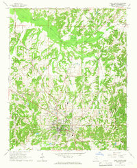 1965 Holly Springs1966 Print · USGSHolly Springs was a prominent hub of education and rail at the height of the mid-sixties. Genealogists and historians can trace family landmarks like Hillcrest Cem, McAlexander Cem, and the grounds of Mississippi Industrial College.2 unique versions available
 - 1965 Map of Lamar, 1966 Print
 1965 Lamar1966 Print · USGSBenton County, Mississippi, and Fayette County, Tennessee, meet in the mid-1960s along a landscape defined by the ILLINOIS CENTRAL railroad. Researchers can trace family roots through numerous local sites like Lamar Cem, Hickory Hill Cem, and Berry Chapel.2 unique versions available
 - 1969 Map of Holly Springs
 1969 Holly Springs1969 Print · USGSNorthern Mississippi and the Tennessee borderlands are detailed here in the late sixties, centered on the rail crossroads of Holly Springs. Genealogists and local historians can trace hundreds of rural landmarks, including Early Grove Cem, Roberts Chapel, and the Sand Flats Jr High Sch.
 - 1971 Map of Byhalia, 1973 Print
 1971 Byhalia1973 Print · USGSByhalia and its rural surrounds in the early 1970s show a landscape of railroad-driven growth and traditional southern church communities. Local researchers can pinpoint family burial sites at Watkins Cem or trace the old rail corridor of the St Louis - San Francisco through Coal Oil Corner.
 - 1971 Map of Marianna, 1973 Print
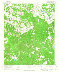
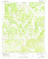 1971 Marianna1973 Print · USGSMarshall County rural life remains centered on historic church congregations and family lands during the early 1970s. Genealogists can trace family connections through numerous sites like Yarbrough Chapel, Nunnally Cem, and the small settlement of Galena.
 - 1971 Map of Wyatte, 1973 Print
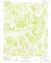 1971 Wyatte1973 Print · USGSThe Marshall and Tate County borderlands come to life in the early 1970s, showcasing a network of rural settlements and crossroad communities. Trace family history through Wyatte, Chulahoma, and local landmarks like Jamieson Chapel or Grubb Hill Cem.2 unique versions available
 - 1971 Map of Laws Hill, 1973 Print
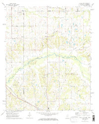
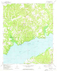 1971 Laws Hill1973 Print · USGSUpper Lafayette County and the Sardis Lake shoreline are captured here in the early seventies, as the river valley's transition to a major reservoir was well-established. Genealogists can trace family sites at Abbeville Cem, Mt Moriah Ch, and the historic Wyatt Cem near the water.2 unique versions available
 - 1971 Map of Red Banks, 1973 Print
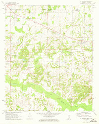
 1971 Red Banks1973 Print · USGSMarshall County in the early seventies is captured here as a landscape of small rail-side settlements and rural parishes. Researchers can locate family landmarks like Wesley Chapel Cem, the old depot site at Victoria, and Antioch Ch.
 - 1971 Map of Mt. Pleasant, 1973 Print
 1971 Mt. Pleasant1973 Print · USGSThe Tennessee-Mississippi borderlands appear here in the early 1970s, showing a rural landscape of small churches and family burial sites. Researchers can trace local history through features like Mt Pleasant, Carey Chapel, and Carington Cem along the Coldwater River.
 - 1971 Map of Byhalia NW, 1973 Print
 1971 Byhalia NW1973 Print · USGSThe Tennessee-Mississippi borderlands appear in the early 1970s as a landscape of small rural settlements and winding river bottoms. Genealogists can locate family landmarks like Handy Corner, McGehee Cem, and the St Louis San Francisco rail line.2 unique versions available
Showing maps 1-25 of 144
Top cities of Marshall County
Frequently asked questions
- What are the different types of historical maps available for Marshall County?
- What is the oldest map of Marshall County?
- Where can I purchase historical maps of Marshall County for my home or office?
- Where can I download high-res historical maps of Marshall County?
- Are there historical topographic maps available for Marshall County?
- Is there historical aerial imagery available for Marshall County?
- Where are historical maps of Marshall County sourced from?