
1964 Map of Holly Springs SE
USGS Topo · Published 1966About this map
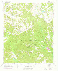
Holly Springs National Forest dominates this mid-1960s landscape, where dense woodland is intersected by the winding Coldwater River and its numerous tributaries. The rural community of Hudsonville sits in the northwest corner, served by the Illinois Central railroad. This area exhibits a typical mid-century Southern rural settlement pattern, defined by small country churches like Hopewell Ch and Harris Chapel and scattered family cemeteries such as Shawnee Cem. A network of Pipelines and a centrally located Lookout Tower reflect the management of natural resources and infrastructure during this period. The terrain is notably dissected by watercourses including Big Snow Creek and Chewalla Creek, with Snow Lake appearing as a distinct landmark near the eastern Forest Boundary.
Find a feature on this map
24 named features on this map. Tap any name to fly to it.
Don’t see what you’re looking for? This feature index may not catch every label — zoom into the map to look around manually.
Map Details
Editions of this 1964 Holly Springs SE Map
2 editions found
Other maps of this area

1944 · Potts Camp
USGS Topo · 1:62,500

1945 · Potts Camp
USGS Topo · 1:62,500

1950 · Ashland
USGS Topo · 1:62,500

1953 · Holly Springs
USGS Topo · 1:62,500

1955 · Blue Mountain
USGS Topo · 1:62,500

1956 · Tupelo
USGS Topo · 1:250,000

1958 · Tupelo
USGS Topo · 1:250,000

1964 · Waterford
USGS Topo · 1:24,000
1965 · Slayden
USGS Topo · 1:24,000
1965 · Holly Springs
USGS Topo · 1:24,000