Old Maps of Gums, Mississippi for Academic Research
Study the evolution of Gums with 14 high-resolution historic maps. Whether you're teaching, researching, or modeling changes in land use, these maps provide essential visual documentation of urban, environmental, and geographic change.
- Analyze long-term change: Track patterns in development, transportation, and natural features.
- Ideal for environmental or urban studies: Support academic projects with primary historical map data.
- Use in the classroom or lab: Educators and researchers rely on these maps to bring historical context to life.
These maps are a powerful tool for teaching, research, and visualizing how Gums has changed over the decades.
Gums, MS maps
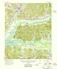
(14)- 1953 Map of West Point, 1973 Print
 1953 West Point1973 Print · USGSNorth-Central Mississippi and the Alabama borderlands are captured here during the mid-twentieth century as new reservoirs and national forests transformed the landscape. Researchers can trace the path of the Mississippi & Skuna Valley railroad or locate old landings along the Tombigbee River and Schooner Creek.3 unique versions available
 - 1955 Map of Coffeeville
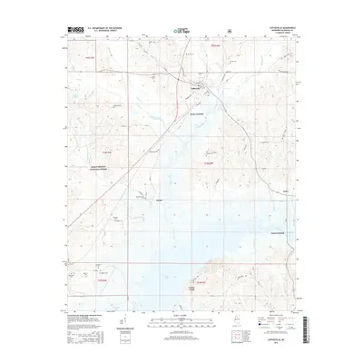
 1955 Coffeeville1955 Print · USGSYalobusha and Grenada Counties are captured here in the mid-fifties, just as the local landscape was being reshaped by the rising Grenada Reservoir. Genealogists and historians can trace dozens of rural landmarks, from the Hopewell Ch & Cem to the Indian Mound and the Illinois Central rail line.2 unique versions available
 - 1958 Map of West Point
 1958 West Point1958 Print · USGSNortheastern Mississippi and western Alabama are shown in the late 1950s, highlighting a region defined by its river-and-rail economy. Researchers can trace family roots through numerous settlements like Artesia and Vardaman or explore the corridor of the Tombigbee River.
 - 1963 Map of West Point
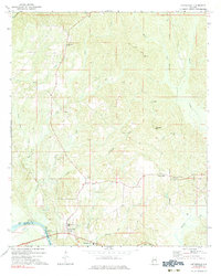
 1963 West Point1963 Print · USGSEastern Mississippi and western Alabama are captured in the early sixties as industrial centers and rail lines connected the Black Prairie to the hills. Genealogists and historians can trace family-named watercourses and the early footprints of Starkville, Columbus, and the Noxubee National Wildlife Refuge.2 unique versions available
 - 1971 Map of Coffeeville, 1983 Print
 1971 Coffeeville1983 Print · USGSThe Tombigbee River corridor in the early 1970s reveals a network of landings and hill country churches along the Clarke and Choctaw County line. Genealogists can locate family landmarks like Jones Chapel, the community at Center Point, and Nichols Landing.
 - 1983 Map of Coffeeville, 1984 Print
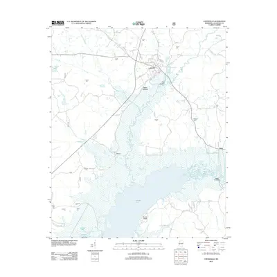
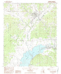 1983 Coffeeville1984 Print · USGSCoffeeville and the northern reaches of the Grenada Lake reservoir are captured here during the early eighties. Genealogists and local historians can trace family roots through numerous sites like Hairston Cem, Pleasant Grove Ch, and the old Gums Crossing on the Skuna River.
 - 1984 Map of West Point
 1984 West Point1984 Print · USGSNorth-Central Mississippi in the mid-eighties shows a landscape defined by massive water management projects and dense timberlands. Researchers can trace the legacy of rural settlements like Geeslin Corner or the rail corridors of the Illinois Central Gulf RR near Grenada Lake.3 unique versions available
 - 1984 Map of Grenada, 1990 Print
 1984 Grenada1990 Print · USGSNorth Central Mississippi’s river valleys and conservation lands are captured here in the mid-1980s. Researchers can trace the sprawling Camp Mc Cain, the Illinois Central Gulf rail line, and the historic Treaty Boundary.
 - 2000 Map of Coffeeville, 2003 Print
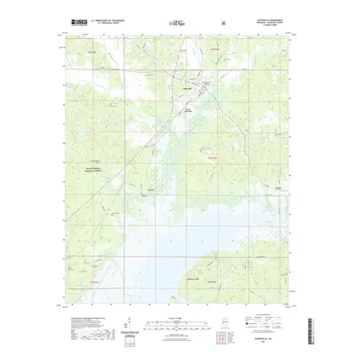
 2000 Coffeeville2003 Print · USGSYalobusha County enters the twenty-first century with a landscape defined by the expansive Grenada Lake and the timbered reaches of the Holly Springs National Forest. Researchers can locate several family-named burial grounds and rural landmarks like the Yalobusha Lookout Tower, Bruce Junction, and Hopewell Ch.
 - 2012 Map of Coffeeville, 2012 Print
 2012 Coffeeville2012 Print · USGSCovers Gums, including Coffeeville, Gums Crossing, and other nearby areas
 - 2015 Map of Coffeeville, 2015 Print
 2015 Coffeeville2015 Print · USGSCovers Gums, including Coffeeville, Gums Crossing, and other nearby areas
 - 2018 Map of Coffeeville, 2018 Print
 2018 Coffeeville2018 Print · USGSCovers Gums, including Coffeeville, Gums Crossing, and other nearby areas
 - 2021 Map of Coffeeville, 2021 Print
 2021 Coffeeville2021 Print · USGSCovers Gums, including Coffeeville, Gums Crossing, and other nearby areas
 - 2024 Map of Coffeeville, 2024 Print
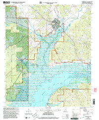
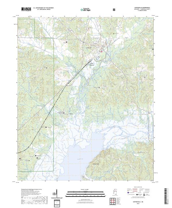 2024 Coffeeville2024 Print · USGSCoffeeville and the surrounding Yalobusha County countryside appear in contemporary detail as the landscape meets the northern waters of the reservoir. Researchers can trace family history through numerous rural landmarks like Mount Myra Cem, Brooms Cem, and the Pleasant Grove Missionary Baptist Church.
End of results
Showing maps 1-14 of 14
Top cities near Gums
- Grenada historical maps
- Water Valley historical maps
- Coffeeville historical maps
- Big Creek historical maps
Frequently asked questions
- What are the different types of historical maps available for Gums?
- What is the oldest map of Gums?
- Where can I purchase historical maps of Gums for my home or office?
- Where can I download high-res historical maps of Gums?
- Are there historical topographic maps available for Gums?
- Is there historical aerial imagery available for Gums?
- Where are historical maps of Gums sourced from?