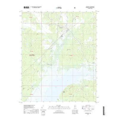
2018 Map of Coffeeville
USGS Topo · Published 2018About this map
Coffeeville serves as the focal point of this Mississippi landscape, situated at the intersection of several local roads like Depot St and Tennessee St. The town sits north of the expansive Grenada Lake, a major hydrological feature formed where the Skuna River and various creeks, including Turkey Creek and Cypress Creek, converge. The western portion of the area is heavily wooded, marked by the boundaries of the Holly Springs National Forest.
Find a feature on this map
75 named features on this map. Tap any name to fly to it.
Don’t see what you’re looking for? This feature index may not catch every label — zoom into the map to look around manually.
Map Details
Editions of this 2018 Coffeeville Map
This is the sole edition of this map. No revisions or reprints were ever made.
Other maps of this area

1953 · West Point
USGS Topo · 1:250,000

1954 · Grenada
USGS Topo · 1:62,500

1954 · Oakland
USGS Topo · 1:62,500

1954 · Water Valley
USGS Topo · 1:62,500

1955 · Water Valley
USGS Topo · 1:62,500

1955 · Coffeeville
USGS Topo · 1:62,500

1956 · Tupelo
USGS Topo · 1:250,000

1958 · Tupelo
USGS Topo · 1:250,000

1958 · West Point
USGS Topo · 1:250,000

1963 · West Point
USGS Topo · 1:250,000