Old Maps of Barry County, Missouri for Metal Detecting
Plan your next treasure hunt with 165 historic maps of Barry County. Find old homesites, ghost towns, trails, and gathering spots that may be lost to time — perfect for identifying promising metal detecting locations.
- Locate forgotten sites: Uncover places like long-lost settlements, abandoned rail lines, or gathering spots.
- Plan better hunts: Use map overlays combined with LiDAR or satellite views to narrow in on historically rich areas.
- Made for detectorists: Thousands of hobbyists use these maps to discover relics, coins, and hidden history.
Use these historic maps to boost your research and find new opportunities beneath the surface of Barry County.
Barry County, MO maps
(165)- 1899 Map of Fayetteville, 1954 Print
 1899 Fayetteville1954 Print · USGSNorthwest Arkansas at the close of the nineteenth century was a land of expanding railroads and deep-rooted Civil War history. Genealogists and historians can trace the foundations of the Ozarks through landmarks like the Pea Ridge Battlefield, Rheas Mill, and the early rail stops at Avoca and Lowell.
 - 1900 Map of Eureka Springs, 1954 Print
 1900 Eureka Springs1954 Print · USGSThe Ozark Mountains around the Arkansas and Missouri border are shown here during the turn of the century, when the river-and-rail economy was firmly established. Researchers can locate early family crossings and landmarks like Knox Ferry, Pivot Rock, and the St. Louis & San Francisco R. R.
 - 1901 Map of Eureka Springs
 1901 Eureka Springs1901 Print · USGSThe Arkansas Ozarks at the turn of the century are captured here in a time of river ferries and mountain townships. Genealogists and historians can locate early settlements like Eureka Springs and Berryville, or trace historic crossings such as Knox Ferry and Ellis Ford.3 unique versions available
 - 1901 Map of Fayetteville
 1901 Fayetteville1901 Print · USGSNorthwest Arkansas is seen here at the start of the twentieth century as railroads and trade began to reshape the Ozark foothills. Researchers can locate the Pea Ridge Battlefield and Elkhorn Tavern, or trace early industrial sites like Osage Mills and Rhea's Mill.4 unique versions available
 - 1904 Map of Fayetteville
 1904 Fayetteville1904 Print · USGSNorthwest Arkansas was a land of emerging railroads and Civil War memory at the turn of the century. Genealogists can locate family homesteads near Rhea's Mill, the Pea Ridge Battlefield, and early river crossings like Vanwinkle Ferry.
 - 1927 Map of Shell Knob
 1927 Shell Knob1927 Print · USGSThe river valleys of the Missouri Ozarks are captured here in the mid-twenties, showing the intricate landscape of the White and James Rivers before they were dammed. Researchers can trace family homesteads near numerous country schools like Gaddis School or locate historic river crossings such as Schreiner Ferry and Big Creek Ford.3 unique versions available
 - 1937 Map of Cassville
 1937 Cassville1937 Print · USGSBarry County in the late thirties shows a landscape of deep Ozark valleys and tightly knit rural communities. Genealogists and historians can trace family roots through numerous local landmarks like Maplewood Cem, Eagle Rock, and Independence Sch.2 unique versions available
 - 1941 Map of Rocky Comfort, 1962 Print
 1941 Rocky Comfort1962 Print · USGSThe Missouri Ozarks are captured here in the early 1940s, showing a landscape defined by the winding Big Sugar Creek and the Missouri and Arkansas railroad. Researchers can trace rural life through dozens of local sites like Chitwood Cem, Rocky Comfort, and the Spring Hill Sch.2 unique versions available
 - 1942 Map of Aurora, 1961 Print
 1942 Aurora1961 Print · USGSThe northern Ozarks come to life in this mid-century survey of the rugged borderlands where three counties meet. Researchers can trace the path of the Missouri Pacific railroad through Aurora or locate family roots at rural landmarks like Charity Cem and Mountain Home Sch.2 unique versions available
 - 1943 Map of Ritchey
 1943 Ritchey1943 Print · USGSSouthwest Missouri during the war years shows a landscape of busy railroads and emerging military sites. Genealogists can trace family roots through numerous local landmarks like Odd Fellows Cem, Dungy Mine, and rural centers such as Stark City.2 unique versions available
 - 1943 Map of Monett
 1943 Monett1943 Print · USGSCrossing the Barry and Lawrence County line during the mid-forties, this map reveals the vital railroad hub at Monett and its surrounding farmsteads. Genealogists can trace family names through landmarks like Red Mill, Arnold Chapel, and the Cox Cem.3 unique versions available
 - 1943 Map of Rocky Comfort
 1943 Rocky Comfort1943 Print · USGSThe Ozark highlands of McDonald County come into sharp focus during the early 1940s, showing a landscape of deep hollows and high ridges. Genealogists can trace family roots through numerous rural landmarks like Seven Star Sch, Greason Cem, and the village of Powell.3 unique versions available
 - 1944 Map of Cassville
 1944 Cassville1944 Print · USGSBarry County and the Missouri Ozarks come alive in the late 1930s, showing the early development of Roaring River State Park. Researchers can trace old family names and sites at True Love Cem, Pender Switch, and the CCC Camp near Cassville.2 unique versions available
 - 1945 Map of Harrison
 1945 Harrison1945 Print · USGSThe Ozark and Boston Mountains straddle the Missouri-Arkansas border during the mid-forties, showing a landscape of forest ridges and river valleys. Genealogists and historians can trace rail-connected towns like Monett and West Plains or early lake developments at Bull Shoals Res and Norfork Lake.
 - 1945 Map of Aurora
 1945 Aurora1945 Print · USGSThe Ozark plateau around Aurora and Crane is captured here during the mid-forties, showing a landscape defined by rail junctions and rural school districts. Researchers can trace ancestral locations like Stubblefield Cem, the Clay Hill Ch, and old springs including Bean Factory Spr.2 unique versions available
 - 1949 Map of Harrison
 1949 Harrison1949 Print · USGSThe Ozark highlands of northern Arkansas and southern Missouri are shown just after the war, when the White River still followed its original course. Genealogists and historians can trace rail lines like the Missouri & Arkansas RR and locate rural hubs like Harrison, Eureka Springs, and Mountain Home.
 - 1950 Map of Shell Knob, 1957 Print
 1950 Shell Knob1957 Print · USGSThe White River valley in the early 1950s retains its original character, defined by an intricate network of river fords and rural schoolhouses. Researchers can trace ancestral connections through named crossings like Cole Ford and community centers like Liberty Church or the Schreiner Ferry.3 unique versions available
 - 1954 Map of Harrison
 1954 Harrison1954 Print · USGSThe Ozarks and Boston Mountains meet during a period of massive river engineering in the mid-fifties. Researchers can trace the early shorelines of Bull Shoals Lake and Table Rock Reservoir or locate inland towns like Berryville and Harrison.
 - 1954 Map of Tulsa
 1954 Tulsa1954 Print · USGSNortheast Oklahoma and the Ozark border are shown here during a period of massive industrial and infrastructure growth. Researchers can trace the legacy of the Tri-State Mining District and the development of major reservoirs like Grand Lake O' The Cherokees.2 unique versions available
 - 1957 Map of Beaver, 1959 Print
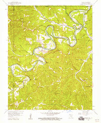 1957 Beaver1959 Print · USGSThe White River valley in Carroll County is shown here in the late fifties, during a period of quiet rural character. Researchers can locate family sites and landmarks like Beaver Cem, the community of Busch, and the waters of Blue Spring.4 unique versions available
 - 1958 Map of Pea Ridge, 1959 Print
 1958 Pea Ridge1959 Print · USGSBenton County, Arkansas, at the end of the 1950s reveals a rural landscape still anchored by its nineteenth-century history. Researchers can locate dozens of family burial sites and country churches, such as Buttrum Cem and Twelve Corners Ch, alongside the landmark Elkhorn Tavern.4 unique versions available
 - 1958 Map of Garfield, 1959 Print
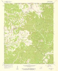 1958 Garfield1959 Print · USGSThe Benton County uplands are captured here in the late fifties as rural life centered around the railroad and timbered ridges. Researchers can trace family sites at Clantonville Cem, Providence Ch, and the now-abandoned Pine Log Sch.4 unique versions available
 - 1958 Map of Tulsa, 1968 Print
 1958 Tulsa1968 Print · USGSNortheast Oklahoma and the Ozark borderlands are captured here during a massive era of reservoir construction and highway expansion. Researchers can trace the mid-century footprints of Tulsa, the sprawling Lake O' the Cherokees, and historical sites like Pea Ridge National Military Park.3 unique versions available
 - 1958 Map of Harrison, 1973 Print
 1958 Harrison1973 Print · USGSThe Ozark and Boston Mountains appear in this mid-century survey as the great White River impoundments were reshaping the region. Researchers can trace the rail lines of the St Louis-San Francisco Ry and locate early settlements like Berryville and Gainesville.
 - 1963 Map of Tulsa
 1963 Tulsa1963 Print · USGSThe Oklahoma and Arkansas borderlands are shown here in the early sixties, a time of massive reservoir construction and heavy mining. Genealogists can trace family roots through settlements like Nowata, Pryor, and Jay, or locate historical zinc and lead mines and coal mines.
Showing maps 1-25 of 165
Top cities of Barry County
- Cassville historical maps
- Purdy historical maps
- Seligman historical maps
- Exeter historical maps
- Wheaton historical maps
- Washburn historical maps
See more
Frequently asked questions
- What are the different types of historical maps available for Barry County?
- What is the oldest map of Barry County?
- Where can I purchase historical maps of Barry County for my home or office?
- Where can I download high-res historical maps of Barry County?
- Are there historical topographic maps available for Barry County?
- Is there historical aerial imagery available for Barry County?
- Where are historical maps of Barry County sourced from?