2020s Maps of Carter County, Missouri
Explore 15 historic maps of Carter County from the 2020s. These maps offer a rare glimpse into what life looked like during the 2020s — showing old roads, neighborhoods, homes, and landmarks that have changed or disappeared over time.
Whether you're researching your family's past, planning a metal detecting trip, or studying how Carter County's landscape evolved across the 2020s, these high-resolution maps are a powerful tool for exploring the history of this region.
- Focus on a specific era: All maps on this page are from the 2020s, giving you a focused view of this time period.
- See what’s changed: Compare century-old streets, trails, and buildings to today's modern landscape using overlays and satellite layers.
- Research with precision: Use these maps for genealogy, historical research, land use analysis, or educational projects.
- View, download, or print: Maps are fully viewable online in high resolution, and can be downloaded or printed for your own records.
Start exploring Carter County's history through authentic maps from the 2020s. This is your window into the past.
Carter County, MO maps
(15)- 2021 Map of Mill Spring, 2021 Print
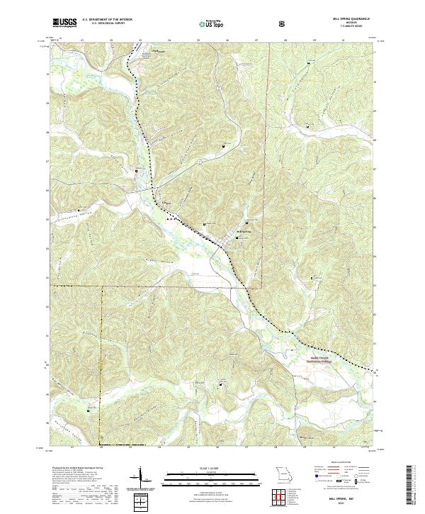 2021 Mill Spring2021 Print · USGSModern-day Mill Spring and Leeper are traced here along the Black River as they appeared in 2021. Genealogists can locate several family burial sites, including Warmack Cem, Scott Cem, and Leeper Cem, tucked within the ridges of the Mark Twain National Forest.
 - 2021 Map of Hogan Hollow, 2021 Print
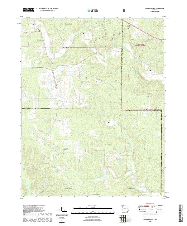 2021 Hogan Hollow2021 Print · USGSRipley and Carter counties are shown here in the 2020s, dominated by the dense canopy of the Mark Twain National Forest. Local historians can trace family roots at the Beaver Dam Catholic Cemetery, Collins Cemetery, and the old settlement of Budapest.
 - 2021 Map of Van Buren North, 2021 Print
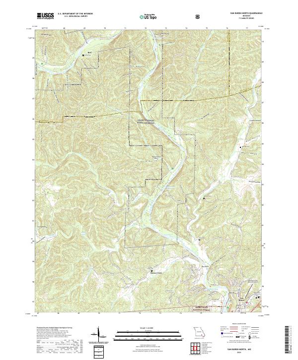 2021 Van Buren North2021 Print · USGSThe Ozark river country comes into focus in this recent survey of Carter County, where the winding Current River meets the hills of the Mark Twain National Forest. Researchers can locate several remote burial sites like Collins Cem and Reed Cem alongside distinctive river landmarks such as Watermelon Shoal.
 - 2021 Map of Grandin SW, 2021 Print
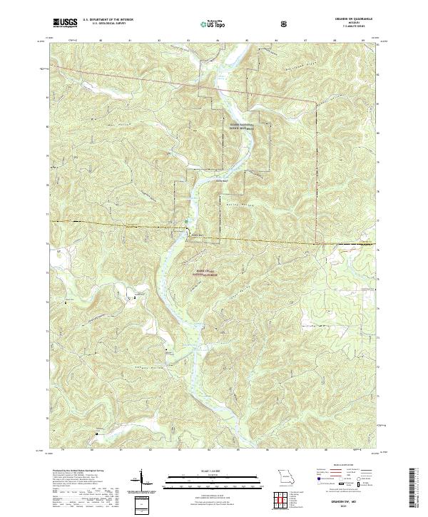 2021 Grandin SW2021 Print · USGSRipley and Carter Counties come alive in this modern survey of the Ozark river country. Researchers can trace family history at Hannas Graveyard or explore the river-carved terrain around Kelley Bluff and the Bay Nothing Recreation Area.
 - 2021 Map of Stegall Mountain, 2021 Print
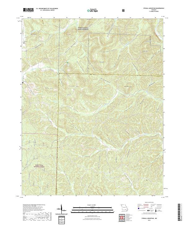 2021 Stegall Mountain2021 Print · USGSThe Missouri Ozarks are shown here in the 2020s, where public forest lands and riverways meet along the county line. Researchers can locate family burial sites like Reed Cem and Horner Cem near peaks such as Stegall Mtn and Mule Mtn.
 - 2021 Map of Hunter, 2021 Print
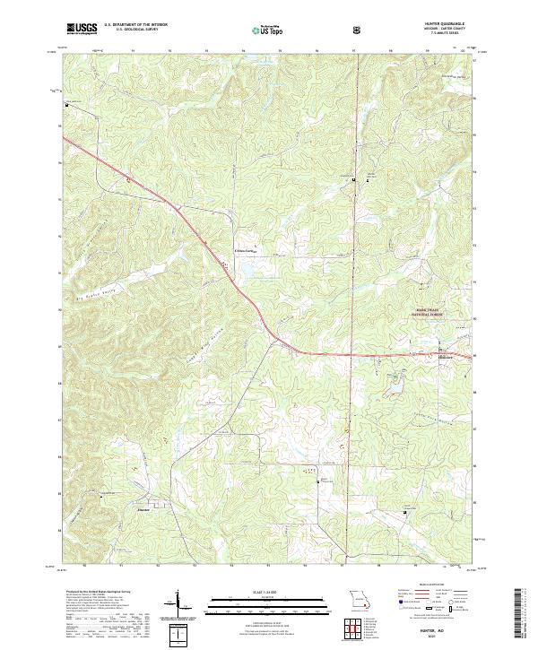 2021 Hunter2021 Print · USGSCarter County at the start of the 2020s shows a landscape of deep hollows and managed timberland. Genealogists can locate several remote burial sites like Whites Mill Cem and Carmel Cem, or trace the winding course of the Prong Little Black River.
 - 2021 Map of Garwood, 2021 Print
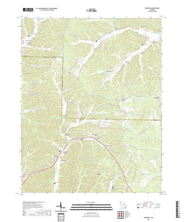 2021 Garwood2021 Print · USGSThe Ozark hollows along the Reynolds and Carter county line were still home to many generational family cemeteries and small valleys in 2021. Genealogists and historians can trace local family roots at Smith Cem, Harris Cem, and the settlement of Garwood.
 - 2021 Map of Ellington SE, 2021 Print
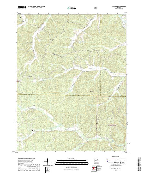 2021 Ellington SE2021 Print · USGSSoutheast Missouri at the intersection of Carter, Wayne, and Reynolds counties reveals a landscape defined by deep-seated family roots and timberlands. Genealogists and hikers can trace historical burials at Potter Cem or explore the drainage of Big Brushy Cr and Webb Cr.
 - 2021 Map of Fremont, 2021 Print
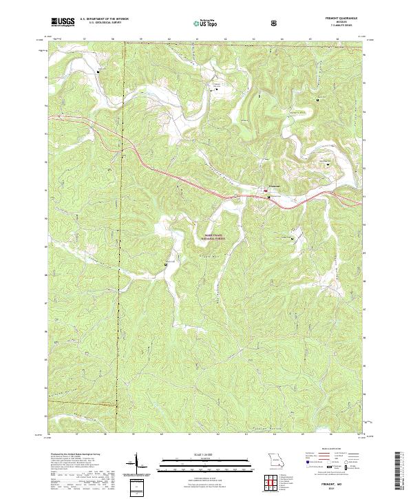 2021 Fremont2021 Print · USGSFremont and the surrounding Ozark woodlands appear in detail during the early 2020s, revealing a landscape of remote cemeteries and historic transport paths. Researchers can trace family sites like Evaline Cem and Snider Cem or locate the route of the OLD TRAM.
 - 2021 Map of Van Buren South, 2021 Print
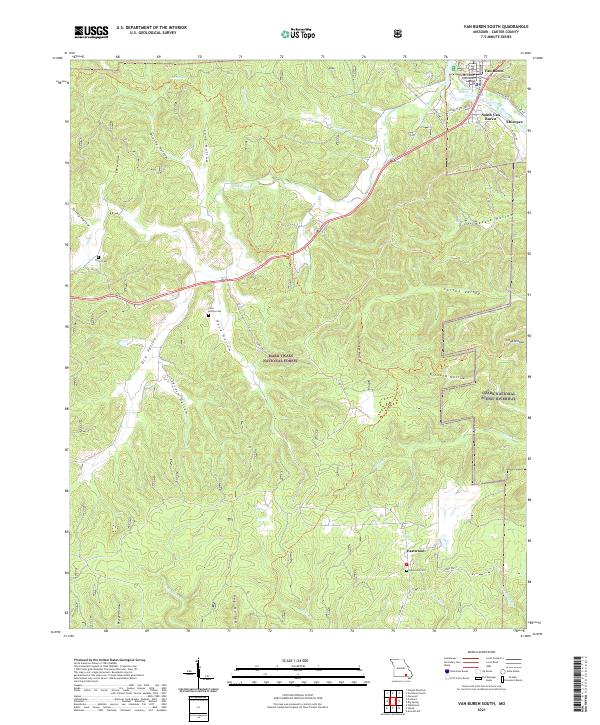 2021 Van Buren South2021 Print · USGSCarter County life centers on the banks of the Current River in this modern topographic study of the Missouri Ozarks. Researchers can trace the civic core at the Carter County Courthouse or locate family history at Turley Cem and Poca Hollow Cem.
 - 2021 Map of Big Spring, 2021 Print
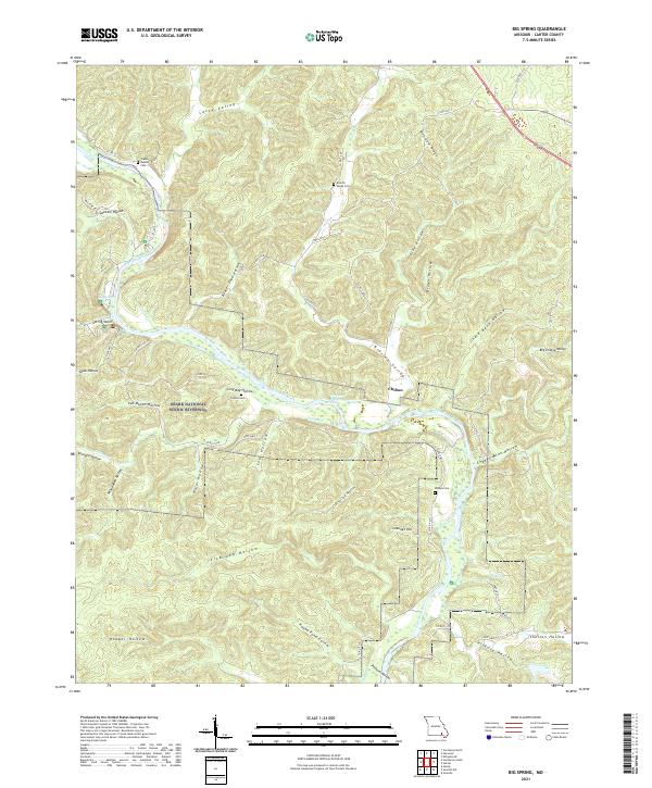 2021 Big Spring2021 Print · USGSCarter County's river-driven landscape is captured here in the early twenty-first century, centered on the Current River corridor. Researchers can trace family history through several local burial sites, including Chilton Cemetery, and explore the terrain around Chilton and Cataract Hill.
 - 2021 Map of Grandin, 2021 Print
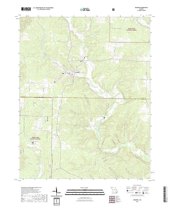 2021 Grandin2021 Print · USGSThe timber town of Grandin and the surrounding Ozark woodlands are shown in great detail during the early 2020s. Researchers can trace rural lineages through family burial sites like McRone Cem or explore landmarks like Devil's Backbone.
 - 2021 Map of Handy, 2021 Print
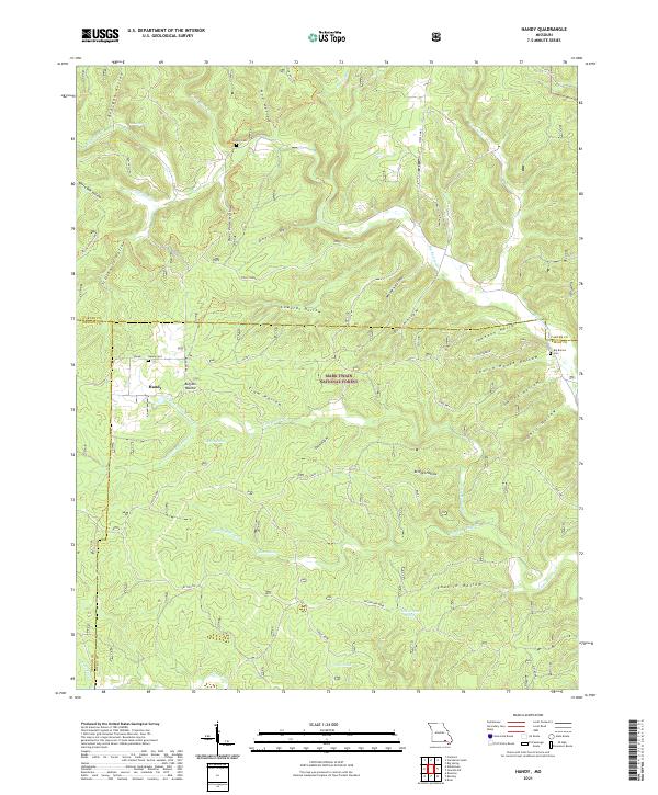 2021 Handy2021 Print · USGSThe Ozark highlands at the meeting of Ripley, Carter, and Oregon Counties are mapped here in the modern era. Researchers can trace local heritage through Handy Cem and Bristol Cem or explore landmarks like Cupola Pond and Devils Horn.
 - 2021 Map of Ellsinore, 2021 Print
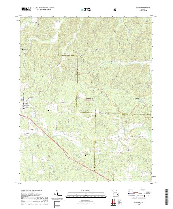 2021 Ellsinore2021 Print · USGSEllsinore and the eastern Ozarks are documented here in 2021, showing the modern character of this forested landscape. Researchers can locate family landmarks like Henson Cem and Kelly Ridge or trace the rural settlement of Upalika.
 - 2021 Map of Wilderness, 2021 Print
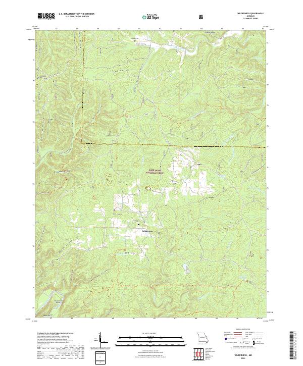 2021 Wilderness2021 Print · USGSThe Missouri Ozarks are showcased here as they appeared in 2021, centered on the rural community of Wilderness and the Mark Twain National Forest. Genealogists and researchers can trace local family landmarks through the Wilderness Cem or follow the path of the Eleven Point Wild and Scenic River past Horseshoe Bend.
End of results
Showing maps 1-15 of 15
Top cities of Carter County
Frequently asked questions
- What are the different types of historical maps available for Carter County?
- What is the oldest map of Carter County?
- Where can I purchase historical maps of Carter County for my home or office?
- Where can I download high-res historical maps of Carter County?
- Are there historical topographic maps available for Carter County?
- Is there historical aerial imagery available for Carter County?
- Where are historical maps of Carter County sourced from?