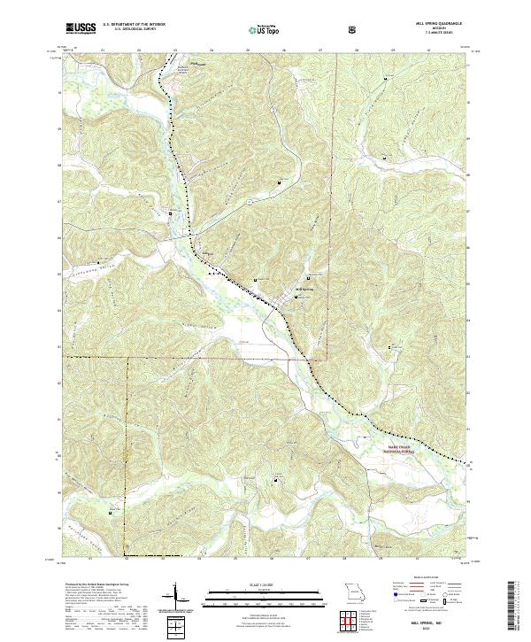
2021 Map of Mill Spring
USGS Topo · Published 2021About this map
Mill Spring and Leeper sit along the winding course of the Black River, centered in a landscape of narrow hollows and high ridges that characterize this section of the Ozarks. The map reveals a dense network of family-named cemeteries, such as Warmack Cem and Bowles Cem, which are often the only remaining markers of early pioneer settlements in the steep drainages like Mining Town Hollow or Evans Hollow.
Find a feature on this map
74 named features on this map. Tap any name to fly to it.
Don’t see what you’re looking for? This feature index may not catch every label — zoom into the map to look around manually.
Map Details
Editions of this 2021 Mill Spring Map
This is the sole edition of this map. No revisions or reprints were ever made.
Other maps of this area

1932 · Piedmont
USGS Topo · 1:62,500

1934 · Williamsville
USGS Topo · 1:48,000

1935 · Piedmont
USGS Topo · 1:62,500

1940 · Williamsville
USGS Topo · 1:62,500

1943 · Ellington
USGS Topo · 1:62,500

1944 · Grandin
USGS Topo · 1:62,500

1945 · Ellington
USGS Topo · 1:62,500

1946 · Grandin
USGS Topo · 1:62,500

1949 · Rolla
USGS Topo · 1:250,000

1953 · Rolla
USGS Topo · 1:250,000