Old Maps of Carter County, Missouri for Hiking & Exploration
Hike through history with 111 historic maps of Carter County. Explore old trails, ghost towns, and forgotten backroads — perfect for outdoor adventurers and local explorers.
- Rediscover forgotten places: Map out old mining camps, roads, and footpaths that no longer exist on modern maps.
- Layer with modern tools: Combine with LiDAR or satellite views to plan hikes through historical terrain.
- Made for exploration: Popular among hikers, overlanders, and local history lovers.
Use these maps to find adventure and explore the hidden past of Carter County.
Carter County, MO maps
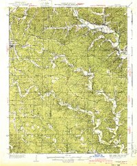
(111)- 1928 Map of Cardareva
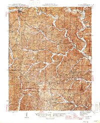
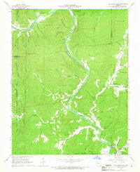
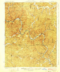 1928 Cardareva1928 Print · USGSThe Missouri Ozarks are captured here in the late 1920s, centered on the winding Current River corridor and its historic river-ford crossings. Genealogists can trace early rural life through numerous sites like Cardareva School, Banker Cave, and the settlement of Deslet.2 unique versions available
 - 1932 Map of Piedmont, 1955 Print
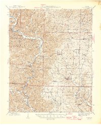
 1932 Piedmont1955 Print · USGSThe Ozark foothills come to life in the early 1930s, showing a landscape defined by the Black Missouri River and the railroad. Genealogists can trace family roots through numerous rural landmarks like Hog Eye Sch, Dees Chapel, and the community of Patterson.2 unique versions available
 - 1934 Map of Williamsville
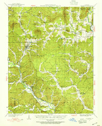
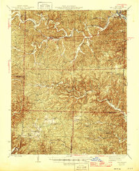
 1934 Williamsville1934 Print · USGSThe Ozark foothills near the Wayne and Butler county line come into focus during the mid-1930s, showing a landscape of timbered hollows and nascent highways. Researchers can locate vanished rural landmarks like the Lone Star School, Kearney Cem, and the specialized Keener Cave Resort.4 unique versions available
 - 1935 Map of Piedmont
 1935 Piedmont1935 Print · USGSWayne County is shown in the mid-1930s as a landscape of timbered ridges and river valleys centered on the rail hub of Piedmont. Genealogists can trace family landmarks like Watkins Store or locate rural centers like Gads Hill and Dees Chapel Sch.2 unique versions available
 - 1940 Map of Williamsville
 1940 Williamsville1940 Print · USGSThe eastern Ozarks at the start of the 1940s reveal a bustling rail-and-river economy centered on the junction of the Missouri Pacific and St Louis - San Francisco. Researchers can trace the unique immigrant history of Budapest or locate vanished landmarks like the Fire Tower CCC Camp and Barrett Mine.2 unique versions available
 - 1943 Map of Ellington, 1956 Print
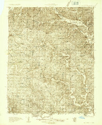
 1943 Ellington1956 Print · USGSThe Reynolds County timberlands and river valleys are captured here in the 1940s as the local landscape faced significant change. Genealogists can trace family footprints through numerous rural landmarks like Pine Valley Cem, Garwood, and Carter Mill Sch.
 - 1944 Map of Van Buren, 1960 Print
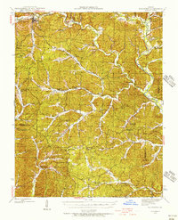
 1944 Van Buren1960 Print · USGSThe Ozark hill country of Carter and Shannon counties appears here in the mid-1940s. Researchers can trace the St Louis San Francisco rail line or locate rural sites like Pleasant Site Cem, Chicopee, and the Bristoll Sch.2 unique versions available
 - 1944 Map of Grandin, 1962 Print
 1944 Grandin1962 Print · USGSDeep in the Ozarks during the 1940s, this area shows a landscape of ridge-top schools and river-bottom homesteads. Genealogists can trace family sites like McDowell Place or search for roots near Shiloh Cem and the Old Iron Mines.
 - 1945 Map of Ellington
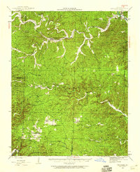
 1945 Ellington1945 Print · USGSThe Missouri Ozarks are captured here during the mid-forties, showing the deep-valley settlements of Reynolds and Carter counties. Genealogists can locate family landmarks such as Newton Cem, Doe Run Ch, and the Upper Doe Run Sch.2 unique versions available
 - 1946 Map of Grandin
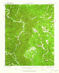
 1946 Grandin1946 Print · USGSThe Ozark hills of Carter and Ripley Counties are captured here in the mid-1940s, highlighting the area's timber and mining heritage. Researchers can locate vanished landmarks like Crossroads Sch, trace the Old Iron Mines, or find family plots at Shiloh Cem.2 unique versions available
 - 1946 Map of Van Buren
 1946 Van Buren1946 Print · USGSThe Ozark foothills of Carter County are shown here in the 1940s, dominated by the winding Current River and the sprawling Clark National Forest. Genealogists and hikers can trace the footprints of rural communities at Wilderness, Bristol Church, and Rinnard School.2 unique versions available
 - 1949 Map of Rolla, 1950 Print
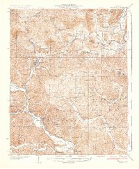
 1949 Rolla1950 Print · USGSThe Missouri Ozarks are captured here just after the war, showing a landscape of deep river valleys and emerging reservoir projects. Genealogists and historians can trace the mining towns of Bonne Terre and Potosi or follow the early route of U.S. Highway 66.
 - 1949 Map of Cardareva, 1957 Print
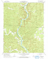
 1949 Cardareva1957 Print · USGSThe mid-century Ozark backcountry along the Current River is detailed here, showing a landscape of river-bend settlements and deep hollows. Researchers can trace rural life through numerous fords and one-room schoolhouses like Owls Bend School and Cardareva Ford.
 - 1953 Map of Rolla
 1953 Rolla1953 Print · USGSSoutheast Missouri’s mining towns and timberlands are seen here at the start of the 1950s. Genealogists and historians can trace the rail-and-river economy through local hubs like Fredericktown and the lead-mining heritage of Potosi and Desloge.
 - 1954 Map of Rolla, 1970 Print
 1954 Rolla1970 Print · USGSThe Missouri Ozarks and the historic Lead Belt are captured in the late sixties, showing a landscape of deep river hollows and industrial mines. Researchers can trace the routes of the Missouri Pacific RR to extraction sites like the Iron Mountain Mine or Pea Ridge Mine.2 unique versions available
 - 1957 Map of Poplar Bluff, 1968 Print
 1957 Poplar Bluff1968 Print · USGSThe Missouri-Arkansas border region is captured here as the timber and rail industries shaped the Ozark foothills. Genealogists and historians can trace the Missouri Pacific Railroad through river towns like Pocahontas, Greenville, and Van Buren.3 unique versions available
 - 1958 Map of Rolla
 1958 Rolla1958 Print · USGSThe Missouri Ozarks and the lead-rich hills of the southeast are captured here in the late fifties as timber and mining shaped the local economy. Researchers can locate family landmarks like the Rolla Cemetery or trace old rail lines including the Missouri-Illinois RR and St Louis-San Francisco RR.
 - 1959 Map of Poplar Bluff
 1959 Poplar Bluff1959 Print · USGSThe Missouri Ozarks and Arkansas borderlands meet in this late 1950s study of the region's diverse terrain and rail-fed towns. Researchers can trace the path of the Missouri Pacific Railroad through Poplar Bluff or locate smaller settlements like Birch Tree and Myrtle.
 - 1959 Map of Rolla
 1959 Rolla1959 Print · USGSMid-century Missouri is defined here by the deep forests of the Ozarks and the industrial peaks of the St Francois Mountains. Genealogists and historians can trace the development of towns like Potosi and Fredericktown or locate rural landmarks like Dry Fork Church and the Phelps County Courthouse.
 - 1960 Map of Poplar Bluff
 1960 Poplar Bluff1960 Print · USGSSoutheast Missouri and Northeast Arkansas are captured here during the post-war era, showing the transition from the Ozark highlands to the Delta. Genealogists and historians can trace rail corridors like the St. Louis Southwestern RR and remote settlements such as Birch Tree and Warm Springs.
 - 1960 Map of Rolla
 1960 Rolla1960 Print · USGSThe Ozark Highlands in the mid-twentieth century reveal a landscape of deep timber and heavy industry. Researchers can trace the rail-and-mine economy through the St Louis-San Francisco RR and the Iron Mountain Mine, alongside the growth of Fort Leonard Wood.
 - 1965 Map of Stegall Mountain, 1966 Print
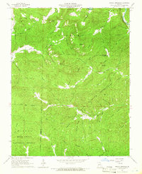 1965 Stegall Mountain1966 Print · USGSThe Missouri Ozarks are captured here in the mid-1960s, a time when conservation and forestry efforts defined the hills of Shannon and Carter Counties. Genealogists and hikers can locate Reed Cem, the Horner Church, and the distinctive Rocky Falls along Rocky Creek.3 unique versions available
 - 1965 Map of Van Buren North, 1966 Print
 1965 Van Buren North1966 Print · USGSThe Current River valley north of Van Buren is shown here in the mid-1960s, a landscape defined by deep hollows and isolated Ozark settlements. Genealogists can locate family landmarks like Collins Cem, Galbraith Cem, and the Bible Ch tucked between the ridges.4 unique versions available
 - 1966 Map of Rolla
 1966 Rolla1966 Print · USGSThe Missouri Ozarks are revealed here in the mid-1960s, showing the intersection of heavy industry and sprawling national forests. Trace the development of the Lead Belt near Flat River or locate family roots in vanished hamlets like Enough and Howes Mill.
 - 1968 Map of Grandin SW, 1969 Print
 1968 Grandin SW1969 Print · USGSRipley and Carter counties are captured in the late sixties as the federal government solidified forest and river protections. Researchers can find family-named landmarks and rural outposts including Good Hope Ch, Hofstader Cem, and the Panther Lookout Tower.2 unique versions available
Showing maps 1-25 of 111
Top cities of Carter County
Frequently asked questions
- What are the different types of historical maps available for Carter County?
- What is the oldest map of Carter County?
- Where can I purchase historical maps of Carter County for my home or office?
- Where can I download high-res historical maps of Carter County?
- Are there historical topographic maps available for Carter County?
- Is there historical aerial imagery available for Carter County?
- Where are historical maps of Carter County sourced from?