Old Maps of Dent County, Missouri for Genealogy
Trace your family roots with 162 historic maps of Dent County. These high-res maps reveal old neighborhoods, homesites, landmarks, and streets — helping you uncover where your ancestors lived and how the area evolved over time.
- Explore historic neighborhoods: Identify where your relatives may have lived in the 1800s or 1900s.
- Compare maps over time: Trace the changes in streets, buildings, and landmarks for multi-generational research.
- Perfect for genealogy & ancestry research: Used by family historians and researchers to map out lineage and migration.
These maps are an incredible resource for exploring your personal connection to Dent County's past.
Dent County, MO maps
(162)- 1912 Map of Rolla
 1912 Rolla1912 Print · USGSThe northern Ozark plateau comes into focus just after the turn of the century as the railroad transforms the river valleys. Genealogists can trace family roots through dozens of rural sites like Western Star School, Turners Mill, and Zion Hill Church.2 unique versions available
 - 1928 Map of Meramec Spring
 1928 Meramec Spring1928 Print · USGSPhelps and Crawford counties in the late twenties are mapped here as a network of rail-side towns and rural school districts. Genealogists can trace family names through dozens of landmarks like Asher Cemetery, Belview Church, and the Bronson Mine.3 unique versions available
 - 1932 Map of Steelville
 1932 Steelville1932 Print · USGSCrawford County's river valleys and rail junctions are documented here during the early 1930s. Genealogists and historians can locate rural landmarks like Frazier Cem, the St Louis-San Francisco rail line, and numerous schools such as Liberty Sch.
 - 1932 Map of Cedar Grove
 1932 Cedar Grove1932 Print · USGSShannon County and the surrounding Ozark highlands are captured in the early 1930s, showing a landscape of small timber-country settlements. Genealogists can trace family homesteads near Cedar Grove and several local schools like Black Valley Sch and Round Valley Sch.
 - 1933 Map of Steelville, 1966 Print
 1933 Steelville1966 Print · USGSCrawford County at the start of the 1930s is a landscape of river-valley settlements and rural industry. Genealogists can trace family lines through dozens of country schools and cemeteries, from Oak Ridge Sch to the Wilkinson Cem near Cherryville.
 - 1937 Map of Steelville
 1937 Steelville1937 Print · USGSCrawford County in the mid-1930s centered on the rail-and-river life of the Steelville area. Researchers can trace early rural life through a detailed network of landmarks like Sligo, Cook Station, and Indian Trail State Park.3 unique versions available
 - 1937 Map of Edgar Springs
 1937 Edgar Springs1937 Print · USGSThe Missouri Ozarks are captured here during the mid-1930s, showing the intersection of rural life and New Deal conservation efforts. Genealogists can locate family landmarks like Freemans Store, Mette Sch, and the Blooming Rose CCC Camp No 1732.
 - 1941 Map of Salem, 1956 Print
 1941 Salem1956 Print · USGSThe Ozark highlands surrounding Salem are captured here in the early 1940s, showing a landscape defined by small farms and local industry. Researchers can trace dozens of rural landmarks, from the County Farm and Lennox Bank to vanished schools like Oak Ridge Sch and Pleasant View Sch.2 unique versions available
 - 1941 Map of Stone Hill, 1958 Print
 1941 Stone Hill1958 Print · USGSDent County and the Ozark hills are captured here in the early 1940s, just as rural school districts and post-office hamlets still anchored local life. Genealogists and researchers can locate numerous family burial grounds and country schools, including Copeland Cem, Union Ch, and the remote Victory Sch.3 unique versions available
 - 1943 Map of Boss, 1963 Print
 1943 Boss1963 Print · USGSThe Ozark highlands of the early 1940s are revealed here through a network of small family settlements and mountain schools. Genealogists can trace family footprints at Old Mill Lodge, Moses Store, or rural burial sites like Abbott Cem.2 unique versions available
 - 1944 Map of Corridon, 1963 Print
 1944 Corridon1963 Print · USGSThe Missouri Ozarks during the mid-forties reveal a landscape of timbered hollows and isolated settlements across the Reynolds and Shannon County lines. Researchers can trace family sites from Bunker to Fruit City, including Cedar Point Sch and the Latter Day Saints Ch.2 unique versions available
 - 1945 Map of Salem
 1945 Salem1945 Print · USGSDent County's rural character and rail connections are preserved here in the mid-1940s. Genealogists can trace family lines through numerous landmarks like Karns Cem, Oakland Sch, and the St. Louis-San Francisco RR at Salem.2 unique versions available
 - 1945 Map of Edgar Springs
 1945 Edgar Springs1945 Print · USGSThe Missouri Ozarks are captured here in the mid-1940s, showing a landscape of upland ridges and deep hollows at the borders of Phelps and Texas counties. Researchers can trace rural community life through the Blooming Rose CCC Camp and remote sites like Bethlehem Sch & Pray Cem.2 unique versions available
 - 1945 Map of Stone Hill
 1945 Stone Hill1945 Print · USGSThe Ozark highlands of Dent County are shown here in the mid-1940s, a landscape defined by the upper Meramec River and deep forest preserves. Researchers can trace rural life through dozens of local landmarks, from the Indian Trail Fish Hatchery to remote settlements like Short Bend and Howes Mill PO.2 unique versions available
 - 1945 Map of Round Spring, 1962 Print
 1945 Round Spring1962 Print · USGSThe Ozark hill country of Shannon County comes to life in the mid-1940s, revealing a landscape of remote hollows and riverside camps. Genealogists and historians can trace old community hubs like the Brushy Post Office, Mauser's Mill, and several country schools.2 unique versions available
 - 1946 Map of Boss
 1946 Boss1946 Print · USGSThe Missouri Ozarks are captured here just after the war, showing the deep hollows and timberlands of the eastern Courtois Hills. Genealogists and researchers can locate family landmarks like Moses Store, the Webb Cem, and numerous rural schoolhouses such as Barton Sch.2 unique versions available
 - 1947 Map of Sinkin
 1947 Sinkin1947 Print · USGSShannon County in the late 1940s reveals a landscape of spring-fed rivers and remote timber settlements. Genealogists and historians can locate numerous rural schools like Sugar Tree Grove Sch and trace the river-mill economy at Brushy Mill and Mansers Mill.
 - 1947 Map of Corridon
 1947 Corridon1947 Print · USGSReynolds and Shannon counties in the late 1940s are shown here as a network of creek-valley settlements and rural schools. Researchers can trace family sites near Bunker, Fruit City, and Dagonia, or locate specific landmarks like Nuckols Cem and Latter Day Saints Ch.
 - 1949 Map of Round Spring
 1949 Round Spring1949 Print · USGSThe Ozark riverways of Shannon and Dent Counties are captured here in the late 1940s as state and federal forestry lands began to consolidate. Local researchers can trace family roots through remote landmarks like Swinney Cem, Falk Mill, and the isolated Brushy PO.
 - 1949 Map of Rolla, 1950 Print
 1949 Rolla1950 Print · USGSThe Missouri Ozarks are captured here just after the war, showing a landscape of deep river valleys and emerging reservoir projects. Genealogists and historians can trace the mining towns of Bonne Terre and Potosi or follow the early route of U.S. Highway 66.
 - 1949 Map of Meramec Spring, 1957 Print
 1949 Meramec Spring1957 Print · USGSPhelps and Dent counties are shown here just after the war, at a time when rural education and mining defined the Missouri Ozarks. Genealogists can locate family landmarks like Wishon Cem, Asher Cemetery, and dozens of district schools such as Roster School.2 unique versions available
 - 1949 Map of Steelville, 1959 Print
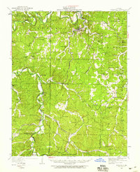 1949 Steelville1959 Print · USGSThe Missouri Ozarks are captured here during the late 1940s, showing the winding Meramec River valley and the waning rail lines of the Frisco system. Genealogists can locate family homesteads near Steelville or trace ancestors at Gordon Cem and Sligo.
 - 1950 Map of Yancy Mills, 1960 Print
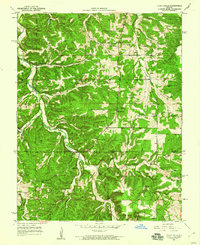 1950 Yancy Mills1960 Print · USGSMid-century Phelps and Dent Counties appear here as a network of ridge-top schools and creek-bottom settlements. Genealogists can locate family landmarks such as the Corn Creek Cem, Philadelphia Ch, and the rural community of Yancy Mills.6 unique versions available
 - 1951 Map of Yancy Mills
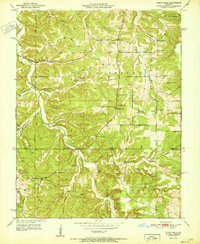 1951 Yancy Mills1951 Print · USGSPhelps County, Missouri, is captured here in the early 1950s as a landscape of rural schools, churches, and winding hollows. Genealogists and local historians can trace the foundations of the community through sites like Yancy Mills PO, Huskey Cem, and Grayson Sch.2 unique versions available
 - 1951 Map of Montauk, 1952 Print
 1951 Montauk1952 Print · USGSThe headwaters of the Current River are captured here in the early fifties, showing the development of Montauk State Park. Researchers can trace old family sites and rural institutions like Paterson Cem, Hepsida Ch, and Alred Sch.5 unique versions available
Showing maps 1-25 of 162
Top cities of Dent County
Frequently asked questions
- What are the different types of historical maps available for Dent County?
- What is the oldest map of Dent County?
- Where can I purchase historical maps of Dent County for my home or office?
- Where can I download high-res historical maps of Dent County?
- Are there historical topographic maps available for Dent County?
- Is there historical aerial imagery available for Dent County?
- Where are historical maps of Dent County sourced from?