1950s Maps of Joachim Township, Missouri
Explore 6 historic maps of Joachim Township from the 1950s. These maps offer a rare glimpse into what life looked like during the 1950s — showing old roads, neighborhoods, homes, and landmarks that have changed or disappeared over time.
Whether you're researching your family's past, planning a metal detecting trip, or studying how Joachim Township's landscape evolved across the 1950s, these high-resolution maps are a powerful tool for exploring the history of this region.
- Focus on a specific era: All maps on this page are from the 1950s, giving you a focused view of this time period.
- See what’s changed: Compare century-old streets, trails, and buildings to today's modern landscape using overlays and satellite layers.
- Research with precision: Use these maps for genealogy, historical research, land use analysis, or educational projects.
- View, download, or print: Maps are fully viewable online in high resolution, and can be downloaded or printed for your own records.
Start exploring Joachim Township's history through authentic maps from the 1950s. This is your window into the past.
Joachim Township, MO maps
(6)- 1954 Map of Belew Creek, 1959 Print
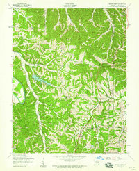 1954 Belew Creek1959 Print · USGSJefferson County hills in the mid-1950s are defined by winding waterways and ridge-top settlements. Genealogists can trace the rural landscape around Lake Tishomingo, Goldman, and local landmarks like Glade Chapel and the Lookout Tower.5 unique versions available
 - 1954 Map of Herculaneum, 1959 Print
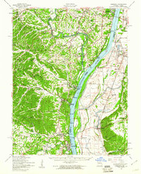
 1954 Herculaneum1959 Print · USGSJefferson County in the mid-1950s shows a landscape shaped by river commerce and the rugged bluffs of the Mississippi River. Genealogists and researchers can trace family landmarks like Mahler Cem, St Lukes Ch, and the early footprints of Herculaneum and Pevely.4 unique versions available
 - 1954 Map of Valmeyer, 1959 Print
 1954 Valmeyer1959 Print · USGSThe Illinois-Missouri borderlands in the mid-1950s showcase a landscape of river-bottom farms and bluff-side hollows along the Mississippi River. Researchers can trace old rail lines like the Missouri Pacific and find vanished rural schools including Central Sch and Miles Prairie Sch.4 unique versions available
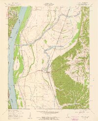
 - 1954 Map of Kimmswick, 1960 Print
 1954 Kimmswick1960 Print · USGSThe Mississippi River corridor south of St. Louis comes to life in the mid-fifties, showing the rail-dependent towns of Kimmswick and Herculaneum. Genealogists and historians can trace family landmarks like Richardson Cem, Point Sch, and Harrisonville Landing.2 unique versions available
 - 1955 Map of De Soto NE
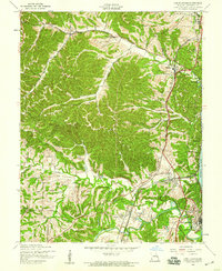
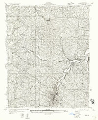
 1955 De Soto NE1955 Print · USGSJefferson County's rural character is preserved here in the mid-1950s, showing the early infrastructure connecting local rail hubs. Family historians can locate a dense network of country schools like Buckie Sch and New Hope Sch along the banks of Joachim Creek.
 - 1958 Map of De Soto NE
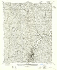
 1958 De Soto NE1958 Print · USGSJefferson County during the early twentieth century shows a landscape defined by rail and creek valleys. Genealogists and local historians can trace the foundations of Festus and Hematite or locate rural landmarks like Haverstick Sch and the Missouri Pacific line.
End of results
Showing maps 1-6 of 6
Top cities near Joachim Township
- Oakville historical maps
- Arnold historical maps
- Festus historical maps
- Eureka historical maps
- Columbia historical maps
- Murphy historical maps
See more
Top neighborhoods of Joachim Township
- Mapaville historical maps
- Donnell historical maps
- Jarvis historical maps
- Hematite historical maps
- Horine historical maps
- Bushburg historical maps
See more
Frequently asked questions
- What are the different types of historical maps available for Joachim Township?
- What is the oldest map of Joachim Township?
- Where can I purchase historical maps of Joachim Township for my home or office?
- Where can I download high-res historical maps of Joachim Township?
- Are there historical topographic maps available for Joachim Township?
- Is there historical aerial imagery available for Joachim Township?
- Where are historical maps of Joachim Township sourced from?