Old Maps of Laclede County, Missouri for Hiking & Exploration
Hike through history with 160 historic maps of Laclede County. Explore old trails, ghost towns, and forgotten backroads — perfect for outdoor adventurers and local explorers.
- Rediscover forgotten places: Map out old mining camps, roads, and footpaths that no longer exist on modern maps.
- Layer with modern tools: Combine with LiDAR or satellite views to plan hikes through historical terrain.
- Made for exploration: Popular among hikers, overlanders, and local history lovers.
Use these maps to find adventure and explore the hidden past of Laclede County.
Laclede County, MO maps
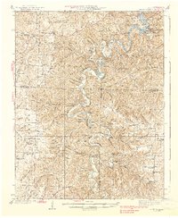
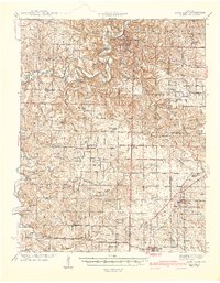
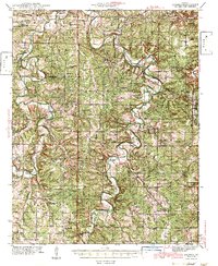
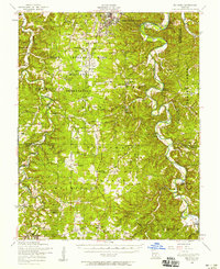
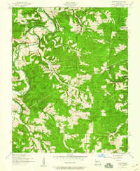
(160)- 1931 Map of Manes
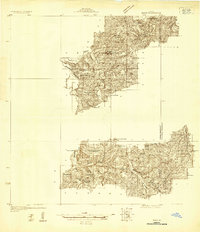 1931 Manes1931 Print · USGSWright and Texas Counties are shown here in the early thirties, a landscape of ridge-top schools and river-valley mills. Researchers can trace rural lineages through local landmarks like Grimes Mill, Post Oak Sch, and Evening Shade Ch.
 - 1933 Map of Stoutland, 1962 Print
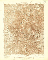
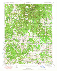
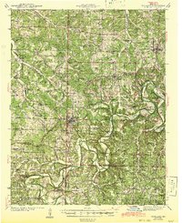
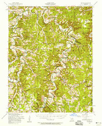
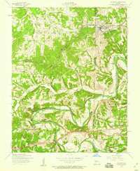
 1933 Stoutland1962 Print · USGSThe Missouri Ozarks during the 1930s are captured here as a landscape of isolated hollows and rail-connected towns. Researchers can trace the St Louis San Francisco railroad line through Stoutland or locate family sites like Bradshaw Cem and Merchant Sch.2 unique versions available
 - 1934 Map of Macks Creek
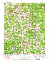
 1934 Macks Creek1934 Print · USGSIn the central Ozarks during the 1930s, the rugged river valleys supported a landscape of isolated homesteads and country schoolhouses. Genealogists can locate family landmarks like Laughlin Cem, Johnston Castle, and the Tunnel Dam along the Niangua River.4 unique versions available
 - 1938 Map of Stoutland
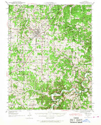
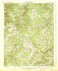 1938 Stoutland1938 Print · USGSThe Missouri Ozarks are captured here during the 1930s, showing a landscape of ridge-top farms and creek-bottom settlements. Researchers can trace the heritage of Camden and Laclede counties through sites like Ozark Fisheries, Darrow Cem, and Stoutland.
 - 1939 Map of Macks Creek
 1939 Macks Creek1939 Print · USGSThe Niangua River valley in the late 1930s reveals a landscape of river crossings and early Ozark tourism. Researchers can trace ancestral locations through numerous rural school sites like Barkley Sch or find landmarks like Hahatonka Castle and Tunnel Dam.2 unique versions available
 - 1939 Map of Long Lane, 1966 Print
 1939 Long Lane1966 Print · USGSDallas and Laclede Counties were defined by the winding Niangua River and the rural rail economy in the late 1930s. Genealogists can find numerous family-named landmarks like Williams Cem and isolated schools such as Blackfoot Sch.
 - 1941 Map of Big Piney
 1941 Big Piney1941 Print · USGSThe Ozarks at the dawn of the war years reveal a landscape of rural schoolhouses and river bends before military expansion. Genealogists can trace family roots through Lone Star Sch, Cook Cem, and the now-transformed settlement of Bloodland.
 - 1941 Map of Manes, 1965 Print
 1941 Manes1965 Print · USGSThe northern Ozarks come to life in this mid-century survey of the Gasconade River valley and the surrounding hills of Laclede and Wright counties. Genealogists can trace family footprints through numerous rural landmarks like Grimes Mill, McBride Cem, and the village of Manes.2 unique versions available
 - 1941 Map of Lebanon, 1968 Print
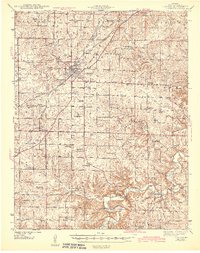
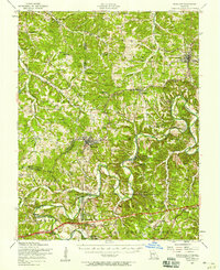
 1941 Lebanon1968 Print · USGSLebanon and the surrounding Laclede County uplands are captured here in the early 1940s, just as the region was defined by Route 66 and a network of one-room schools. Genealogists can locate family landmarks like Atchley Cem and Santiago Cem, or trace vanished rural hubs such as Caffeyville and Orla.
 - 1942 Map of Long Lane
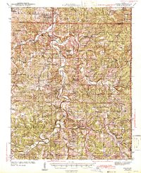
 1942 Long Lane1942 Print · USGSThe Ozark plateau comes alive in the early 1940s, showing a land defined by the winding Niangua River and the rural townships of Wilson and Union. Researchers can trace dozens of country schoolhouses like Lonesome Hill Sch and Loudon Smoke Sch or locate ancestors near Shanks Cem.3 unique versions available
 - 1943 Map of Richland
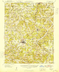
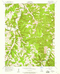
 1943 Richland1943 Print · USGSThe Missouri Ozarks during the early 1940s are documented here, showing the rural communities of Pulaski and Camden counties connected by the rail lines. Genealogists can locate family landmarks like Manes Cem, Buzzard Roost Sch, and Wair Chapel.
 - 1943 Map of Lebanon
 1943 Lebanon1943 Print · USGSLaclede County at the start of the 1940s reveals a landscape where the St Louis San Francisco railway and early aviation at Lebanon Airport met deep-rooted Ozark settlements. Genealogists can trace family footprints across dozens of local landmarks like Roper Cem, Hough Chapel, and the Bear Thicket Sch.2 unique versions available
 - 1943 Map of Big Piney
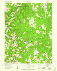
 1943 Big Piney1943 Print · USGSThe Missouri Ozarks are shown here during the early years of the Second World War as federal land expansion reshaped the region. Genealogists and local historians can trace family roots through numerous country schools like Lone Star Sch and churches including St Annie Ch and Dondas Ch.2 unique versions available
 - 1943 Map of Manes
 1943 Manes1943 Print · USGSWright and Laclede counties are shown here in the 1940s as a landscape of river-bottom farms and rural school districts. Researchers can trace family ties through dozens of local landmarks like Latham Mill, Competition, and Indian Grove Sch.3 unique versions available
 - 1943 Map of Drynob
 1943 Drynob1943 Print · USGSThe Ozark plateau of Laclede County is captured here in the early 1940s, just as the nearby military presence began to reshape the landscape. Genealogists and historians can trace numerous rural schools like Stockdale Sch and family cemeteries such as Similin Cem and Nicks Cem.3 unique versions available
 - 1946 Map of Niangua, 1966 Print
 1946 Niangua1966 Print · USGSMid-century Webster County is shown here during a time when rural life centered on the St Louis-San Francisco rail line and local country schools. Genealogists can locate family landmarks such as Bumgardner Ford, Eighty Eight Sch, and Sparkle Brook Cem.
 - 1948 Map of Niangua
 1948 Niangua1948 Print · USGSIn the late 1940s, Webster County was a landscape of small farming communities and river crossings. Trace the old rail line to Marshfield or find rural landmarks like Eighty Eight Sch, Mission Home Ch, and the crossings at Johnston Ford.2 unique versions available
 - 1954 Map of Springfield
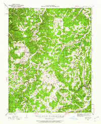
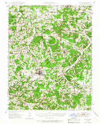
 1954 Springfield1954 Print · USGSThe Missouri Ozarks are captured here during the post-war era, showing the expansion of Springfield and the surrounding river valleys. Genealogists and historians can trace local landmarks like Mount Comfort Cemetery and the Fort Leonard Wood military grounds.6 unique versions available
 - 1954 Map of Drynob, 1958 Print
 1954 Drynob1958 Print · USGSThe rural hills of Laclede County are captured here in the mid-fifties as many one-room schoolhouses were beginning to close. You can trace early Ozark river crossings at Hall Ford Bridge or locate family sites like the Stewart Cemetery and Mt Pleasant Church.2 unique versions available
 - 1954 Map of Big Piney, 1958 Print
 1954 Big Piney1958 Print · USGSThe mid-century Ozark highlands are captured here during a period of massive federal transition, as military expansion met traditional rural life. Researchers can trace family names and vanished sites through the Bloodland Cemetery, the Roby Lookout Tower, and several abandoned schoolhouses like Morman Valley School.3 unique versions available
 - 1954 Map of Richland, 1958 Print
 1954 Richland1958 Print · USGSThe Gasconade River valley and the St. Louis-San Francisco rail line define this mid-Missouri landscape during the mid-fifties. Genealogists can trace family names through dozens of rural sites, including Thornsberry Cemetery, Makarie Bridge, and several early schoolhouses.2 unique versions available
 - 1954 Map of Drew, 1959 Print
 1954 Drew1959 Print · USGSLaclede County's river valleys and rural settlements are captured in the mid-1950s, showing a landscape of small schools and family cemeteries. Trace ancestral sites at Heard Cemetery, visit Meeks Store, or locate vanished schoolhouses like Barnett School.2 unique versions available
 - 1954 Map of Roby, 1959 Print
 1954 Roby1959 Print · USGSThe Missouri Ozarks during the mid-1950s reveals a landscape of dense national forest and expanding military grounds. Genealogists can trace family footprints at Macedonia Cemetery or locate the former sites of rural education at Bloodland School and Blackjack School.3 unique versions available
 - 1954 Map of Winnipeg, 1959 Print
 1954 Winnipeg1959 Print · USGSLaclede and Texas Counties are documented here in the mid-1950s, showing the rural communities and forest lands along the Gasconade River. Researchers can locate family landmarks like the Winnipeg Cem and multiple local schools, including several noted as abandoned like the Morehouse School.2 unique versions available
 - 1954 Map of Richland, 1959 Print
 1954 Richland1959 Print · USGSRichland sits at a tri-county junction during the mid-fifties, where the railroad and the Gasconade River shaped local life. Genealogists can locate family landmarks like Manes Cemetery and Independence Church, or trace the legacy of rural education at Wait School (Aban'd).2 unique versions available
Showing maps 1-25 of 160
Top cities of Laclede County
- Lebanon historical maps
- Conway historical maps
- Phillipsburg historical maps
- Evergreen historical maps
- Caffeyville historical maps
Frequently asked questions
- What are the different types of historical maps available for Laclede County?
- What is the oldest map of Laclede County?
- Where can I purchase historical maps of Laclede County for my home or office?
- Where can I download high-res historical maps of Laclede County?
- Are there historical topographic maps available for Laclede County?
- Is there historical aerial imagery available for Laclede County?
- Where are historical maps of Laclede County sourced from?