1980s Maps of McDonald County, Missouri
Explore 9 historic maps of McDonald County from the 1980s. These maps offer a rare glimpse into what life looked like during the 1980s — showing old roads, neighborhoods, homes, and landmarks that have changed or disappeared over time.
Whether you're researching your family's past, planning a metal detecting trip, or studying how McDonald County's landscape evolved across the 1980s, these high-resolution maps are a powerful tool for exploring the history of this region.
- Focus on a specific era: All maps on this page are from the 1980s, giving you a focused view of this time period.
- See what’s changed: Compare century-old streets, trails, and buildings to today's modern landscape using overlays and satellite layers.
- Research with precision: Use these maps for genealogy, historical research, land use analysis, or educational projects.
- View, download, or print: Maps are fully viewable online in high resolution, and can be downloaded or printed for your own records.
Start exploring McDonald County's history through authentic maps from the 1980s. This is your window into the past.
McDonald County, MO maps
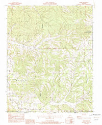
(9)- 1982 Map of McNatt
 1982 McNatt1982 Print · USGSThe Missouri Ozarks are captured here in the early 1980s, revealing a landscape of deep hollows and rural outposts. Researchers can trace family-named landmarks and old water sources like McNatt, Coal Mine Hol, and the banks of Big Sugar Creek.
 - 1982 Map of Rocky Comfort
 1982 Rocky Comfort1982 Print · USGSThe northern Ozarks in the early eighties are mapped here in detail, centered on the Newton and McDonald County border. Researchers can trace family-named hollows and sites like Rocky Comfort, Ridgley, and Christian Spring.
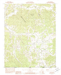
 - 1982 Map of Noel
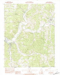 1982 Noel1982 Print · USGSThe Elk River valley and the southern reaches of McDonald County are shown in the early eighties as a network of river towns and hollows. Trace the paths between Noel, Pineville, and Elk Springs or locate rural landmarks like Deer Lick Spring and Bosky-Dell.
 - 1982 Map of Anderson
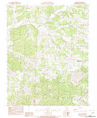
 1982 Anderson1982 Print · USGSThe area surrounding Anderson and Goodman in the early 1980s reveals a terrain defined by deep hollows and creek junctions. Genealogists and historians can trace the geography of Splitlog, the path of Patterson Creek, and family-named landmarks like Tatum Hill.
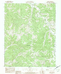
 - 1982 Map of Jacket
 1982 Jacket1982 Print · USGSThe Missouri-Arkansas border region in the early eighties was a landscape of deep hollows and isolated Ozark settlements. Local historians can trace the road networks connecting Jacket, Trent, and Cove or locate family sites near Big Sugar Creek and Eggleston Mountain.
 - 1982 Map of Jane
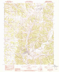
 1982 Jane1982 Print · USGSThe Ozark highlands of southern Missouri come into focus during the early eighties, showing the rural character of Jane and the surrounding hollows. Researchers can trace land details from Big Sugar Creek to family-named landmarks like Whittaker Spring and Bobs Knob.
 - 1982 Map of Powell
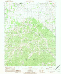
 1982 Powell1982 Print · USGSMcDonald County, Missouri, at the start of the 1980s reveals a landscape of high ridges and deep hollows along the Arkansas border. Researchers can trace the winding course of Big Sugar Creek or explore family-named landmarks like the Whittenburg Hills and Bentonville Ridge.
 - 1982 Map of Bethpage
 1982 Bethpage1982 Print · USGSIn the early 1980s, the hollows and ridges of McDonald County supported a network of rural settlements and named family landmarks. Researchers can trace the landscape from Cyclone to Bethlehem, identifying sites like Stillhouse Hollow and Bee Bluff.
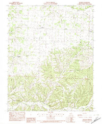
 - 1986 Map of Neosho
 1986 Neosho1986 Print · USGSThe tri-state border region comes alive in the mid-eighties as a landscape of mining heritage and river valleys. Researchers can trace the rail lines of the Kansas City Southern Ry and locate rural landmarks like Gibson Cem and Peoria.2 unique versions available
End of results
Showing maps 1-9 of 9
Top cities of McDonald County
- Anderson historical maps
- Noel historical maps
- Goodman historical maps
- Southwest City historical maps
- Pineville historical maps
- Lanagan historical maps
See more
Frequently asked questions
- What are the different types of historical maps available for McDonald County?
- What is the oldest map of McDonald County?
- Where can I purchase historical maps of McDonald County for my home or office?
- Where can I download high-res historical maps of McDonald County?
- Are there historical topographic maps available for McDonald County?
- Is there historical aerial imagery available for McDonald County?
- Where are historical maps of McDonald County sourced from?