2020s Maps of Osage County, Missouri
Explore 17 historic maps of Osage County from the 2020s. These maps offer a rare glimpse into what life looked like during the 2020s — showing old roads, neighborhoods, homes, and landmarks that have changed or disappeared over time.
Whether you're researching your family's past, planning a metal detecting trip, or studying how Osage County's landscape evolved across the 2020s, these high-resolution maps are a powerful tool for exploring the history of this region.
- Focus on a specific era: All maps on this page are from the 2020s, giving you a focused view of this time period.
- See what’s changed: Compare century-old streets, trails, and buildings to today's modern landscape using overlays and satellite layers.
- Research with precision: Use these maps for genealogy, historical research, land use analysis, or educational projects.
- View, download, or print: Maps are fully viewable online in high resolution, and can be downloaded or printed for your own records.
Start exploring Osage County's history through authentic maps from the 2020s. This is your window into the past.
Osage County, MO maps
(17)- 2021 Map of Loose Creek, 2021 Print
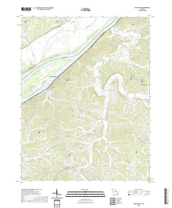 2021 Loose Creek2021 Print · USGSOsage County's river-driven landscape is captured here in the early twenty-first century, centered on the meeting of the Missouri and Osage rivers. Genealogists can trace family roots through numerous sites like Bonnots Mill, Frankenstein, and the Immaculate Conception Cem.
 - 2021 Map of Freeburg, 2021 Print
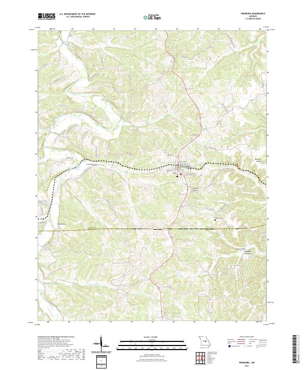 2021 Freeburg2021 Print · USGSOsage and Maries counties appear in this recent survey of the Missouri interior, centered on the community of Freeburg. Local history researchers can trace family landmarks and burial sites like Holy Family Cem or follow the winding course of the Maries River.
 - 2021 Map of Summerfield, 2021 Print
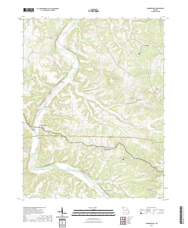 2021 Summerfield2021 Print · USGSOsage and Maries counties appear as a network of river bluffs and rural settlements in this 2021 survey. Researchers can locate family heritage sites like Koenig Cem and Branson Cem or trace the winding path of the Gasconade River past Fish Hollow Bluff.
 - 2021 Map of Morrison, 2021 Print
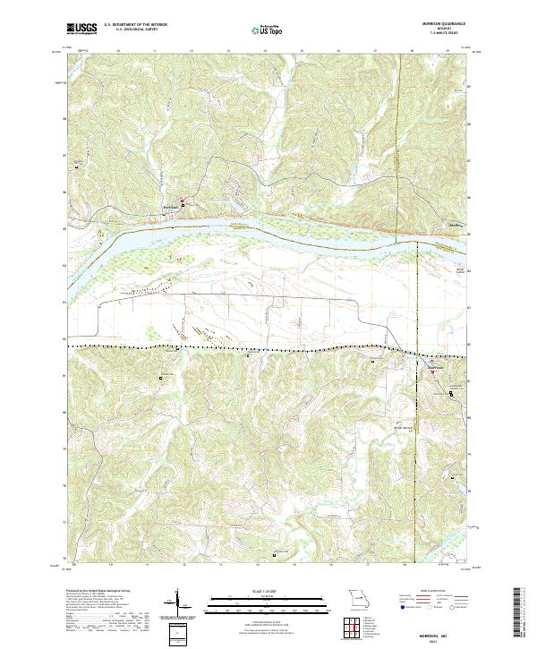 2021 Morrison2021 Print · USGSMorrison and the Missouri River bottoms appear in this modern survey of the Gasconade and Callaway county borders. Genealogists can trace numerous local burial sites like Assumption Catholic Cem and Ferguson Cem near the banks of Baileys Cr.
 - 2021 Map of Cooper Hill, 2021 Print
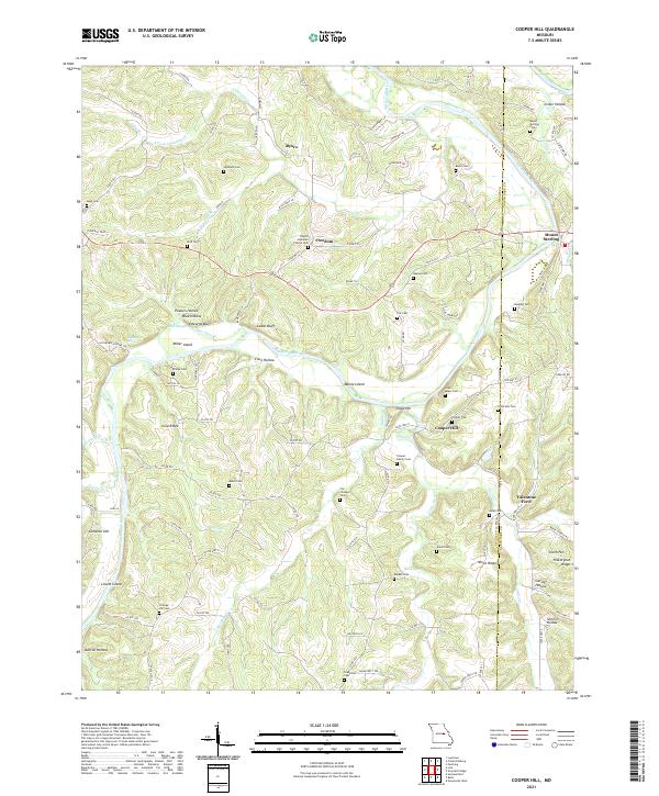 2021 Cooper Hill2021 Print · USGSOsage and Gasconade counties are defined by the winding river valley and rugged ridge systems in this recent 2021 study. Genealogists and local historians can trace family roots through numerous remote burial grounds like Haynes Cem and Mount Sterling Cem.
 - 2021 Map of Belle, 2021 Print
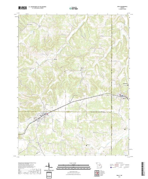 2021 Belle2021 Print · USGSThe tri-county borderlands of Maries, Osage, and Gasconade counties are documented here in the early twenty-first century. Genealogists and local historians can trace family roots through numerous remote burial grounds including Backues Cem, Liberty Cem, and Crider Cem.
 - 2021 Map of Luystown, 2021 Print
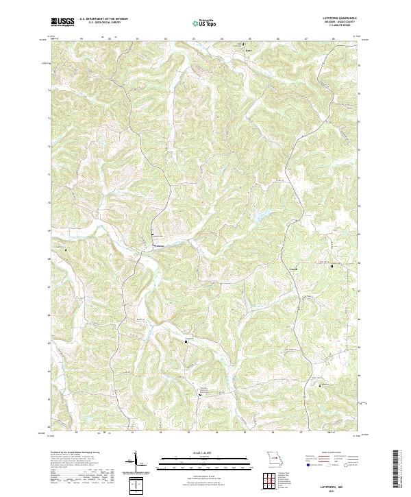 2021 Luystown2021 Print · USGSOsage County's rural heartland is meticulously documented here as it appeared in the early 2020s. Researchers can trace family history through numerous burial sites like Luystown Cem and Agee Cem or explore the creek valleys of Ben Branch and Indian Cr.
 - 2021 Map of Westphalia East, 2021 Print
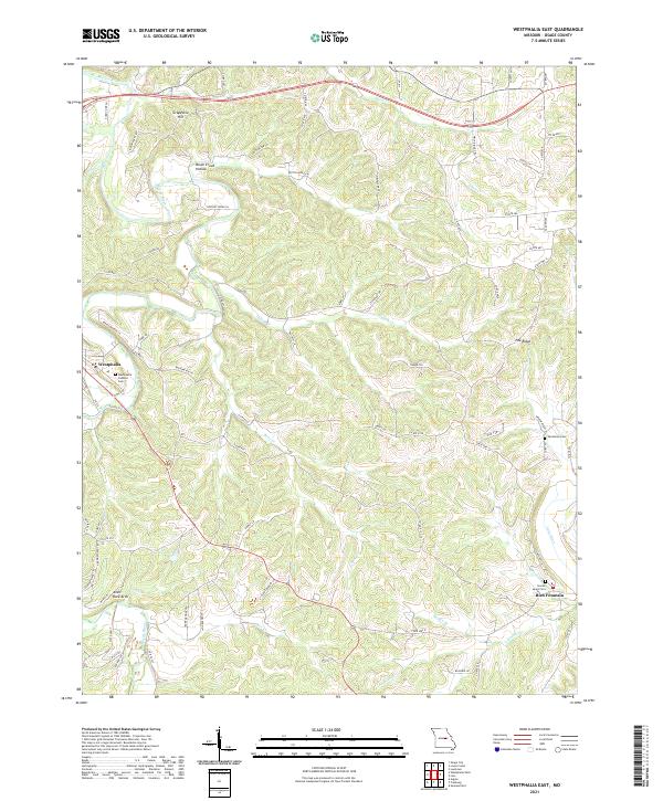 2021 Westphalia East2021 Print · USGSOsage County comes into focus in the early 2020s, showing a Missouri landscape defined by the winding Maries River and historic rural communities. Researchers can trace family roots at Westphalia Catholic Cem or locate natural landmarks like Anvil Rock Arch.
 - 2021 Map of Fredericksburg, 2021 Print
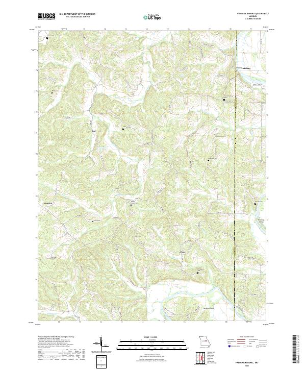 2021 Fredericksburg2021 Print · USGSThe Osage and Gasconade county borderlands are defined by the winding Gasconade River in this modern survey. Genealogists can trace family heritage through local burial sites like Hancock Cem and Baileys Creek Cem or the rural settlements of Fredericksburg and Aud.
 - 2021 Map of Mokane East, 2021 Print
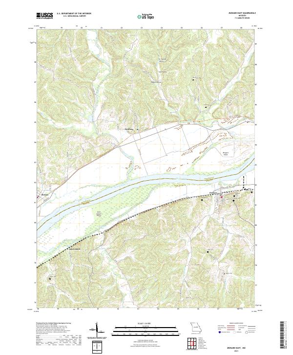 2021 Mokane East2021 Print · USGSMissouri River communities and island geography are documented here just after the turn of the decade. Genealogists can locate family sites like Riverview Cem and Bode Cem or trace the riverfronts of Chamois and Saint Aubert.
 - 2021 Map of Mokane West, 2021 Print
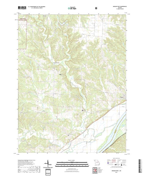 2021 Mokane West2021 Print · USGSCallaway County's rural landscape is captured here in the early twenty-first century, bounded by the river and national forest. Researchers can locate family sites near Mount Tabor Cem or trace the early paths around Browns Ford and Mokane.
 - 2021 Map of Argyle, 2021 Print
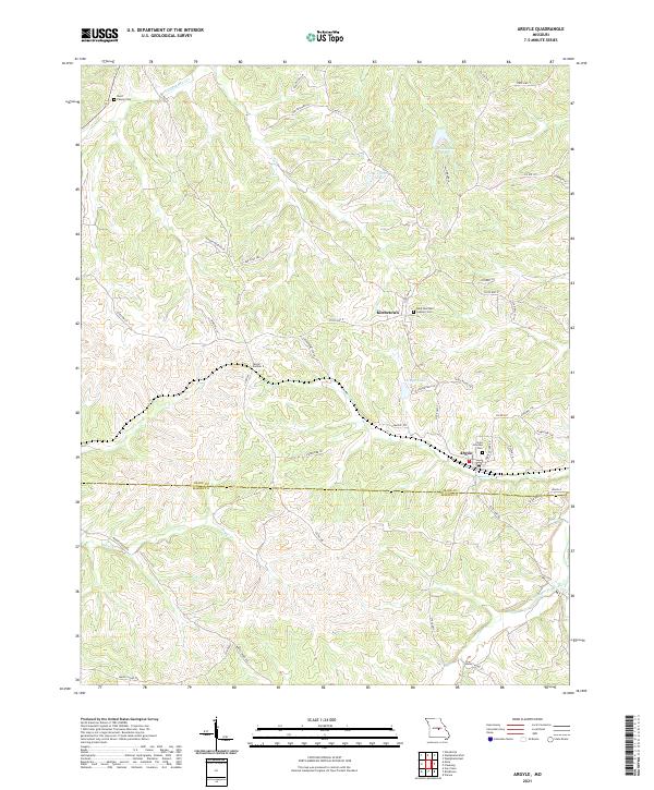 2021 Argyle2021 Print · USGSOsage and Maries counties meet in this Missouri landscape at the start of the 2020s, centered on the communities of Argyle and Koeltztown. Genealogists and historians can trace local family landmarks and infrastructure like the Burd Family Cem and Tunnel Number 2.
 - 2021 Map of Meta, 2021 Print
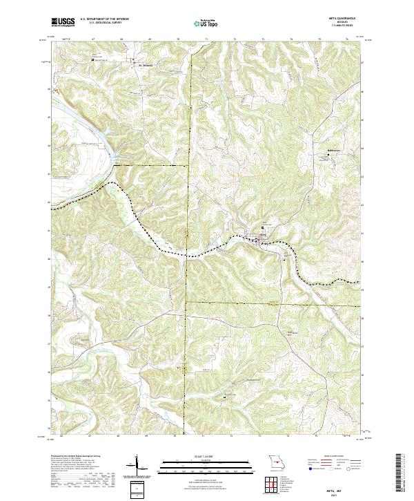 2021 Meta2021 Print · USGSOsage and Miller counties are shown here in the early 2020s, a landscape defined by the winding Osage River and rural ridge settlements. Genealogists can locate family-named sites like Thompson Cem or trace old routes such as Scheuer Ferry Rd and Old St Thomas Rd.
 - 2021 Map of Osage City, 2021 Print
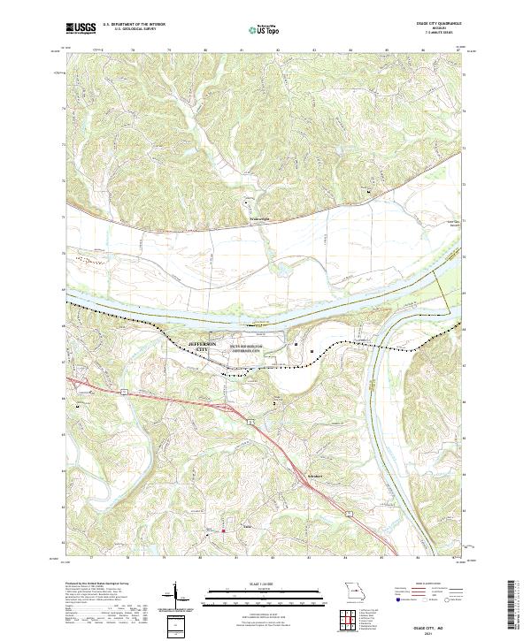 2021 Osage City2021 Print · USGSCentral Missouri's river heritage is on full display in the early 2020s where the Missouri River and Osage River converge near the state capital. Local researchers can trace family lands near Taos and Schubert or locate historic burial sites like Osage City Cem and Thorp Cem.
 - 2021 Map of Westphalia West, 2021 Print
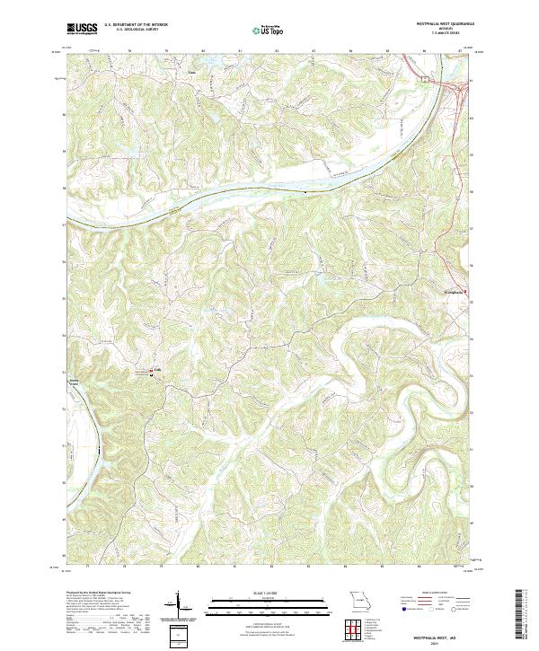 2021 Westphalia West2021 Print · USGSOsage and Cole counties are captured here in the early 2020s, centered on the river-bluff settlements and rural crossroads south of the state capital. Researchers can trace family history at Saint Anthony of Padua Cem and locate landmarks in Westphalia, Folk, and Taos.
 - 2021 Map of Wardsville, 2021 Print
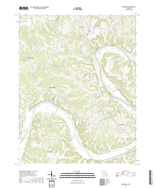 2021 Wardsville2021 Print · USGSCole County’s river-carved landscape is shown in detail during the early 2020s, centered on the winding Osage River. Local historians can trace family connections at Saint Stanislaus Cem and explore the rural settlements of Wardsville and St. Thomas.
 - 2021 Map of Linn, 2021 Print
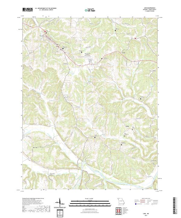 2021 Linn2021 Print · USGSOsage County in the 2020s remains centered on the courthouse town of Linn, where historic family cemeteries dot the creek-fed ridges. Genealogists and researchers can trace local roots at Saint George Cem, Judge Branson Cem, and the rural settlement at Judge.
End of results
Showing maps 1-17 of 17
Top cities of Osage County
- Linn historical maps
- Chamois historical maps
- Freeburg historical maps
- Westphalia historical maps
- Meta historical maps
Frequently asked questions
- What are the different types of historical maps available for Osage County?
- What is the oldest map of Osage County?
- Where can I purchase historical maps of Osage County for my home or office?
- Where can I download high-res historical maps of Osage County?
- Are there historical topographic maps available for Osage County?
- Is there historical aerial imagery available for Osage County?
- Where are historical maps of Osage County sourced from?