1930s Maps of Ozark County, Missouri
Explore 6 historic maps of Ozark County from the 1930s. These maps offer a rare glimpse into what life looked like during the 1930s — showing old roads, neighborhoods, homes, and landmarks that have changed or disappeared over time.
Whether you're researching your family's past, planning a metal detecting trip, or studying how Ozark County's landscape evolved across the 1930s, these high-resolution maps are a powerful tool for exploring the history of this region.
- Focus on a specific era: All maps on this page are from the 1930s, giving you a focused view of this time period.
- See what’s changed: Compare century-old streets, trails, and buildings to today's modern landscape using overlays and satellite layers.
- Research with precision: Use these maps for genealogy, historical research, land use analysis, or educational projects.
- View, download, or print: Maps are fully viewable online in high resolution, and can be downloaded or printed for your own records.
Start exploring Ozark County's history through authentic maps from the 1930s. This is your window into the past.
Ozark County, MO maps
(6)- 1934 Map of Gainesville
 1934 Gainesville1934 Print · USGSOzark County in the mid-1930s is a landscape of river-dependent settlements and ridges. Genealogists can trace family roots through sites like Price Cem, Smith Chapel, and numerous river crossings including White Ferry and Osburn Ford.2 unique versions available
 - 1936 Map of Thornfield
 1936 Thornfield1936 Print · USGSOzark County in the mid-1930s is a landscape of high ridges and deep river hollows where rural life centered on local schoolhouses and isolated post offices. Researchers can trace family history through sites like Franklin Grove Cem, Thornfield, and Igo School.
 - 1936 Map of Ava
 1936 Ava1936 Print · USGSIn the mid-1930s, this area of the Ozarks was a tapestry of small school districts and rural congregations. Genealogists can trace family footprints across Old Toledo, find remote burial sites like Mt Lebanon Cem, or locate landmarks such as Happy Home Ch.
 - 1937 Map of Buckhart
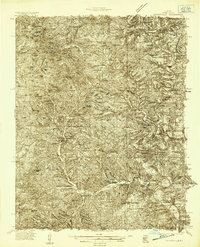
 1937 Buckhart1937 Print · USGSThe Ozark ridges of Douglas and Ozark counties are shown here in the late 1930s, featuring a landscape of isolated farmsteads and rural schoolhouses. Researchers can locate family roots at Rockbridge, trace the waters of Bryant Creek, or find ancestral burial sites like Yates Cem.
 - 1937 Map of Bradleyville
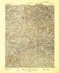
 1937 Bradleyville1937 Print · USGSDouglas County in the late 1930s was a landscape of remote hollows and high ridges connected by a network of one-room schools and small post offices. Trace family roots at Huffman Cem or locate forgotten community hubs like Old Merritt and Lone Star Sch.
 - 1939 Map of Topaz
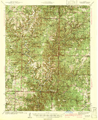 1939 Topaz1939 Print · USGSThe North Fork River valley in Douglas and Ozark counties is captured here in the late 1930s, showing a landscape defined by riverside mills and rural schools. Genealogists can trace family landmarks across Richville, Siloam Springs, and Hammonds Mill, or find remote sites like Mitts Cem and Little Zion Sch.3 unique versions available
End of results
Showing maps 1-6 of 6
Top cities of Ozark County
Frequently asked questions
- What are the different types of historical maps available for Ozark County?
- What is the oldest map of Ozark County?
- Where can I purchase historical maps of Ozark County for my home or office?
- Where can I download high-res historical maps of Ozark County?
- Are there historical topographic maps available for Ozark County?
- Is there historical aerial imagery available for Ozark County?
- Where are historical maps of Ozark County sourced from?