1970s Maps of Ozark County, Missouri
Explore 12 historic maps of Ozark County from the 1970s. These maps offer a rare glimpse into what life looked like during the 1970s — showing old roads, neighborhoods, homes, and landmarks that have changed or disappeared over time.
Whether you're researching your family's past, planning a metal detecting trip, or studying how Ozark County's landscape evolved across the 1970s, these high-resolution maps are a powerful tool for exploring the history of this region.
- Focus on a specific era: All maps on this page are from the 1970s, giving you a focused view of this time period.
- See what’s changed: Compare century-old streets, trails, and buildings to today's modern landscape using overlays and satellite layers.
- Research with precision: Use these maps for genealogy, historical research, land use analysis, or educational projects.
- View, download, or print: Maps are fully viewable online in high resolution, and can be downloaded or printed for your own records.
Start exploring Ozark County's history through authentic maps from the 1970s. This is your window into the past.
Ozark County, MO maps
(12)- 1972 Map of Bull Shoals, 1973 Print
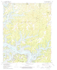 1972 Bull Shoals1973 Print · USGSThe Ozark borderlands in the early 1970s reveal a landscape shaped by the White River and the growth of lakeside communities. Researchers can trace local heritage through landmarks like Newton Flat Cemetery, Oakland School, and the Bull Shoals Caverns.3 unique versions available
 - 1972 Map of Cotter NW, 1973 Print
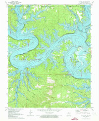 1972 Cotter NW1973 Print · USGSThe Ozark borderlands in the early seventies reveal a landscape transformed by the waters of Bull Shoals Lake. Researchers can trace old resource-heavy landmarks like Stave Mill Hollow and Coal Pit Hollow alongside the settlements of Linley and Midway.2 unique versions available
 - 1972 Map of Peel, 1973 Print
 1972 Peel1973 Print · USGSThe Marion County shoreline and the Arkansas-Missouri state line are captured here in the early seventies as the reservoir era reshaped the White River valley. Trace historical family sites and local landmarks like Peel Ferry, Keesee Cem, and the old Lead Mine.2 unique versions available
 - 1973 Map of Rockbridge, 1975 Print
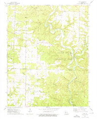
 1973 Rockbridge1975 Print · USGSCrossing the Douglas and Ozark county line in the early 1970s, this area shows a landscape of deep hollows and active spring systems. Local historians can trace the foundations of Rockbridge, locate the Assumption Abbey, or find family landmarks like Walker Knob and Yates Cem.
 - 1973 Map of Gentryville, 1975 Print
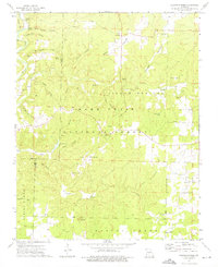
 1973 Gentryville1975 Print · USGSThe Douglas and Ozark County borderlands come into focus in the 1970s, showing a landscape defined by winding hollows and small rural congregations. Researchers can locate historic family burial grounds like Eaton Cem and trace the roads connecting Gentryville to Blackjack Ch.
 - 1973 Map of Dora, 1976 Print
 1973 Dora1976 Print · USGSDora and the North Fork White River corridor appear here in the early seventies, spanning the border of Douglas and Ozark counties. Researchers can trace rural cemeteries like Fish and Cudworth Cem, or locate landmarks like Twin Bridges and Hammonds Mill Camp.3 unique versions available
 - 1973 Map of Siloam Springs, 1976 Print
 1973 Siloam Springs1976 Print · USGSThe Missouri Ozarks are captured here in the early 1970s, showing the intersection of Douglas and Howell counties within the Mark Twain National Forest. Genealogists and local historians can trace family sites like Mitts Cem and Thornton Cem, or locate landmarks such as the Siloam Lookout Tower and Tabor Cave.
 - 1979 Map of Cotter NW, 1981 Print
 1979 Cotter NW1981 Print · USGSBull Shoals Lake winds through the Ozark landscape in this late 1970s aerial survey of northern Arkansas. Researchers can trace the sprawling shoreline and local landmarks like the settlement of Midway and the vast reaches of Bull Shoals Lake.
 - 1979 Map of Clarkridge, 1981 Print
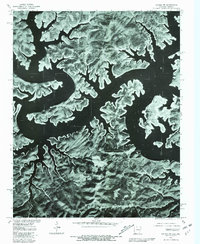
 1979 Clarkridge1981 Print · USGSBaxter County at the end of the seventies is seen through detailed aerial imagery along the Missouri border. Researchers can trace the winding fingers of Norfork Lake and the rural roads connecting the community of CLARKRIDGE.
 - 1979 Map of Midway, 1981 Print
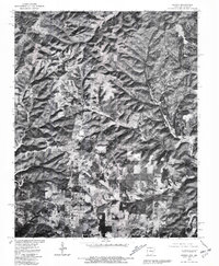 1979 Midway1981 Print · USGSThe Baxter County highlands of the late seventies are revealed in this aerial orthophotograph. Researchers can trace the homesteads and ridge roads around Midway, Arkawana, and the community of Three Brothers near the Missouri line.
 - 1979 Map of Bull Shoals, 1981 Print
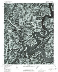
 1979 Bull Shoals1981 Print · USGSNorthern Arkansas at the close of the 1970s is captured in this detailed aerial study of the Ozark shoreline. Researchers can trace the development of lakeside communities like Bull Shoals, Lakeview, and Oakland against the backdrop of Bull Shoals Lake.
 - 1979 Map of Gamaliel, 1981 Print
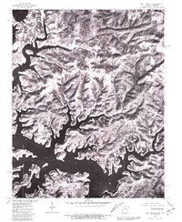
 1979 Gamaliel1981 Print · USGSBaxter County at the turn of the eighties shows a landscape defined by the winding waters of the Ozarks. Local researchers can trace land use patterns around Gamaliel and Cumi, or follow the shoreline of Norfork Lake.
End of results
Showing maps 1-12 of 12
Top cities of Ozark County
Frequently asked questions
- What are the different types of historical maps available for Ozark County?
- What is the oldest map of Ozark County?
- Where can I purchase historical maps of Ozark County for my home or office?
- Where can I download high-res historical maps of Ozark County?
- Are there historical topographic maps available for Ozark County?
- Is there historical aerial imagery available for Ozark County?
- Where are historical maps of Ozark County sourced from?