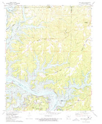
1972 Map of Bull Shoals
USGS Topo · Published 1973About this map
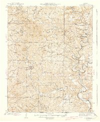
Bull Shoals Lake and the White River dominate this Ozark Plateau landscape, marking the winding border between Arkansas and Missouri. The map captures the region's mid-century character, where recreation and local community life overlap. Public use areas like Oakland Public Use Area and various campgrounds line the intricate shoreline, while the higher ground of Promise Land Ridge and Long Mountain provides a backdrop for inland settlements. Small local landmarks like the Oakland School, Newton Flat Cemetery, and the Lookout Tower on Long Mountain offer specific points of interest for genealogists and local historians. This era shows the developed town of Bull Shoals south of the dam, complete with Bull Shoals Caverns, contrasted against quieter spots like Graves and Hilltop Mission further north near the state line.
Find a feature on this map
47 named features on this map. Tap any name to fly to it.
Don’t see what you’re looking for? This feature index may not catch every label — zoom into the map to look around manually.
Map Details
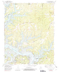
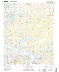
Editions of this 1972 Bull Shoals Map
3 editions found
Other maps of this area

1890 · Mountain Home
USGS Topo · 1:125,000

1891 · Mountain Home
USGS Topo · 1:125,000

1893 · Yellville
USGS Topo · 1:125,000

1894 · Mountain Home
USGS Topo · 1:125,000

1903 · Yellville
USGS Topo · 1:125,000

1905 · Yellville
USGS Topo · 1:125,000

1929 · Yellville
USGS Topo · 1:125,000
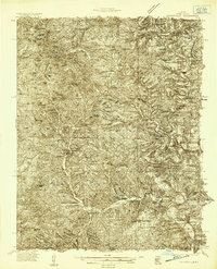
1934 · Gainesville
USGS Topo · 1:48,000

1936 · Thornfield
USGS Topo · 1:48,000
1940 · Gainesville
USGS Topo · 1:62,500