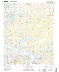
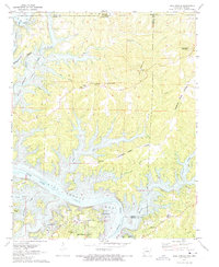
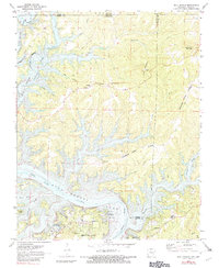
1972 Map of Bull Shoals
USGS Topo · Published 1982About this map
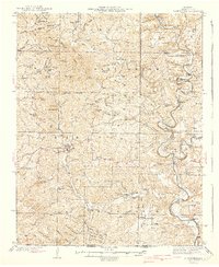
Bull Shoals Lake dominates this north-central Arkansas landscape, its winding shoreline and numerous coves like Hollingsworth Cove carved into the limestone hills of Marion and Baxter Counties. The 1972 topography illustrates the complex relationship between the managed reservoir and the original path of the White River below the dam. Inland, rural life centers on small communities like Oakland, where the Oakland Sch and a local Community Hall served as social anchors. Along the high ground of Promise Land Ridge, the presence of the Promise Land Ch and family burial sites like Newton Flat Cem provide critical data for those tracing local lineages. Further south, the map details the burgeoning recreation and tourism around Lakeview and the Bull Shoals Caverns, showing the region's transition into a destination for Ozark visitors.
Find a feature on this map
35 named features on this map. Tap any name to fly to it.
Don’t see what you’re looking for? This feature index may not catch every label — zoom into the map to look around manually.
Map Details
Editions of this 1972 Bull Shoals Map
3 editions found
Other maps of this area

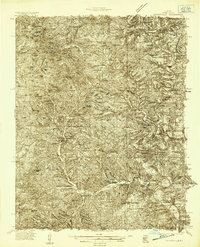
1890 · Mountain Home
USGS Topo · 1:125,000

1891 · Mountain Home
USGS Topo · 1:125,000

1893 · Yellville
USGS Topo · 1:125,000

1894 · Mountain Home
USGS Topo · 1:125,000

1903 · Yellville
USGS Topo · 1:125,000

1905 · Yellville
USGS Topo · 1:125,000

1929 · Yellville
USGS Topo · 1:125,000
1934 · Gainesville
USGS Topo · 1:48,000

1936 · Thornfield
USGS Topo · 1:48,000
1940 · Gainesville
USGS Topo · 1:62,500