1960s Maps of Pettis County, Missouri
Explore 5 historic maps of Pettis County from the 1960s. These maps offer a rare glimpse into what life looked like during the 1960s — showing old roads, neighborhoods, homes, and landmarks that have changed or disappeared over time.
Whether you're researching your family's past, planning a metal detecting trip, or studying how Pettis County's landscape evolved across the 1960s, these high-resolution maps are a powerful tool for exploring the history of this region.
- Focus on a specific era: All maps on this page are from the 1960s, giving you a focused view of this time period.
- See what’s changed: Compare century-old streets, trails, and buildings to today's modern landscape using overlays and satellite layers.
- Research with precision: Use these maps for genealogy, historical research, land use analysis, or educational projects.
- View, download, or print: Maps are fully viewable online in high resolution, and can be downloaded or printed for your own records.
Start exploring Pettis County's history through authentic maps from the 1960s. This is your window into the past.
Pettis County, MO maps
(5)- 1960 Map of Otterville West, 1979 Print
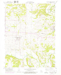 1960 Otterville West1979 Print · USGSWestern Pettis County at the start of the 1960s shows a landscape of small Missouri towns and established farmsteads along the Missouri Pacific railroad. Researchers can trace local heritage at Smithton Cem, Providence Ch, and the outlying Quarries.
 - 1961 Map of Pyrmont, 1962 Print
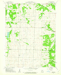
 1961 Pyrmont1962 Print · USGSThe Pettis, Benton, and Morgan county lines meet in this rural Missouri landscape during the early sixties. Genealogists can trace family footprints at St Paul Cem, Lake Creek Ch, and Holy Cross Cem, or locate the Fish Hatchery.
 - 1961 Map of Otterville West, 1962 Print
 1961 Otterville West1962 Print · USGSSettled farmland and rail-side towns in Pettis and Cooper counties are captured here just before the mid-century. Genealogists and local researchers can trace the precise layout of Smithton, locate rural landmarks like Smithton Cemetery, and follow the Missouri Pacific rail line.
 - 1961 Map of Bahner, 1962 Print
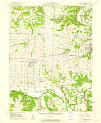
 1961 Bahner1962 Print · USGSPettis and Benton Counties are captured in the early sixties, showing a landscape of family-named schools and quiet crossroads. Researchers can trace rural life through the Old Railroad Grade and local landmarks like Lone Star Cem and Prairie Grove Sch.2 unique versions available
 - 1962 Map of Knob Noster, 1963 Print
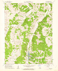
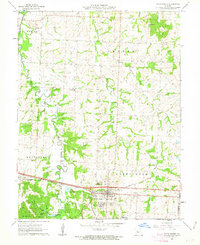 1962 Knob Noster1963 Print · USGSMid-century Johnson County comes into focus through this survey of the railroad town and its military neighbor. Genealogists and historians can trace family plots at Wampler Cem and Lee Cem or locate rural landmarks like Valley City and the Dunkard Ch.3 unique versions available
End of results
Showing maps 1-5 of 5
Top cities of Pettis County
- Sedalia historical maps
- La Monte historical maps
- Smithton historical maps
- Green Ridge historical maps
- Houstonia historical maps
- Hughesville historical maps
Frequently asked questions
- What are the different types of historical maps available for Pettis County?
- What is the oldest map of Pettis County?
- Where can I purchase historical maps of Pettis County for my home or office?
- Where can I download high-res historical maps of Pettis County?
- Are there historical topographic maps available for Pettis County?
- Is there historical aerial imagery available for Pettis County?
- Where are historical maps of Pettis County sourced from?