Old Maps of Duke, Missouri for Hiking & Exploration
Hike through history with 14 historic maps of Duke. Explore old trails, ghost towns, and forgotten backroads — perfect for outdoor adventurers and local explorers.
- Rediscover forgotten places: Map out old mining camps, roads, and footpaths that no longer exist on modern maps.
- Layer with modern tools: Combine with LiDAR or satellite views to plan hikes through historical terrain.
- Made for exploration: Popular among hikers, overlanders, and local history lovers.
Use these maps to find adventure and explore the hidden past of Duke.
Duke, MO maps
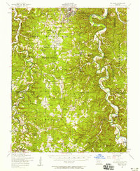
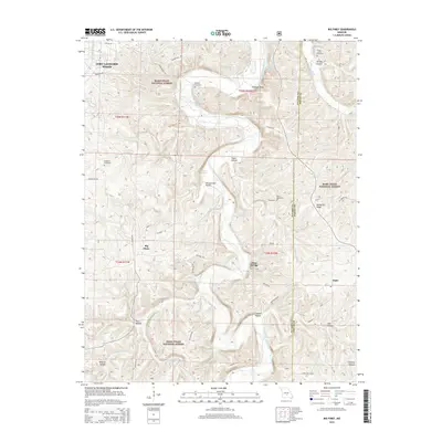
(14)- 1941 Map of Big Piney
 1941 Big Piney1941 Print · USGSThe Ozarks at the dawn of the war years reveal a landscape of rural schoolhouses and river bends before military expansion. Genealogists can trace family roots through Lone Star Sch, Cook Cem, and the now-transformed settlement of Bloodland.
 - 1943 Map of Big Piney
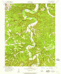
 1943 Big Piney1943 Print · USGSThe Missouri Ozarks are shown here during the early years of the Second World War as federal land expansion reshaped the region. Genealogists and local historians can trace family roots through numerous country schools like Lone Star Sch and churches including St Annie Ch and Dondas Ch.2 unique versions available
 - 1954 Map of Springfield
 1954 Springfield1954 Print · USGSThe Missouri Ozarks are captured here during the post-war era, showing the expansion of Springfield and the surrounding river valleys. Genealogists and historians can trace local landmarks like Mount Comfort Cemetery and the Fort Leonard Wood military grounds.6 unique versions available
 - 1954 Map of Big Piney, 1958 Print
 1954 Big Piney1958 Print · USGSThe mid-century Ozark highlands are captured here during a period of massive federal transition, as military expansion met traditional rural life. Researchers can trace family names and vanished sites through the Bloodland Cemetery, the Roby Lookout Tower, and several abandoned schoolhouses like Morman Valley School.3 unique versions available
 - 1954 Map of Big Piney, 1959 Print
 1954 Big Piney1959 Print · USGSPulaski County at the edge of the Mark Twain National Forest comes into sharp focus during the mid-fifties. Genealogists and historians can trace old homesteads and landmarks like Hopewell Church, the Democrat School, and the winding Big Piney River.6 unique versions available
 - 1958 Map of Springfield
 1958 Springfield1958 Print · USGSThe Missouri Ozarks are captured during the mid-century era of growth, centered on the bustling hub of Springfield. Genealogists and historians can trace family roots through numerous landmarks like Ebenezer Church, Stockton Cem, and the various county courthouses.
 - 1959 Map of Springfield
 1959 Springfield1959 Print · USGSThe Missouri Ozarks are captured here during a decade of postwar growth and increasing highway connectivity. Researchers can trace the legacy of the St Louis-San Francisco RR and locate early sites in Springfield, Lebanon, and Mountain Grove.
 - 1976 Map of Big Piney, 1980 Print
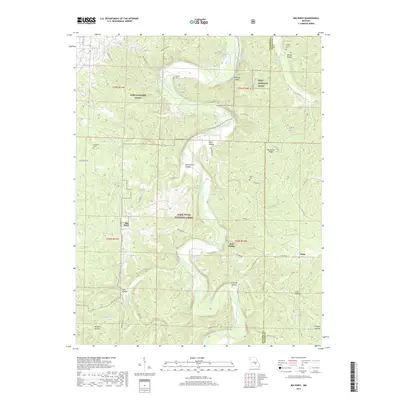
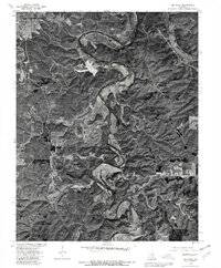 1976 Big Piney1980 Print · USGSThe Ozark highlands of Pulaski County appear in sharp detail in the mid-1970s, showcasing the winding Big Piney River and the northern presence of Fort Leonard Wood. Researchers can trace rural road networks and land use around the settlements of Big Piney and Duke.
 - 1982 Map of Lebanon, 1983 Print
 1982 Lebanon1983 Print · USGSThe Missouri Ozarks are captured in the early eighties as Interstate 44 and the St Louis-San Francisco rail line link growing towns with the Fort Leonard Wood Military Reservation. Genealogists and historians can trace family-named sites like Flatwood Church and old post offices at Sleeper and Nebo.
 - 2004 Map of Big Piney, 2006 Print
 2004 Big Piney2006 Print · USGSThe Big Piney River valley in the early 2000s reveals a unique landscape where the Mark Twain National Forest meets the Fort Leonard Wood Military Reservation. Researchers can trace family sites like Ramsey Cemetery and the Democrat School (Site) near the Big Piney River.
 - 2012 Map of Big Piney, 2012 Print
 2012 Big Piney2012 Print · USGSCovers Duke, including Big Piney, Ross Bridge, and other nearby areas
 - 2015 Map of Big Piney, 2015 Print
 2015 Big Piney2015 Print · USGSCovers Duke, including Big Piney, Ross Bridge, and other nearby areas
 - 2017 Map of Big Piney, 2017 Print
 2017 Big Piney2017 Print · USGSCovers Duke, including Big Piney, Ross Bridge, and other nearby areas
 - 2021 Map of Big Piney, 2021 Print
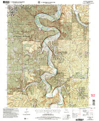
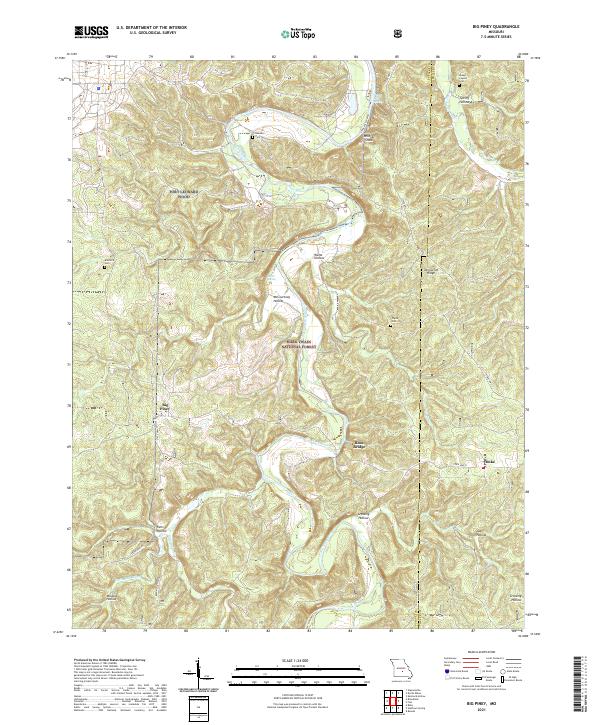 2021 Big Piney2021 Print · USGSThe Big Piney River valley in the early 2020s shows a landscape where the Fort Leonard Wood military reservation meets the Mark Twain National Forest. Local history is preserved in rural landmarks like the Knapp Lawson Cem, Duke, and the Ross Bridge.
End of results
Showing maps 1-14 of 14
Top cities near Duke
- Saint Robert historical maps
- Waynesville historical maps
- Sherrill historical maps
- Licking historical maps
- Edgar Springs historical maps
- Plato historical maps
Frequently asked questions
- What are the different types of historical maps available for Duke?
- What is the oldest map of Duke?
- Where can I purchase historical maps of Duke for my home or office?
- Where can I download high-res historical maps of Duke?
- Are there historical topographic maps available for Duke?
- Is there historical aerial imagery available for Duke?
- Where are historical maps of Duke sourced from?