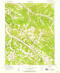
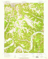
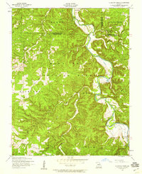
1950s Maps of Pulaski County, Missouri
Explore 26 historic maps of Pulaski County from the 1950s. These maps offer a rare glimpse into what life looked like during the 1950s — showing old roads, neighborhoods, homes, and landmarks that have changed or disappeared over time.
Whether you're researching your family's past, planning a metal detecting trip, or studying how Pulaski County's landscape evolved across the 1950s, these high-resolution maps are a powerful tool for exploring the history of this region.
- Focus on a specific era: All maps on this page are from the 1950s, giving you a focused view of this time period.
- See what’s changed: Compare century-old streets, trails, and buildings to today's modern landscape using overlays and satellite layers.
- Research with precision: Use these maps for genealogy, historical research, land use analysis, or educational projects.
- View, download, or print: Maps are fully viewable online in high resolution, and can be downloaded or printed for your own records.
Start exploring Pulaski County's history through authentic maps from the 1950s. This is your window into the past.
Pulaski County, MO maps
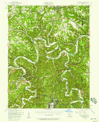
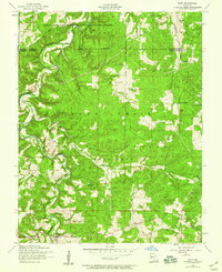
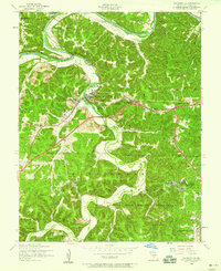
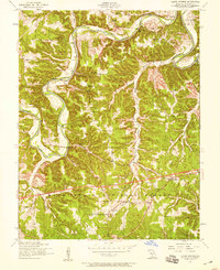
(26)- 1950 Map of Tavern
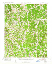 1950 Tavern1950 Print · USGSMaries County and the surrounding Missouri countryside appear here in the late 1940s, showing a landscape defined by river bends and rural schoolhouses. Researchers can locate family landmarks like Ricker Ch, Brinktown Sch, and Barnhart Cem.3 unique versions available
 - 1954 Map of Jefferson City
 1954 Jefferson City1954 Print · USGSCentral Missouri in the early postwar years showcases a landscape defined by the winding Lake of the Ozarks and the state capital at Jefferson City. Researchers can trace the mid-century rail networks of the Missouri Pacific RR and locate rural communities like Tuscumbia, St Elizabeth, and St Anthony.2 unique versions available
 - 1954 Map of Springfield
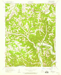
 1954 Springfield1954 Print · USGSThe Missouri Ozarks are captured here during the post-war era, showing the expansion of Springfield and the surrounding river valleys. Genealogists and historians can trace local landmarks like Mount Comfort Cemetery and the Fort Leonard Wood military grounds.6 unique versions available
 - 1954 Map of Hancock, 1955 Print
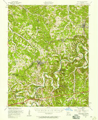
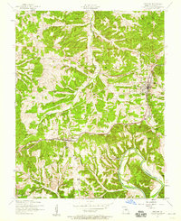
 1954 Hancock1955 Print · USGSIn the mid-fifties, this Pulaski County landscape shows a rural Missouri community still anchored by its many country cemeteries and riverside landmarks. Genealogists and historians can trace family locations through Sweet Home Church, Jury Siding, and the Decker Cemetery.2 unique versions available
 - 1954 Map of Drynob, 1958 Print
 1954 Drynob1958 Print · USGSThe rural hills of Laclede County are captured here in the mid-fifties as many one-room schoolhouses were beginning to close. You can trace early Ozark river crossings at Hall Ford Bridge or locate family sites like the Stewart Cemetery and Mt Pleasant Church.2 unique versions available
 - 1954 Map of Big Piney, 1958 Print
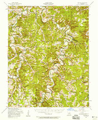
 1954 Big Piney1958 Print · USGSThe mid-century Ozark highlands are captured here during a period of massive federal transition, as military expansion met traditional rural life. Researchers can trace family names and vanished sites through the Bloodland Cemetery, the Roby Lookout Tower, and several abandoned schoolhouses like Morman Valley School.3 unique versions available
 - 1954 Map of Waynesville, 1958 Print
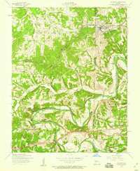
 1954 Waynesville1958 Print · USGSThe Missouri Ozarks are captured here during the mid-fifties, showing the expansion of Fort Leonard Wood and the winding course of the Gasconade River. Researchers can locate dozens of country landmarks, from the Dixon Lookout Tower to rural sites like Wheeler Mill and the Pisgah School.2 unique versions available
 - 1954 Map of Richland, 1958 Print
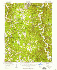
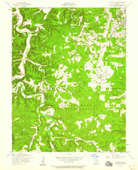
 1954 Richland1958 Print · USGSThe Gasconade River valley and the St. Louis-San Francisco rail line define this mid-Missouri landscape during the mid-fifties. Genealogists can trace family names through dozens of rural sites, including Thornsberry Cemetery, Makarie Bridge, and several early schoolhouses.2 unique versions available
 - 1954 Map of Devils Elbow, 1959 Print
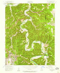 1954 Devils Elbow1959 Print · USGSMid-century Pulaski County is defined here by the winding Big Piney River and the sprawling footprint of a major military installation. Local historians can trace family sites like Spaulding Cem and the small rail siding at Hunt Siding along the river bluffs.5 unique versions available
 - 1954 Map of Big Piney, 1959 Print
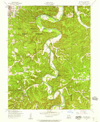 1954 Big Piney1959 Print · USGSPulaski County at the edge of the Mark Twain National Forest comes into sharp focus during the mid-fifties. Genealogists and historians can trace old homesteads and landmarks like Hopewell Church, the Democrat School, and the winding Big Piney River.6 unique versions available
 - 1954 Map of Roby, 1959 Print
 1954 Roby1959 Print · USGSThe Missouri Ozarks during the mid-1950s reveals a landscape of dense national forest and expanding military grounds. Genealogists can trace family footprints at Macedonia Cemetery or locate the former sites of rural education at Bloodland School and Blackjack School.3 unique versions available
 - 1954 Map of Richland, 1959 Print
 1954 Richland1959 Print · USGSRichland sits at a tri-county junction during the mid-fifties, where the railroad and the Gasconade River shaped local life. Genealogists can locate family landmarks like Manes Cemetery and Independence Church, or trace the legacy of rural education at Wait School (Aban'd).2 unique versions available
 - 1954 Map of Bloodland, 1959 Print
 1954 Bloodland1959 Print · USGSIn the mid-1950s, this area of Pulaski County shows the growth of the military installation alongside traditional Ozark settlements. Genealogists and historians can locate old rural burial grounds like Friendship Cem and McCann Cem, or trace the path of Roubidoux Creek near Hanna.3 unique versions available
 - 1954 Map of Brownfield, 1959 Print
 1954 Brownfield1959 Print · USGSThe Gasconade River and the Mark Twain National Forest define this Ozark landscape in the mid-fifties. Genealogists can trace family names through several cemeteries like Rollins Cem and Cook Cem or locate the old Brownfield School.2 unique versions available
 - 1954 Map of Waynesville, 1959 Print
 1954 Waynesville1959 Print · USGSWaynesville and the surrounding Ozark hollows are captured in the mid-fifties as the local landscape adapted to the presence of the neighboring military reservation. Genealogists can trace family landmarks and rural institutions like Gospel Ridge Union Church, Storie Cem, and the Old Indian Lead Mine.5 unique versions available
 - 1954 Map of Conns Creek, 1959 Print
 1954 Conns Creek1959 Print · USGSCamden and Pulaski counties are shown here in the mid-fifties, just as rural school consolidation was leaving several buildings idle. Local researchers can trace family landmarks like Miles Cemetery, Sellars, and the Fairview School (abandoned).2 unique versions available
 - 1954 Map of Drynob, 1959 Print
 1954 Drynob1959 Print · USGSLaclede and Pulaski Counties are shown during the mid-1950s as the river-carved landscape began to see the closing of its traditional country schools. Genealogists can trace family names through the Ripley Cemetery and Brandon Cemetery or locate the old Oakland School and Abo settlement.2 unique versions available
 - 1954 Map of Dixon, 1959 Print
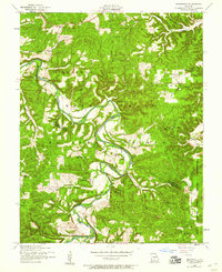
 1954 Dixon1959 Print · USGSThe town of Dixon and the surrounding Ozark hills are captured in the mid-1950s as the rail line still defined the local economy. Genealogists and researchers can trace family landmarks like Egan Cemetery, Boiling Spring, and the Gaddy School (Abandoned).4 unique versions available
 - 1954 Map of Slabtown Spring, 1959 Print
 1954 Slabtown Spring1959 Print · USGSTexas County and the surrounding Ozark river valleys are shown in the mid-fifties, just as rural school consolidation began leaving landmarks like the Harmon Valley School behind. Genealogists can trace family sites at Omalley Cem or locate the riverside settlements of Slabtown and Hazleton.3 unique versions available
 - 1954 Map of Ozark Springs, 1959 Print
 1954 Ozark Springs1959 Print · USGSPulaski County, Missouri, is shown here in the mid-1950s as a landscape of deep river bends and rural education nodes. Genealogists can trace family landmarks like Pauley Cem or locate several decommissioned sites such as Hickory Grove School.3 unique versions available
 - 1954 Map of Crocker, 1959 Print
 1954 Crocker1959 Print · USGSMid-century Pulaski County is centered on the St Louis - San Francisco railroad and the river-carved hills around Crocker. Genealogists and researchers can trace local family landmarks and rural infrastructure from the Swedeborg School to the Swede Lookout Tower.2 unique versions available
 - 1955 Map of Jefferson City, 1967 Print
 1955 Jefferson City1967 Print · USGSCentral Missouri in the mid-fifties is defined by the winding Missouri River and the expanding reach of Lake of the Ozarks. Researchers can trace the rail corridors of the Missouri Pacific or locate the early footprint of Whiteman AFB and Jefferson City.4 unique versions available
 - 1958 Map of Jefferson City
 1958 Jefferson City1958 Print · USGSCentral Missouri in the late fifties shows a region transforming through the growth of Whiteman Air Force Base and the Lake of the Ozarks. Researchers can trace rail lines like the Missouri Pacific or find family roots at Enloe Cemetery and Mount Pleasant Cem.
 - 1958 Map of Springfield
 1958 Springfield1958 Print · USGSThe Missouri Ozarks are captured during the mid-century era of growth, centered on the bustling hub of Springfield. Genealogists and historians can trace family roots through numerous landmarks like Ebenezer Church, Stockton Cem, and the various county courthouses.
 - 1959 Map of Jefferson City
 1959 Jefferson City1959 Print · USGSCentral Missouri is captured during the mid-fifties as the river economy and rail networks like the Missouri Pacific met the rise of the automobile. Local researchers can trace family landmarks and rural infrastructure from the Lake of the Ozarks up to Providence Cemetery and Knob Noster State Park.
Showing maps 1-25 of 26
Top cities of Pulaski County
- Saint Robert historical maps
- Waynesville historical maps
- Richland historical maps
- Dixon historical maps
- Crocker historical maps
Frequently asked questions
- What are the different types of historical maps available for Pulaski County?
- What is the oldest map of Pulaski County?
- Where can I purchase historical maps of Pulaski County for my home or office?
- Where can I download high-res historical maps of Pulaski County?
- Are there historical topographic maps available for Pulaski County?
- Is there historical aerial imagery available for Pulaski County?
- Where are historical maps of Pulaski County sourced from?