Old Maps of Pulaski County, Missouri for Academic Research
Study the evolution of Pulaski County with 131 high-resolution historic maps. Whether you're teaching, researching, or modeling changes in land use, these maps provide essential visual documentation of urban, environmental, and geographic change.
- Analyze long-term change: Track patterns in development, transportation, and natural features.
- Ideal for environmental or urban studies: Support academic projects with primary historical map data.
- Use in the classroom or lab: Educators and researchers rely on these maps to bring historical context to life.
These maps are a powerful tool for teaching, research, and visualizing how Pulaski County has changed over the decades.
Pulaski County, MO maps
(131)- 1888 Map of Tuscumbia
 1888 Tuscumbia1888 Print · USGSThe Osage River valley comes to life in the 1880s, showcasing the intricate river bends and rugged hills of central Missouri. Genealogists and researchers can trace the original locations of early settlements like Tuscumbia, St. Elizabeth, and Iberia.
 - 1894 Map of Tuscumbia
 1894 Tuscumbia1894 Print · USGSCentral Missouri's river-and-rail landscape is captured here in the 1890s as the Osage River served as the region's main artery. Genealogists and historians can trace the early boundaries of communities like Tuscumbia, St. Elizabeth, and Iberia.3 unique versions available
 - 1933 Map of Iberia, 1963 Print
 1933 Iberia1963 Print · USGSThe Osage River hills during the early 1930s reveal a landscape of isolated farmsteads and rural schoolhouses. Genealogists can trace family roots through numerous sites like Ramsey Cem, Gott Ch, and vanished school districts like Stumpf Sch.2 unique versions available
 - 1936 Map of Waynesville
 1936 Waynesville1936 Print · USGSPulaski County during the mid-1930s is defined by its winding river valleys and the expansion of the Gardner National Forest. Researchers can trace ancestral locations through an extensive network of rural landmarks, including the Old Indian Lead Mine, Riddle Bridge, and the Sweet Home Ch.
 - 1937 Map of Iberia
 1937 Iberia1937 Print · USGSIberia and the surrounding Miller County hills are captured here in the mid-1930s, showing a landscape of small farms and crossroads communities. Genealogists can trace family footprints at Ramsey Cem, Twelve Corners Ch, and dozens of rural school sites like Barton Sch.2 unique versions available
 - 1941 Map of Big Piney
 1941 Big Piney1941 Print · USGSThe Ozarks at the dawn of the war years reveal a landscape of rural schoolhouses and river bends before military expansion. Genealogists can trace family roots through Lone Star Sch, Cook Cem, and the now-transformed settlement of Bloodland.
 - 1942 Map of Waynesville
 1942 Waynesville1942 Print · USGSPulaski County during the early 1940s shows a landscape of deep river bends and the emergence of wartime infrastructure. Genealogists can trace family roots through numerous sites like Burchard Cem, the Old Indian Lead Mine, and the original footprint of Fort Leonard Wood.
 - 1943 Map of Richland
 1943 Richland1943 Print · USGSThe Missouri Ozarks during the early 1940s are documented here, showing the rural communities of Pulaski and Camden counties connected by the rail lines. Genealogists can locate family landmarks like Manes Cem, Buzzard Roost Sch, and Wair Chapel.
 - 1943 Map of Big Piney
 1943 Big Piney1943 Print · USGSThe Missouri Ozarks are shown here during the early years of the Second World War as federal land expansion reshaped the region. Genealogists and local historians can trace family roots through numerous country schools like Lone Star Sch and churches including St Annie Ch and Dondas Ch.2 unique versions available
 - 1943 Map of Drynob
 1943 Drynob1943 Print · USGSThe Ozark plateau of Laclede County is captured here in the early 1940s, just as the nearby military presence began to reshape the landscape. Genealogists and historians can trace numerous rural schools like Stockdale Sch and family cemeteries such as Similin Cem and Nicks Cem.3 unique versions available
 - 1944 Map of Waynesville
 1944 Waynesville1944 Print · USGSPulaski County at the peak of the Second World War shows a landscape in transition as the new Fort Leonard Wood takes shape among the Ozark hills. Genealogists and researchers can trace family-named sites like Wheelers Mill, Riddle Bridge, and the Joiner Cem along the winding Gasconade River.2 unique versions available
 - 1947 Map of Jefferson City, 1949 Print
 1947 Jefferson City1949 Print · USGSCentral Missouri and the northern Ozarks come into focus in this late 1940s survey of the river-and-rail landscape. Genealogists and historians can trace the growth of Jefferson City and Sedalia or locate family roots near Bagnell Dam and the Lake of the Ozarks.
 - 1948 Map of Tavern, 1973 Print
 1948 Tavern1973 Print · USGSMaries County life in the late 1940s was centered on the river valleys and a network of rural schools. Genealogists can trace family landmarks like Old Van Cleve, the Barnhart Cem, and numerous schoolhouses including Camp Ground Sch.2 unique versions available
 - 1950 Map of Tavern
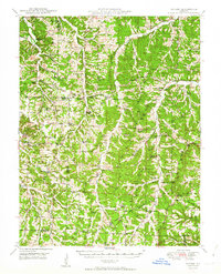 1950 Tavern1950 Print · USGSMaries County and the surrounding Missouri countryside appear here in the late 1940s, showing a landscape defined by river bends and rural schoolhouses. Researchers can locate family landmarks like Ricker Ch, Brinktown Sch, and Barnhart Cem.3 unique versions available
 - 1954 Map of Jefferson City
 1954 Jefferson City1954 Print · USGSCentral Missouri in the early postwar years showcases a landscape defined by the winding Lake of the Ozarks and the state capital at Jefferson City. Researchers can trace the mid-century rail networks of the Missouri Pacific RR and locate rural communities like Tuscumbia, St Elizabeth, and St Anthony.2 unique versions available
 - 1954 Map of Springfield
 1954 Springfield1954 Print · USGSThe Missouri Ozarks are captured here during the post-war era, showing the expansion of Springfield and the surrounding river valleys. Genealogists and historians can trace local landmarks like Mount Comfort Cemetery and the Fort Leonard Wood military grounds.6 unique versions available
 - 1954 Map of Hancock, 1955 Print
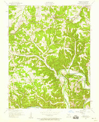 1954 Hancock1955 Print · USGSIn the mid-fifties, this Pulaski County landscape shows a rural Missouri community still anchored by its many country cemeteries and riverside landmarks. Genealogists and historians can trace family locations through Sweet Home Church, Jury Siding, and the Decker Cemetery.2 unique versions available
 - 1954 Map of Drynob, 1958 Print
 1954 Drynob1958 Print · USGSThe rural hills of Laclede County are captured here in the mid-fifties as many one-room schoolhouses were beginning to close. You can trace early Ozark river crossings at Hall Ford Bridge or locate family sites like the Stewart Cemetery and Mt Pleasant Church.2 unique versions available
 - 1954 Map of Big Piney, 1958 Print
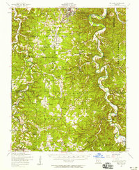 1954 Big Piney1958 Print · USGSThe mid-century Ozark highlands are captured here during a period of massive federal transition, as military expansion met traditional rural life. Researchers can trace family names and vanished sites through the Bloodland Cemetery, the Roby Lookout Tower, and several abandoned schoolhouses like Morman Valley School.3 unique versions available
 - 1954 Map of Waynesville, 1958 Print
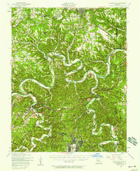 1954 Waynesville1958 Print · USGSThe Missouri Ozarks are captured here during the mid-fifties, showing the expansion of Fort Leonard Wood and the winding course of the Gasconade River. Researchers can locate dozens of country landmarks, from the Dixon Lookout Tower to rural sites like Wheeler Mill and the Pisgah School.2 unique versions available
 - 1954 Map of Richland, 1958 Print
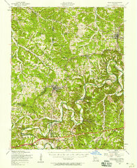 1954 Richland1958 Print · USGSThe Gasconade River valley and the St. Louis-San Francisco rail line define this mid-Missouri landscape during the mid-fifties. Genealogists can trace family names through dozens of rural sites, including Thornsberry Cemetery, Makarie Bridge, and several early schoolhouses.2 unique versions available
 - 1954 Map of Devils Elbow, 1959 Print
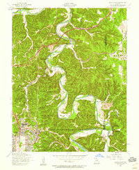 1954 Devils Elbow1959 Print · USGSMid-century Pulaski County is defined here by the winding Big Piney River and the sprawling footprint of a major military installation. Local historians can trace family sites like Spaulding Cem and the small rail siding at Hunt Siding along the river bluffs.5 unique versions available
 - 1954 Map of Big Piney, 1959 Print
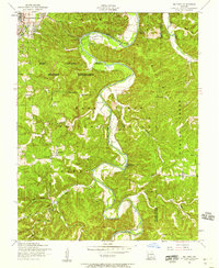 1954 Big Piney1959 Print · USGSPulaski County at the edge of the Mark Twain National Forest comes into sharp focus during the mid-fifties. Genealogists and historians can trace old homesteads and landmarks like Hopewell Church, the Democrat School, and the winding Big Piney River.6 unique versions available
 - 1954 Map of Roby, 1959 Print
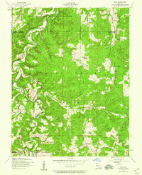 1954 Roby1959 Print · USGSThe Missouri Ozarks during the mid-1950s reveals a landscape of dense national forest and expanding military grounds. Genealogists can trace family footprints at Macedonia Cemetery or locate the former sites of rural education at Bloodland School and Blackjack School.3 unique versions available
 - 1954 Map of Richland, 1959 Print
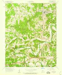 1954 Richland1959 Print · USGSRichland sits at a tri-county junction during the mid-fifties, where the railroad and the Gasconade River shaped local life. Genealogists can locate family landmarks like Manes Cemetery and Independence Church, or trace the legacy of rural education at Wait School (Aban'd).2 unique versions available
Showing maps 1-25 of 131
Top cities of Pulaski County
- Saint Robert historical maps
- Waynesville historical maps
- Richland historical maps
- Dixon historical maps
- Crocker historical maps
Frequently asked questions
- What are the different types of historical maps available for Pulaski County?
- What is the oldest map of Pulaski County?
- Where can I purchase historical maps of Pulaski County for my home or office?
- Where can I download high-res historical maps of Pulaski County?
- Are there historical topographic maps available for Pulaski County?
- Is there historical aerial imagery available for Pulaski County?
- Where are historical maps of Pulaski County sourced from?