1960s Maps of Saint Francois County, Missouri
Explore 14 historic maps of Saint Francois County from the 1960s. These maps offer a rare glimpse into what life looked like during the 1960s — showing old roads, neighborhoods, homes, and landmarks that have changed or disappeared over time.
Whether you're researching your family's past, planning a metal detecting trip, or studying how Saint Francois County's landscape evolved across the 1960s, these high-resolution maps are a powerful tool for exploring the history of this region.
- Focus on a specific era: All maps on this page are from the 1960s, giving you a focused view of this time period.
- See what’s changed: Compare century-old streets, trails, and buildings to today's modern landscape using overlays and satellite layers.
- Research with precision: Use these maps for genealogy, historical research, land use analysis, or educational projects.
- View, download, or print: Maps are fully viewable online in high resolution, and can be downloaded or printed for your own records.
Start exploring Saint Francois County's history through authentic maps from the 1960s. This is your window into the past.
Saint Francois County, MO maps
(14)- 1960 Map of Rolla
 1960 Rolla1960 Print · USGSThe Ozark Highlands in the mid-twentieth century reveal a landscape of deep timber and heavy industry. Researchers can trace the rail-and-mine economy through the St Louis-San Francisco RR and the Iron Mountain Mine, alongside the growth of Fort Leonard Wood.
 - 1960 Map of Vineland, 1961 Print
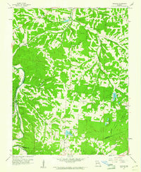 1960 Vineland1961 Print · USGSJefferson and St. Francois counties are shown here in the early sixties, as rural life centered around the Big River and the Missouri Pacific line. Researchers can trace family history through sites like Moontown Cem, the Sunrise Sch, and Valles Mines.2 unique versions available
 - 1962 Map of St. Louis
 1962 St. Louis1962 Print · USGSThe mid-century gateway to the west shows the metropolitan expansion of St Louis alongside its critical river confluences. Genealogists and historians can trace the rail corridors of the Missouri Pacific RR and settlements from Fulton to De Soto.
 - 1963 Map of St. Louis, 1970 Print
 1963 St. Louis1970 Print · USGSSt. Louis and its surrounding river valleys are captured here during the peak of mid-century suburban expansion and industrial activity. Trace the historic rail routes of the Norfolk and Western Ry or locate the St Louis Ordnance Plant and early stretches of US Highway 66.4 unique versions available
 - 1964 Map of Lawrenceton, 1965 Print
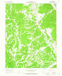
 1964 Lawrenceton1965 Print · USGSSte. Genevieve County in the early sixties is characterized by small family settlements and winding creek valleys. Researchers can locate several family burial grounds like Patterson Cem and Jennings Cem or trace the drainage of Terre Bleue Creek.3 unique versions available
 - 1964 Map of French Village, 1965 Print
 1964 French Village1965 Print · USGSThe rural borders of St. Francois and Ste. Genevieve counties are captured in the mid-1960s, showing a landscape defined by creeks and country chapels. Genealogists can locate family landmarks like Perret Cem, Russell Chapel, and the French Village Lookout Tower.2 unique versions available
 - 1964 Map of Halifax, 1965 Print
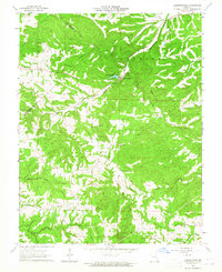
 1964 Halifax1965 Print · USGSJefferson and St. Francois counties are captured in the mid-1960s as the local landscape transitions between historic mining and quiet rural life. Genealogists can trace family connections at the German Ch Cem, Byrd Cem, and the settlement at Valles Mines.2 unique versions available
 - 1964 Map of Sprott, 1965 Print
 1964 Sprott1965 Print · USGSSte. Genevieve County in the early sixties reveals a landscape of dispersed family settlements and country schoolhouses. Genealogists can trace local heritage through Chestnut Ridge Sch, Genevieve Ch, and numerous burial sites like Oakland Cem and McGee Cem.2 unique versions available
 - 1964 Map of Danby, 1965 Print
 1964 Danby1965 Print · USGSSte. Genevieve County in the mid-sixties remained a landscape of remote family cemeteries and wooded hollows. Genealogists can trace family names at Bockenkamp Cem and Moehler Cem, or follow the rail corridor of the St Louis San Francisco.2 unique versions available
 - 1964 Map of Farmington, 1965 Print
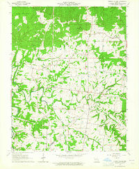
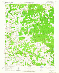
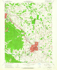 1964 Farmington1965 Print · USGSMid-century St. Francois County reveals a bustling regional hub centered on the city of Farmington. Researchers can trace old family lines through over a dozen rural burial grounds like Barton Cem or locate industrial sites such as Mine No 10 and the Missouri Pacific rail corridor.3 unique versions available
 - 1966 Map of Rolla
 1966 Rolla1966 Print · USGSThe Missouri Ozarks are revealed here in the mid-1960s, showing the intersection of heavy industry and sprawling national forests. Trace the development of the Lead Belt near Flat River or locate family roots in vanished hamlets like Enough and Howes Mill.
 - 1966 Map of St. Louis
 1966 St. Louis1966 Print · USGSThe St. Louis metropolitan area and its surrounding river valleys are captured here during the mid-sixties era of suburban growth and industrial strength. Genealogists and historians can trace the foundations of local communities through sites like Old Pioneer Cem, Parks College, and the Jefferson Barracks Military Reservation.
 - 1968 Map of Graniteville, 1970 Print
 1968 Graniteville1970 Print · USGSThe Missouri Ozarks are captured here in the late sixties as the region's quarrying and mining heritage remains clearly visible. Genealogists and historians can trace family locations through Belleview Sch and Thomas Cem, or follow the industrial legacy of the Missouri Pacific near Graniteville.2 unique versions available
 - 1968 Map of Iron Mountain Lake, 1970 Print
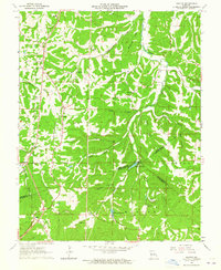
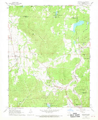
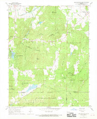 1968 Iron Mountain Lake1970 Print · USGSIn the Missouri Ozarks during the late 1960s, the terrain south of the St Francis River was a mix of national forest and active mining communities. Local historians can trace old property lines and cemetery locations like German Cem, or explore the rail network through Iron Mountain Lake and Doe Run.2 unique versions available
End of results
Showing maps 1-14 of 14
Top cities of Saint Francois County
- Farmington historical maps
- Park Hills historical maps
- Bonne Terre historical maps
- Desloge historical maps
- Bismarck historical maps
- Leadwood historical maps
See more
Frequently asked questions
- What are the different types of historical maps available for Saint Francois County?
- What is the oldest map of Saint Francois County?
- Where can I purchase historical maps of Saint Francois County for my home or office?
- Where can I download high-res historical maps of Saint Francois County?
- Are there historical topographic maps available for Saint Francois County?
- Is there historical aerial imagery available for Saint Francois County?
- Where are historical maps of Saint Francois County sourced from?