Old Maps of Shannon County, Missouri for Genealogy
Trace your family roots with 184 historic maps of Shannon County. These high-res maps reveal old neighborhoods, homesites, landmarks, and streets — helping you uncover where your ancestors lived and how the area evolved over time.
- Explore historic neighborhoods: Identify where your relatives may have lived in the 1800s or 1900s.
- Compare maps over time: Trace the changes in streets, buildings, and landmarks for multi-generational research.
- Perfect for genealogy & ancestry research: Used by family historians and researchers to map out lineage and migration.
These maps are an incredible resource for exploring your personal connection to Shannon County's past.
Shannon County, MO maps
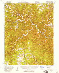
(184)- 1915 Map of Eminence, 1956 Print
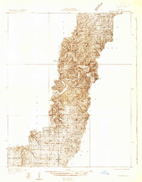
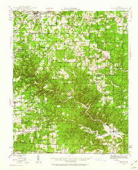
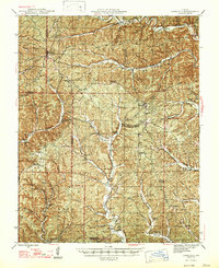
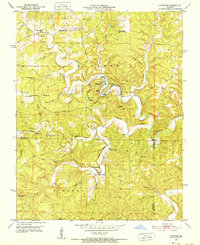
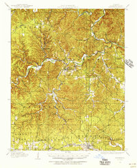 1915 Eminence1956 Print · USGSShannon County at the height of the early twentieth-century timber era shows a landscape defined by deep hollows and the winding Current River. Genealogists can trace family roots through numerous rural landmarks like Angeline P.O., West Eminence, and over a dozen country schools including Shawnee School.2 unique versions available
 - 1917 Map of Eminence
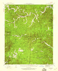
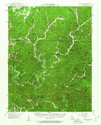
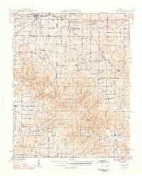
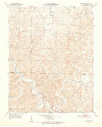
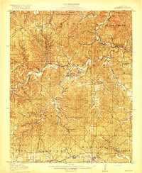 1917 Eminence1917 Print · USGSThe Ozark highlands of Shannon County are captured here just as the timber industry and river-based commerce shaped local life. Researchers can trace the footprints of lost rural communities at Horse Hollow Angeline P.O., Delaware, and West Eminence.4 unique versions available
 - 1928 Map of Cardareva
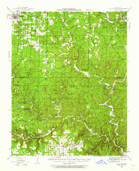
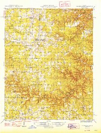
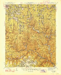
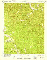
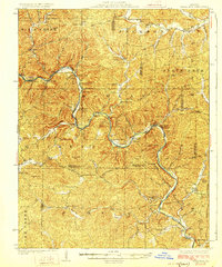 1928 Cardareva1928 Print · USGSThe Missouri Ozarks are captured here in the late 1920s, centered on the winding Current River corridor and its historic river-ford crossings. Genealogists can trace early rural life through numerous sites like Cardareva School, Banker Cave, and the settlement of Deslet.2 unique versions available
 - 1931 Map of Bandyville
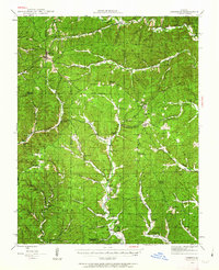
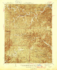
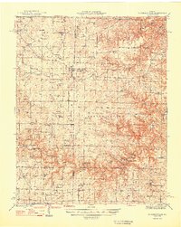
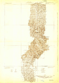 1931 Bandyville1931 Print · USGSThe Eleven Point River valley in the early 1930s remains a landscape of isolated rural townships and crossroads schools. Genealogists can trace family roots through sites like Falling Springs Cemetery, Hickory Grove Ch, and Bildad Sch.
 - 1932 Map of Cedar Grove
 1932 Cedar Grove1932 Print · USGSShannon County and the surrounding Ozark highlands are captured in the early 1930s, showing a landscape of small timber-country settlements. Genealogists can trace family homesteads near Cedar Grove and several local schools like Black Valley Sch and Round Valley Sch.
 - 1944 Map of Van Buren, 1960 Print
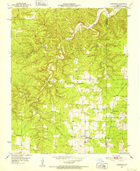
 1944 Van Buren1960 Print · USGSThe Ozark hill country of Carter and Shannon counties appears here in the mid-1940s. Researchers can trace the St Louis San Francisco rail line or locate rural sites like Pleasant Site Cem, Chicopee, and the Bristoll Sch.2 unique versions available
 - 1944 Map of Birch Tree, 1962 Print
 1944 Birch Tree1962 Print · USGSShannon and Oregon Counties are shown in the mid-1940s, a landscape defined by the winding Eleven Point River and isolated Ozark settlements. Genealogists and historians can trace family roots through sites like Oak Forest Cem, Fair Grove Sch, and New Liberty.2 unique versions available
 - 1944 Map of Corridon, 1963 Print
 1944 Corridon1963 Print · USGSThe Missouri Ozarks during the mid-forties reveal a landscape of timbered hollows and isolated settlements across the Reynolds and Shannon County lines. Researchers can trace family sites from Bunker to Fruit City, including Cedar Point Sch and the Latter Day Saints Ch.2 unique versions available
 - 1945 Map of Montier, 1960 Print
 1945 Montier1960 Print · USGSThe Missouri Ozarks during the mid-1940s are documented here, showing a landscape of small settlements and river valleys just as the post-war era began. Local historians can trace dozens of country schools and churches, from Gravel Ridge Sch to the Hilltop Mission and the remote Sherwood Reese Ranch.2 unique versions available
 - 1945 Map of Round Spring, 1962 Print
 1945 Round Spring1962 Print · USGSThe Ozark hill country of Shannon County comes to life in the mid-1940s, revealing a landscape of remote hollows and riverside camps. Genealogists and historians can trace old community hubs like the Brushy Post Office, Mauser's Mill, and several country schools.2 unique versions available
 - 1946 Map of Summersville
 1946 Summersville1946 Print · USGSThe Ozark plateau near the Texas and Shannon county lines appears in the late 1940s as a landscape of remote hollows and high ridges. Local historians can trace old community centers like Arroll or locate the numerous rural schoolhouses including Oak Ridge Sch and Welch Sch.2 unique versions available
 - 1946 Map of Van Buren
 1946 Van Buren1946 Print · USGSThe Ozark foothills of Carter County are shown here in the 1940s, dominated by the winding Current River and the sprawling Clark National Forest. Genealogists and hikers can trace the footprints of rural communities at Wilderness, Bristol Church, and Rinnard School.2 unique versions available
 - 1947 Map of Sinkin
 1947 Sinkin1947 Print · USGSShannon County in the late 1940s reveals a landscape of spring-fed rivers and remote timber settlements. Genealogists and historians can locate numerous rural schools like Sugar Tree Grove Sch and trace the river-mill economy at Brushy Mill and Mansers Mill.
 - 1947 Map of Corridon
 1947 Corridon1947 Print · USGSReynolds and Shannon counties in the late 1940s are shown here as a network of creek-valley settlements and rural schools. Researchers can trace family sites near Bunker, Fruit City, and Dagonia, or locate specific landmarks like Nuckols Cem and Latter Day Saints Ch.
 - 1948 Map of Montier
 1948 Montier1948 Print · USGSPost-war Howell, Shannon, and Oregon Counties come to life here, showing the ridge-and-hollow social network of the Missouri Ozarks. Genealogists can trace family names through dozens of rural landmarks like Marble Hill Sch, Bennett Chapel, and the Brown Cem.2 unique versions available
 - 1948 Map of Birch Tree
 1948 Birch Tree1948 Print · USGSThe Missouri Ozarks are documented here in the late 1940s, showing a landscape of state forests and spring-fed rivers. Local historians can trace family locations near New Liberty, Oak Forest Cem, and numerous rural schoolhouses like Spring Creek Sch.2 unique versions available
 - 1948 Map of Summersville
 1948 Summersville1948 Print · USGSSummersville and the surrounding Ozark plateau are captured here in the late 1940s, showing a landscape defined by small farms and karst geology. Genealogists can locate numerous rural landmarks like Heelstring Sch, Riley Cem, and the river-side Rymer Ranch.
 - 1949 Map of Round Spring
 1949 Round Spring1949 Print · USGSThe Ozark riverways of Shannon and Dent Counties are captured here in the late 1940s as state and federal forestry lands began to consolidate. Local researchers can trace family roots through remote landmarks like Swinney Cem, Falk Mill, and the isolated Brushy PO.
 - 1949 Map of Rolla, 1950 Print
 1949 Rolla1950 Print · USGSThe Missouri Ozarks are captured here just after the war, showing a landscape of deep river valleys and emerging reservoir projects. Genealogists and historians can trace the mining towns of Bonne Terre and Potosi or follow the early route of U.S. Highway 66.
 - 1949 Map of Cardareva, 1957 Print
 1949 Cardareva1957 Print · USGSThe mid-century Ozark backcountry along the Current River is detailed here, showing a landscape of river-bend settlements and deep hollows. Researchers can trace rural life through numerous fords and one-room schoolhouses like Owls Bend School and Cardareva Ford.
 - 1951 Map of Montauk, 1952 Print
 1951 Montauk1952 Print · USGSThe headwaters of the Current River are captured here in the early fifties, showing the development of Montauk State Park. Researchers can trace old family sites and rural institutions like Paterson Cem, Hepsida Ch, and Alred Sch.5 unique versions available
 - 1951 Map of Cedargrove, 1952 Print
 1951 Cedargrove1952 Print · USGSMid-century life in the Ozark Highlands centered on the winding Current River and the isolated hollows of Dent and Shannon counties. Genealogists and historians can trace old community anchors like Halbrook Cem, Rector, and Jadwin Sch.6 unique versions available
 - 1951 Map of Lewis Hollow, 1952 Print
 1951 Lewis Hollow1952 Print · USGSShannon County in the early fifties is defined by the winding Current River and its intricate network of hollows. Researchers can trace the placement of rural landmarks like Lewis Hollow Sch, the Hartshorn Lookout Tower, and Black Valley Sch.5 unique versions available
 - 1951 Map of Hartshorn, 1952 Print
 1951 Hartshorn1952 Print · USGSThe Ozark highlands near Hartshorn are captured here in the early fifties, showing a landscape defined by the winding Current River. Local historians can locate vanished landmarks like Round Valley Sch and family-named sites such as Smith Cem or Center Valley Ch.4 unique versions available
 - 1951 Map of Cedargrove, 1958 Print
 1951 Cedargrove1958 Print · USGSThe Current River valley and the rural hills of Shannon and Texas counties come alive in the early fifties. Genealogists and historians can trace family roots through numerous country landmarks like Jadwin School, Antioch Cem, and Hartshorn Lookout Tower.3 unique versions available
Showing maps 1-25 of 184
Top cities of Shannon County
Frequently asked questions
- What are the different types of historical maps available for Shannon County?
- What is the oldest map of Shannon County?
- Where can I purchase historical maps of Shannon County for my home or office?
- Where can I download high-res historical maps of Shannon County?
- Are there historical topographic maps available for Shannon County?
- Is there historical aerial imagery available for Shannon County?
- Where are historical maps of Shannon County sourced from?