1960s Maps of Shannon County, Missouri
Explore 23 historic maps of Shannon County from the 1960s. These maps offer a rare glimpse into what life looked like during the 1960s — showing old roads, neighborhoods, homes, and landmarks that have changed or disappeared over time.
Whether you're researching your family's past, planning a metal detecting trip, or studying how Shannon County's landscape evolved across the 1960s, these high-resolution maps are a powerful tool for exploring the history of this region.
- Focus on a specific era: All maps on this page are from the 1960s, giving you a focused view of this time period.
- See what’s changed: Compare century-old streets, trails, and buildings to today's modern landscape using overlays and satellite layers.
- Research with precision: Use these maps for genealogy, historical research, land use analysis, or educational projects.
- View, download, or print: Maps are fully viewable online in high resolution, and can be downloaded or printed for your own records.
Start exploring Shannon County's history through authentic maps from the 1960s. This is your window into the past.
Shannon County, MO maps
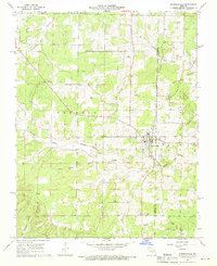
(23)- 1960 Map of Poplar Bluff
 1960 Poplar Bluff1960 Print · USGSSoutheast Missouri and Northeast Arkansas are captured here during the post-war era, showing the transition from the Ozark highlands to the Delta. Genealogists and historians can trace rail corridors like the St. Louis Southwestern RR and remote settlements such as Birch Tree and Warm Springs.
 - 1960 Map of Rolla
 1960 Rolla1960 Print · USGSThe Ozark Highlands in the mid-twentieth century reveal a landscape of deep timber and heavy industry. Researchers can trace the rail-and-mine economy through the St Louis-San Francisco RR and the Iron Mountain Mine, alongside the growth of Fort Leonard Wood.
 - 1964 Map of Bartlett, 1966 Print
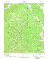
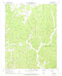
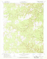
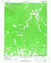 1964 Bartlett1966 Print · USGSShannon County in the mid-1960s shows a landscape of deep Ozark hollows and quiet railway stops along the St Louis San Francisco line. Researchers can locate the Manger of Bethlehem Ch, the Delaware Cem, and the community of Bartlett.3 unique versions available
 - 1965 Map of Alley Spring, 1966 Print
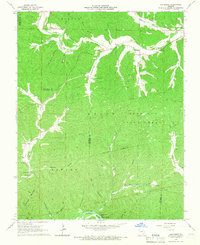
 1965 Alley Spring1966 Print · USGSShannon County's deep hollows and spring-fed rivers are captured here in the mid-1960s, just as the region's natural beauty was becoming a formal state fixture. Researchers can trace local heritage through Flatwood Cem, the settlement at Venice, and the early grounds of Alley Spring State Park.4 unique versions available
 - 1965 Map of Powder Mill Ferry, 1966 Print
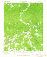
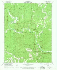
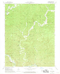
 1965 Powder Mill Ferry1966 Print · USGSThe Current River valley in Shannon County remained a place of river-crossings and natural springs during the mid-1960s. Genealogists and researchers can locate landmarks like Powder Mill Ferry, Blue Spring, and several caves including Marvel Cave.4 unique versions available
 - 1965 Map of Stegall Mountain, 1966 Print
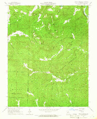 1965 Stegall Mountain1966 Print · USGSThe Missouri Ozarks are captured here in the mid-1960s, a time when conservation and forestry efforts defined the hills of Shannon and Carter Counties. Genealogists and hikers can locate Reed Cem, the Horner Church, and the distinctive Rocky Falls along Rocky Creek.3 unique versions available
 - 1965 Map of Exchange, 1966 Print
 1965 Exchange1966 Print · USGSThe Ozark hollows of Reynolds and Shannon County come to life in the mid-1960s, showing a landscape shaped by the Current River. Genealogists can trace family footprints through the Pumpkin Hollow Cemetery, Neeley Cem, and the small settlement of Exchange.
 - 1965 Map of Eminence, 1966 Print
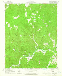
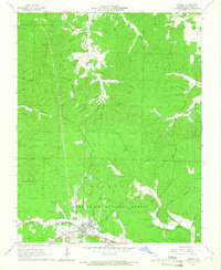
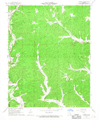
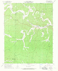
 1965 Eminence1966 Print · USGSThe confluence of the Jacks Fork and Current River dominates Shannon County in the mid-sixties. Genealogists can locate family landmarks like Chilton Cem, Bethany Chapel, and the fire lookouts atop Tip Top Mtn and Goot Mtn.4 unique versions available
 - 1965 Map of Winona, 1966 Print
 1965 Winona1966 Print · USGSWinona and the surrounding Ozark woodlands are captured here in the mid-1960s as the rail and road networks shaped Shannon County life. Researchers can trace local genealogy at Pine Lawn Cemetery or locate old industrial sites like the Sutton Mine and the St Louis-San Francisco rail line.3 unique versions available
 - 1965 Map of Van Buren North, 1966 Print
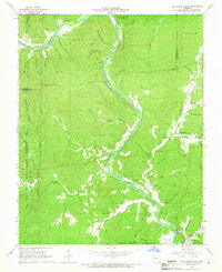 1965 Van Buren North1966 Print · USGSThe Current River valley north of Van Buren is shown here in the mid-1960s, a landscape defined by deep hollows and isolated Ozark settlements. Genealogists can locate family landmarks like Collins Cem, Galbraith Cem, and the Bible Ch tucked between the ridges.4 unique versions available
 - 1966 Map of Rolla
 1966 Rolla1966 Print · USGSThe Missouri Ozarks are revealed here in the mid-1960s, showing the intersection of heavy industry and sprawling national forests. Trace the development of the Lead Belt near Flat River or locate family roots in vanished hamlets like Enough and Howes Mill.
 - 1966 Map of Midridge, 1968 Print
 1966 Midridge1968 Print · USGSMidridge and the surrounding Ozarks are captured in the mid-1960s, showing the high ridges of the Shannon and Reynolds county line. Researchers can locate local landmarks like Himont Lookout Tower, trace family roots at Nuckols Cem, or find the Adair Creek Mine.3 unique versions available
 - 1967 Map of Corridon SE, 1968 Print
 1967 Corridon SE1968 Print · USGSThis mid-century survey of the Reynolds County hills captures the isolated farmsteads and church communities of the Missouri Ozarks. Genealogists can locate family landmarks like Sutterfield Cem, Dickens Valley Ch, and the high point at Panther Hill.2 unique versions available
 - 1967 Map of Bunker, 1968 Print
 1967 Bunker1968 Print · USGSThe town of Bunker straddles the Dent and Reynolds county lines in the late sixties, surrounded by the timberlands of the Ozarks. Genealogists and hikers can locate family cemeteries like Parks Cem and natural landmarks such as Turner Cave and the Natural Bridge.3 unique versions available
 - 1967 Map of Loggers Lake, 1969 Print
 1967 Loggers Lake1969 Print · USGSThe Ozark wilderness of Dent and Shannon Counties comes alive in the 1960s, showing the deep woods of the Clark National Forest. Researchers can find family burial sites like Chatman Cem and trace old roads near Loggers Lake.3 unique versions available
 - 1967 Map of Gladden, 1969 Print
 1967 Gladden1969 Print · USGSThe Missouri Ozarks during the late sixties are captured here along the border of Dent and Shannon counties. Genealogists and hikers can locate family burial sites like Empire Cem and Gray Cem or trace the karst landscape at Devils Well.
 - 1967 Map of Round Spring, 1970 Print
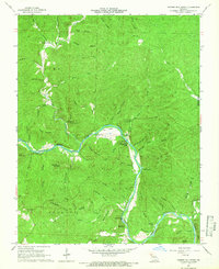
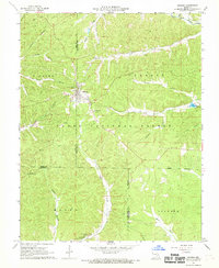
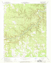
 1967 Round Spring1970 Print · USGSShannon County's river-cut landscape is captured here in the late sixties, just as the riverways were coming under federal protection. Genealogists and local historians can locate remote family landmarks like Weese Cem, Timber Sch, and the grounds of Camp Zoe.4 unique versions available
 - 1968 Map of Pine Crest
 1968 Pine Crest1968 Print · USGSThe Missouri Ozarks are captured here during a transition towards river conservation, centered on the winding North Prong Jacks Fork. Researchers can trace the rural landscape through the locations of the Arroll School, Harlow Ford, and Cold Spring Cemetery.4 unique versions available
 - 1968 Map of Summersville, 1969 Print
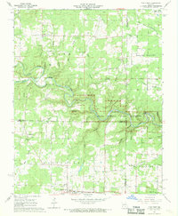
 1968 Summersville1969 Print · USGSSummersville and the surrounding Ozark borderlands are captured here in the late sixties, showcasing a landscape of winding hollows and plateau farms. Genealogists and local historians can locate Bethel Ch, trace family plots at Pickett Cem, or find the old Midvale settlement.2 unique versions available
 - 1968 Map of Summersville NE, 1969 Print
 1968 Summersville NE1969 Print · USGSShannon County was a land of deep hollows and karst geology in the late sixties, just as federal river protection was beginning. Researchers can trace the rural community at Flat Rock Ch, find family history at Black Pond Cem, and locate the unique Forty Acre Sinkhole.3 unique versions available
 - 1968 Map of Fremont, 1969 Print
 1968 Fremont1969 Print · USGSFremont and the surrounding Ozark woodlands appear here in the late sixties as the forest reclaimed former industrial grounds. Researchers can find the Site of Old Midco Iron Works, the Fremont Lookout Tower, and several family cemeteries like Evaline Cem.2 unique versions available
 - 1968 Map of The Sinks, 1969 Print
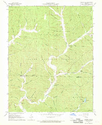
 1968 The Sinks1969 Print · USGSShannon County's Ozark interior is documented here in the late sixties, showing the interplay of rugged hollows and protected federal lands. Researchers can find old sites like Mauser Mill, Heaton Cem, and the distinctive limestone features of The Sinks.4 unique versions available
 - 1968 Map of Jam Up Cave, 1970 Print
 1968 Jam Up Cave1970 Print · USGSShannon County's river-cut uplands are shown in the late sixties just as the riverways were being protected. Researchers can locate family landmarks like Turkey Oak Cem, Bures Ch, and the massive entrance of Jam Up Cave along the Jacks Fork.4 unique versions available
End of results
Showing maps 1-23 of 23
Top cities of Shannon County
Frequently asked questions
- What are the different types of historical maps available for Shannon County?
- What is the oldest map of Shannon County?
- Where can I purchase historical maps of Shannon County for my home or office?
- Where can I download high-res historical maps of Shannon County?
- Are there historical topographic maps available for Shannon County?
- Is there historical aerial imagery available for Shannon County?
- Where are historical maps of Shannon County sourced from?