Old Maps of Crawford County, Missouri
Explore 67 old maps of Crawford County, spanning from 1903 to today. These high-resolution historic maps reveal how streets, neighborhoods, landmarks, and natural features evolved over time — perfect for genealogy, metal detecting, research, and local history exploration.
What you can do with these maps:
- See how Crawford County changed over time: Compare historical maps to modern-day views to trace roads, homesites, rail lines & more.
- View detailed metadata: Each map includes creators, publishers, year, scale, and archive source.
- Overlay maps with satellite & LiDAR: Visualize the past alongside modern tools to explore terrain & human change.
- Trusted historical sources: Maps sourced from the USGS, Library of Congress, and other archives.
- Access maps your way: View online, download high-res files, or order prints for personal or research use.
Start exploring old maps of Crawford County to uncover forgotten places, hidden landmarks, and the deep history beneath your feet.
Crawford County, MO maps
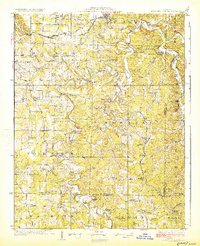
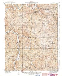
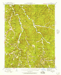
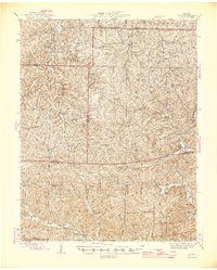
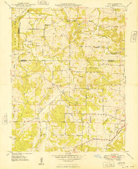
(67)- 1903 Map of Sullivan
 1903 Sullivan1903 Print · USGSCovers Crawford County, including Union, Sullivan, and other nearby areas3 unique versions available
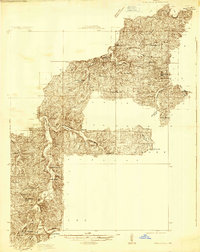
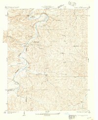
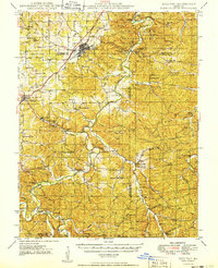
 - 1928 Map of Meramec Spring
 1928 Meramec Spring1928 Print · USGSCovers Crawford County, including Rolla, St. James, and other nearby areas3 unique versions available
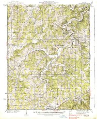
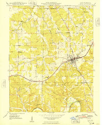
 - 1932 Map of Steelville
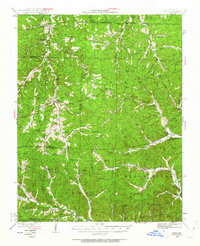
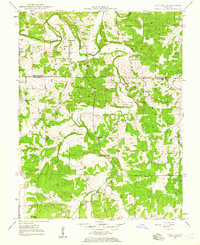
 1932 Steelville1932 Print · USGSCovers Crawford County, including Steelville, Cedar Ford, and other nearby areas
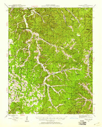
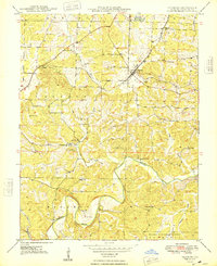
 - 1933 Map of Steelville, 1966 Print
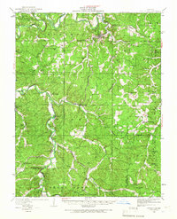 1933 Steelville1966 Print · USGSCovers Crawford County, including Steelville, Cedar Ford, and other nearby areas
 - 1934 Map of Meramec State Park, 1962 Print
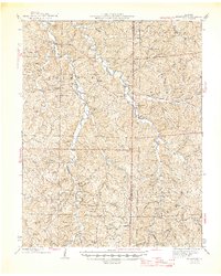
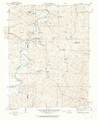 1934 Meramec State Park1962 Print · USGSCovers Crawford County, including Sullivan, Miramiguoa Park, and other nearby areas2 unique versions available
 - 1934 Map of Redbird, 1962 Print
 1934 Redbird1962 Print · USGSCovers Crawford County, including St. James, Mount Pleasant Ford, and other nearby areas
 - 1937 Map of Steelville
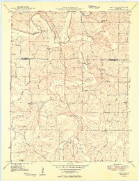
 1937 Steelville1937 Print · USGSCovers Crawford County, including Steelville, Cedar Ford, and other nearby areas3 unique versions available
 - 1937 Map of Meramec State Park
 1937 Meramec State Park1937 Print · USGSCovers Crawford County, including Sullivan, Miramiguoa Park, and other nearby areas
 - 1938 Map of Redbird
 1938 Redbird1938 Print · USGSCovers Crawford County, including St. James, Mount Pleasant Ford, and other nearby areas3 unique versions available
 - 1941 Map of Stone Hill, 1958 Print
 1941 Stone Hill1958 Print · USGSCovers Crawford County, including Max, Short Bend, and other nearby areas3 unique versions available
 - 1943 Map of Berryman, 1957 Print
 1943 Berryman1957 Print · USGSCovers Crawford County, including Quaker, Czar, and other nearby areas4 unique versions available
 - 1943 Map of Boss, 1963 Print
 1943 Boss1963 Print · USGSCovers Crawford County, including Viburnum, Red Point, and other nearby areas2 unique versions available
 - 1945 Map of Stone Hill
 1945 Stone Hill1945 Print · USGSCovers Crawford County, including Max, Short Bend, and other nearby areas2 unique versions available
 - 1945 Map of Berryman
 1945 Berryman1945 Print · USGSCovers Crawford County, including Quaker, Czar, and other nearby areas2 unique versions available
 - 1946 Map of Boss
 1946 Boss1946 Print · USGSCovers Crawford County, including Viburnum, Red Point, and other nearby areas2 unique versions available
 - 1947 Map of Sullivan
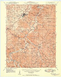
 1947 Sullivan1947 Print · USGSCovers Crawford County, including Sullivan, Bourbon, and other nearby areas3 unique versions available
 - 1948 Map of Cuba
 1948 Cuba1948 Print · USGSCovers Crawford County, including Cuba, Amanda, and other nearby areas5 unique versions available
 - 1948 Map of Leasburg
 1948 Leasburg1948 Print · USGSCovers Crawford County, including Leasburg, Hofflins, and other nearby areas5 unique versions available
 - 1948 Map of Argo
 1948 Argo1948 Print · USGSCovers Crawford County, including Bourbon, Argo, and other nearby areas4 unique versions available
 - 1948 Map of Oak Hill, 1960 Print
 1948 Oak Hill1960 Print · USGSCovers Crawford County, including Oak Hill, Gasconade County, and other nearby areas3 unique versions available
 - 1949 Map of Saint Louis
 1949 Saint Louis1949 Print · USGSCovers Crawford County, including St. Louis, O'Fallon, and other nearby areas2 unique versions available
 - 1949 Map of Oak Hill
 1949 Oak Hill1949 Print · USGSCovers Crawford County, including Oak Hill, Gasconade County, and other nearby areas2 unique versions available
 - 1949 Map of Sullivan
 1949 Sullivan1949 Print · USGSCovers Crawford County, including Sullivan, Bourbon, and other nearby areas
 - 1949 Map of Rolla, 1950 Print
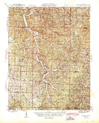
 1949 Rolla1950 Print · USGSCovers Crawford County, including Rolla, Farmington, and other nearby areas
 - 1949 Map of Meramec Spring, 1957 Print
 1949 Meramec Spring1957 Print · USGSCovers Crawford County, including Rolla, St. James, and other nearby areas2 unique versions available
Showing maps 1-25 of 67
Top cities of Crawford County
- Cuba historical maps
- Steelville historical maps
- Bourbon historical maps
- Leasburg historical maps
- West Sullivan historical maps
Frequently asked questions
- What are the different types of historical maps available for Crawford County?
- What is the oldest map of Crawford County?
- Where can I purchase historical maps of Crawford County for my home or office?
- Where can I download high-res historical maps of Crawford County?
- Are there historical topographic maps available for Crawford County?
- Is there historical aerial imagery available for Crawford County?
- Where are historical maps of Crawford County sourced from?