Old Maps of Hays District, Montana for Academic Research
Study the evolution of Hays District with 100 high-resolution historic maps. Whether you're teaching, researching, or modeling changes in land use, these maps provide essential visual documentation of urban, environmental, and geographic change.
- Analyze long-term change: Track patterns in development, transportation, and natural features.
- Ideal for environmental or urban studies: Support academic projects with primary historical map data.
- Use in the classroom or lab: Educators and researchers rely on these maps to bring historical context to life.
These maps are a powerful tool for teaching, research, and visualizing how Hays District has changed over the decades.
Hays District, MT maps
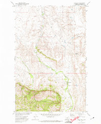
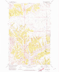
(100)- 1943 Map of Landusky
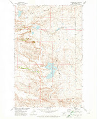
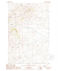
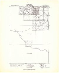 1943 Landusky1943 Print · USGSPhillips County during the early 1940s is shown here as a landscape of isolated mountain settlements and the wild Missouri Breaks. Researchers can trace the layout of Landusky, the mountain peaks of the Jefferson National Forest, and river landmarks such as Cow Island.
 - 1953 Map of Havre, 1967 Print
 1953 Havre1967 Print · USGSNorthern Montana’s Hi-Line comes into focus in the mid-fifties, centered on the Milk River and the critical Great Northern rail link. Genealogists can trace small sidings and settlements like Assinniboine, Laredo, and Box Elder alongside the Fort Belknap Agency.3 unique versions available
 - 1954 Map of Cow Island, 1956 Print
 1954 Cow Island1956 Print · USGSThe Missouri River breaks of Montana are captured here during the mid-fifties, showing the isolated river valley at the borders of Blaine, Fergus, and Phillips counties. Researchers can locate the Kip Homestead, trace the path of the Jeep Trail, and see the prominent Cow Island in the river's bend.3 unique versions available
 - 1954 Map of Lewistown, 1967 Print
 1954 Lewistown1967 Print · USGSCentral Montana at the height of the mid-century rail era reveals a landscape shaped by the Judith River and high mountain ranges. Trace the old lines of the Great Northern through Lewistown and Denton, or locate sites like Giltedge and Landusky.3 unique versions available
 - 1956 Map of Rattlesnake, 1957 Print
 1956 Rattlesnake1957 Print · USGSBlaine County's high country is captured here during the mid-1950s, showing the intersection of the Bearpaw Mountains and the surrounding ranching basins. Researchers can trace rural landmarks like the Rattlesnake Sch, the Four O'Clock Reservoir, and the distinctive Runyan Bench.3 unique versions available
 - 1957 Map of Havre
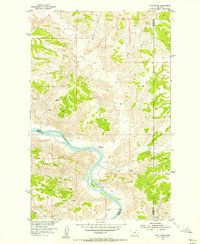
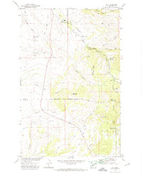
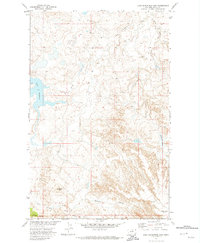
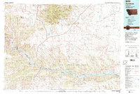
 1957 Havre1957 Print · USGSNorth-central Montana at the mid-century is defined by the vital Great Northern rail corridor and the winding Milk River. Researchers can trace old settlements like Laredo and Savoy, or locate historic sites such as the Hays (old) Sub Agency and the Chinook No 1 mine.
 - 1958 Map of Havre
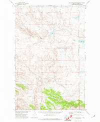
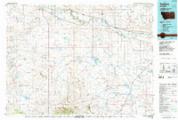
 1958 Havre1958 Print · USGSUpper Montana in the late fifties was a landscape of remote rail towns and vast high-plain ranges. Genealogists and historians can trace the Great Northern railroad through Havre, Chinook, and the Fort Belknap Indian Reservation.
 - 1959 Map of Lewistown
 1959 Lewistown1959 Print · USGSCentral Montana in the mid-1950s shows a landscape defined by the winding Missouri River and the rise of the South Moccasin Mtns. Researchers can trace the rail lines of the Great Northern through towns like Winifred and locate the Cat Creek Oil Field.3 unique versions available
 - 1971 Map of Crazyman Coulee, 1974 Print
 1971 Crazyman Coulee1974 Print · USGSBlaine and Phillips counties meet at the reservation line in the early 1970s. Trace old ranching water sources and land divisions along Crazyman Coulee, Brockie Spring, and Squaw Creek.
 - 1971 Map of Putnam Lake, 1974 Print
 1971 Putnam Lake1974 Print · USGSBlaine County, Montana, at the start of the 1970s shows a landscape shaped by drainage coulees and the Fort Belknap Indian Reservation Boundary. Trace water-focused landmarks like Putnam Lake, Suction Creek, and Haystack Butte.
 - 1971 Map of Hays, 1974 Print
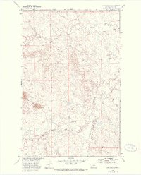
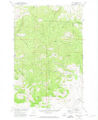
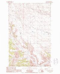
 1971 Hays1974 Print · USGSThe Fort Belknap Indian Reservation comes into focus during the 1970s, centered on the community of Hays. Researchers can trace the grounds of St Pauls Mission, locate family sites at Laddusky Cem, or explore the foothills near Eagle Child Mountain.
 - 1971 Map of Lodge Pole NW, 1974 Print
 1971 Lodge Pole NW1974 Print · USGSThe Fort Belknap Indian Reservation in the early seventies reveals a landscape shaped by hydrology and isolated infrastructure. Researchers can trace water resources like Peoples Creek or locate the remote Landing Strip and the high points of the Three Buttes.
 - 1971 Map of Lodge Pole NE, 1974 Print
 1971 Lodge Pole NE1974 Print · USGSThe Fort Belknap Indian Reservation in northern Montana appears here in the early 1970s, showcasing its complex drainage patterns. Genealogists and historians can trace the paths of Peoples Creek, Lodge Pole Creek, and the prominent landmark of Black Butte.
 - 1971 Map of Stiffarm Coulee, 1974 Print
 1971 Stiffarm Coulee1974 Print · USGSThe southern portion of the Fort Belknap Indian Reservation is shown here in the early 1970s as the plains meet the Little Rocky Mountains. Researchers can trace remote landmarks like a lone Grave and family-named features including Four Bear Coulee and Powder Face Canyon.
 - 1971 Map of Lake Seventeen NE, 1974 Print
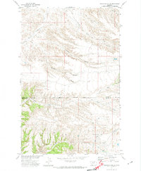
 1971 Lake Seventeen NE1974 Print · USGSThe high plains of Blaine County in the early 1970s reveal a landscape of deep coulees and isolated buttes. Researchers can trace the winding Peoples Creek, locate the prominent Three Buttes, and follow the historic Pack Trail across the eastern ridges.
 - 1971 Map of Lodge Pole, 1974 Print
 1971 Lodge Pole1974 Print · USGSThe Fort Belknap Indian Reservation is documented here in the early 1970s as it meets the northern foothills of the Little Rockies. Local researchers can trace family landmarks and water sources like Lodge Pole, Black Bull Spring, and Mouse Butte.
 - 1971 Map of Lake Seventeen East, 1974 Print
 1971 Lake Seventeen East1974 Print · USGSThe Fort Belknap Indian Reservation comes into focus during the early 1970s, showing a landscape shaped by high plains water and terrain. Researchers can trace land features like Lake Seventeen, Squaw Butte, and Warneke Coulee.
 - 1971 Map of Lake Seventeen West, 1974 Print
 1971 Lake Seventeen West1974 Print · USGSBlaine County ranchlands and the eastern border of the Fort Belknap Indian Reservation are captured here in the early 1970s. Trace the path of Suction Creek as it winds toward Lake Seventeen and study the terrain of Timber Ridge.
 - 1971 Map of Zortman, 1974 Print
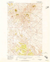
 1971 Zortman1974 Print · USGSThe Little Rocky Mountains of Montana are captured in the early 1970s, showcasing a landscape shaped by persistent mining and high-elevation terrain. Researchers can trace the layout of mining camps like Zortman and Landusky alongside shafts such as the Little Ben Mine and Gold Bug Mine.
 - 1971 Map of John Coulee, 1974 Print
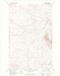
 1971 John Coulee1974 Print · USGSBlaine and Phillips counties are captured here in the early 1970s at the edge of the Fort Belknap Indian Reservation Boundary. Researchers can trace the drainage patterns of the Badlands and find remote landmarks like John Coulee and a scattered Jeep Trail.
 - 1984 Map of Zortman
 1984 Zortman1984 Print · USGSCentral Montana in the mid-eighties shows a vast landscape of tribal lands and protected wilderness along the Missouri River breaks. Genealogists and historians can trace the remote settlements of Zortman and Landusky or locate landmarks like Mission Peak and D V Junction.
 - 1984 Map of Dodson, 1985 Print
 1984 Dodson1985 Print · USGSNorthern Montana ranching and reservation life are captured here in the mid-eighties as the Milk River valley sustains a string of railroad towns. Researchers can locate historic sites like Graveyard Hill, the Fort Belknap Agency, and several rural schoolhouses.
 - 1987 Map of Rattlesnake
 1987 Rattlesnake1987 Print · USGSBlaine County's high plateaus and deep drainage coulees are captured in the late eighties, showing a landscape defined by ranching and resource use. Researchers can trace the area's infrastructure through the Coal Mine, a remote Landing Strip, and the Suction Creek Reservoir.
 - 1987 Map of Suction Butte
 1987 Suction Butte1987 Print · USGSThe Bearpaw Mountains of Montana appear in detail during the late eighties, showing a landscape of high buttes and desert reaches. Researchers can trace the drainage of Suction Creek and locate family-named landmarks like Mc Donald Basin and Belcher Peak.
 - 1993 Map of Rocky Boy, 1994 Print
 1993 Rocky Boy1994 Print · USGSThe Bears Paw Mountains and the high plains of north-central Montana appear here in the early nineties, centered on the Rocky Boys Indian Reservation. You can trace the historic Bears Paw Battlefield and find isolated sites like Cleveland and the Blackjack Mine.
Showing maps 1-25 of 100
Top neighborhoods of Hays District
Frequently asked questions
- What are the different types of historical maps available for Hays District?
- What is the oldest map of Hays District?
- Where can I purchase historical maps of Hays District for my home or office?
- Where can I download high-res historical maps of Hays District?
- Are there historical topographic maps available for Hays District?
- Is there historical aerial imagery available for Hays District?
- Where are historical maps of Hays District sourced from?