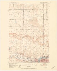
1900s (20th Century) Maps of Cascade County, Montana
Explore 130 historic maps of Cascade County from the 1900s (20th Century). These maps offer a rare glimpse into what life looked like during the 1900s — showing old roads, neighborhoods, homes, and landmarks that have changed or disappeared over time.
Whether you're researching your family's past, planning a metal detecting trip, or studying how Cascade County's landscape evolved across the 1900s, these high-resolution maps are a powerful tool for exploring the history of this region.
- Focus on a specific era: All maps on this page are from the 1900s, giving you a focused view of this time period.
- See what’s changed: Compare century-old streets, trails, and buildings to today's modern landscape using overlays and satellite layers.
- Research with precision: Use these maps for genealogy, historical research, land use analysis, or educational projects.
- View, download, or print: Maps are fully viewable online in high resolution, and can be downloaded or printed for your own records.
Start exploring Cascade County's history through authentic maps from the 1900s. This is your window into the past.
Cascade County, MT maps
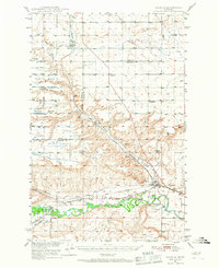
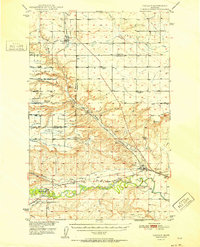
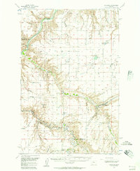
(130)- 1902 Map of Little Belt Mts.
 1902 Little Belt Mts.1902 Print · USGSMeagher County at the close of the nineteenth century is a landscape of mountain mining camps and riverside settlements. Researchers can trace early industry and family roots near the Sapphire Mine, the town of White Sulphur Springs, and the camp at Neihart.3 unique versions available
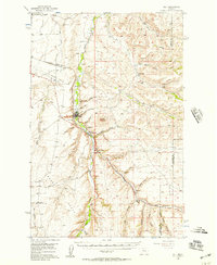
 - 1920 Map of Choteau
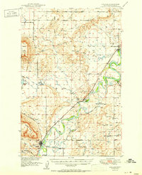
 1920 Choteau1920 Print · USGSNorth-central Montana in the early twentieth century shows a landscape being reshaped by irrigation canals and competing rail lines. Family historians can trace early settlements like Agawam, Bole, and Gilman, or locate regional landmarks like Priest Butte and Pishkun Reservoir.
 - 1943 Map of Hogan
 1943 Hogan1943 Print · USGSCrossing the Continental Divide during the early twentieth century, this survey shows the high-country landscape between the Sun and Dearborn rivers. Researchers can trace early settlements like Stearns and Hogan, or find remote landmarks such as Silver Camp and the Dry Creek Reservoir Site.
 - 1948 Map of Portage
 1948 Portage1948 Print · USGSThe Missouri River corridor near Great Falls is shown in the late 1940s, a landscape shaped by hydroelectric dams and expanding military aviation. Genealogists and researchers can trace local landmarks like Goffe Ranch, Salem Sch, and the Great Northern rail lines.4 unique versions available
 - 1948 Map of White Sulphur Springs, 1951 Print
 1948 White Sulphur Springs1951 Print · USGSMontana's capital and the high country of the Big Belt Mountains come alive in this mid-century survey. Trace the early hydroelectric developments at Canyon Ferry Dam or follow the historic rail lines through Ringling and Townsend.
 - 1949 Map of Portage
 1949 Portage1949 Print · USGSThe Missouri River breaks through the Montana high plains in the late 1940s, revealing a landscape of vital hydroelectric dams and rural rail stops. Local historians can trace the development of Morony Dam, family holdings at Golie Ranch, and early settlements like Portage.2 unique versions available
 - 1949 Map of Cascade, 1956 Print
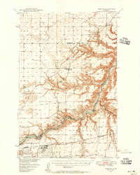
 1949 Cascade1956 Print · USGSCascade and Ulm are captured here at the mid-century point, during a period of steady ranching and river-side development along the Missouri River. Genealogists and historians can locate the Castner Falls Cem, Superior School, and the defunct Elizabeth Reservoir.2 unique versions available
 - 1949 Map of Great Falls, 1966 Print
 1949 Great Falls1966 Print · USGSMid-century Great Falls and the Missouri River basin are shown here during a period of post-war industrial and educational expansion. Researchers can trace the heritage of the area via the Bootlegger Trail, the Black Eagle Dam, and schools like Ursuline Academy and McKinley Sch.
 - 1949 Map of Vaughn, 1968 Print
 1949 Vaughn1968 Print · USGSThe Sun River valley is captured here in the late 1940s, showing a landscape defined by industrial rail lines and sophisticated irrigation. You can trace the path of the Great Northern railroad through Vaughn or locate the Gettel School and Sun River Cemetery.
 - 1950 Map of Fairfield, 1952 Print
 1950 Fairfield1952 Print · USGSIn the early 1950s, the Teton County prairie was a landscape of irrigation canals and rail lines centered on Fairfield. Trace the development of the Missouri River Basin through features like the Greenfield Main Canal, Old Fort Shaw, and the Great Northern railroad.4 unique versions available
 - 1951 Map of Great Falls
 1951 Great Falls1951 Print · USGSGreat Falls and the surrounding Cascade County plains come alive in this mid-century survey of the Missouri River basin. Genealogists and local historians can trace the early layout of Black Eagle, locate the Ursuline Academy, and follow the historic Bootlegger Trail.2 unique versions available
 - 1951 Map of Cascade
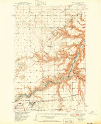
 1951 Cascade1951 Print · USGSMid-century Montana comes into focus as the Missouri River winds past the growing settlements and cattle country of Cascade County. Researchers can trace family sites near Superior School, the Castner Falls Cemetery, and the Great Northern rail line.2 unique versions available
 - 1952 Map of Vaughn
 1952 Vaughn1952 Print · USGSThe Montana benchlands north of Great Falls come into focus in the early fifties, where the Sun River and Muddy Creek meet. Genealogists and historians can trace the irrigation canals, the Great Northern rail lines, and landmarks like Sun River Cemetery or the Gettel School.
 - 1954 Map of Great Falls
 1954 Great Falls1954 Print · USGSThe Missouri River valley in the mid-1950s is shown at a time of significant industrial and military growth. Genealogists and historians can locate early schools and rail stops like Tiger Butte Community Center, Fort Benton, and the Anaconda Wire Plant.4 unique versions available
 - 1954 Map of Lander Crossing, 1956 Print
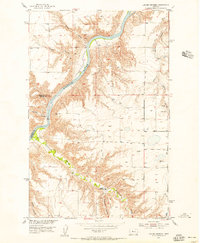 1954 Lander Crossing1956 Print · USGSThe Missouri River breaks of Montana are captured here in the mid-fifties, revealing the intricate network of coulees carving into the Chouteau County landscape. Researchers can trace the winding course of Highwood Creek and locate landmarks like Lander Crossing, Huntley Coulee, and Windmill 3353.2 unique versions available
 - 1954 Map of Waltham, 1956 Print
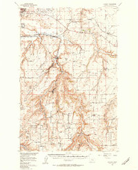
 1954 Waltham1956 Print · USGSThe high plains of Chouteau and Cascade Counties come alive in the mid-1950s, centered on the winding canyons and rail tunnels of Belt Creek. Researchers can trace the path of the Milwaukee Road through the landscape past Waltham and the Shepherd Butte School.2 unique versions available
 - 1955 Map of Stockett, 1957 Print
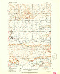
 1955 Stockett1957 Print · USGSCascade County in the mid-fifties reveals a landscape of coal-mining settlements and military growth south of the Missouri River. Genealogists and historians can trace family roots through numerous rural markers like Flemming Sch, Sandcoulee Cem, and the high-ground community of Stockett.3 unique versions available
 - 1955 Map of Gore Hill, 1957 Print
 1955 Gore Hill1957 Print · USGSThe area around Great Falls in the mid-1950s shows a landscape of river-carved benches and burgeoning aviation infrastructure. Researchers can locate family landmarks like Truly Sch, Red Butte Sch, and the Mount Olivet Cemetery.
 - 1955 Map of Choteau, 1978 Print
 1955 Choteau1978 Print · USGSWestern Montana during the mid-fifties is captured here as a land of rugged high-country wilderness and vital eastern plains irrigation. Genealogists and historians can locate remote outposts like Condon, the communal Miller Colony, and the rail stops of the Chicago Milwaukee St Paul and Pacific.
 - 1956 Map of Highwood, 1957 Print
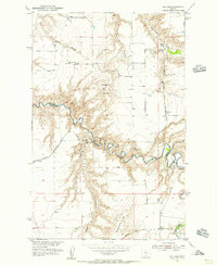
 1956 Highwood1957 Print · USGSHighwood and the Chouteau County borderlands are seen here in the mid-1950s, a period defined by the Missouri River and the reaching tracks of the Milwaukee Road. Genealogists and historians can trace rail-side stops like Waltham and Lander Crossing, or locate the rural Shepherd Butte Sch near the forks of the Missouri River.2 unique versions available
 - 1956 Map of Belt, 1957 Print
 1956 Belt1957 Print · USGSCentral Montana in the mid-fifties reveals a landscape defined by the Great Northern railroad and rural school districts. Researchers can trace the legacy of mining and homesteading through sites like the Orr East Belt Mine, Pleasant View Cemetery, and Belt Butte.
 - 1957 Map of Choteau
 1957 Choteau1957 Print · USGSMontana's mountain front meets the eastern plains in the mid-fifties, showing the transition from forested wilderness to irrigated ranch land. Genealogists and historians can trace the rail lines of the Great Northern and find settlements like Choteau, Augusta, and Seeley Lake.
 - 1957 Map of Great Falls
 1957 Great Falls1957 Print · USGSMontana's central plains and mountain foothills are captured here in the mid-fifties, showing the hub of Great Falls and the surrounding grain-shipping towns. Genealogists can trace family roots through the rail sidings of the Great Northern and small rural communities like Sand Coulee or Fort Benton.
 - 1958 Map of Choteau
 1958 Choteau1958 Print · USGSMontana's front range meets the high wilderness in the late fifties, where the Great Northern railway connects ranching towns to the eastern plains. Researchers can trace the development of irrigation at Bynum Reservoir or locate remote camps like the Big Prairie District Ranger Station and Helmville.2 unique versions available
 - 1958 Map of White Sulphur Springs, 1968 Print
 1958 White Sulphur Springs1968 Print · USGSCentral Montana in the late fifties was a landscape of high-country mining and newly formed reservoirs. You can trace the rail-and-river economy of the era through sites like Canyon Ferry Lake, the East Pacific Mine, and the historic Fort Logan.3 unique versions available
Showing maps 1-25 of 130
Top cities of Cascade County
- Great Falls historical maps
- Cascade historical maps
- Belt historical maps
- Stockett historical maps
- Neihart historical maps
Frequently asked questions
- What are the different types of historical maps available for Cascade County?
- What is the oldest map of Cascade County?
- Where can I purchase historical maps of Cascade County for my home or office?
- Where can I download high-res historical maps of Cascade County?
- Are there historical topographic maps available for Cascade County?
- Is there historical aerial imagery available for Cascade County?
- Where are historical maps of Cascade County sourced from?